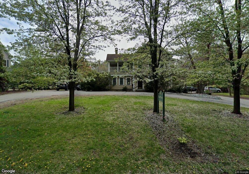
1283 Elm St Concord, MA 01742
Estimated Value: $388,000 - $1,022,000
2
Beds
3
Baths
1,705
Sq Ft
$402/Sq Ft
Est. Value
About This Home
This home is located at 1283 Elm St, Concord, MA 01742 and is currently estimated at $684,619, approximately $401 per square foot. 1283 Elm St is a home located in Middlesex County with nearby schools including Thoreau Elementary School, Concord Middle School, and Concord Carlisle High School.
Ownership History
Date
Name
Owned For
Owner Type
Purchase Details
Closed on
Sep 10, 2008
Sold by
Elm Place Llc
Bought by
Frank Elizabeth A and Frank Matthew B
Current Estimated Value
Home Financials for this Owner
Home Financials are based on the most recent Mortgage that was taken out on this home.
Original Mortgage
$123,200
Outstanding Balance
$82,180
Interest Rate
6.58%
Mortgage Type
Purchase Money Mortgage
Estimated Equity
$602,439
Create a Home Valuation Report for This Property
The Home Valuation Report is an in-depth analysis detailing your home's value as well as a comparison with similar homes in the area
Home Values in the Area
Average Home Value in this Area
Purchase History
| Date | Buyer | Sale Price | Title Company |
|---|---|---|---|
| Frank Elizabeth A | $160,000 | -- |
Source: Public Records
Mortgage History
| Date | Status | Borrower | Loan Amount |
|---|---|---|---|
| Open | Frank Elizabeth A | $123,200 |
Source: Public Records
Tax History
| Year | Tax Paid | Tax Assessment Tax Assessment Total Assessment is a certain percentage of the fair market value that is determined by local assessors to be the total taxable value of land and additions on the property. | Land | Improvement |
|---|---|---|---|---|
| 2025 | $35 | $267,200 | $0 | $267,200 |
| 2024 | $3,343 | $254,600 | $0 | $254,600 |
| 2023 | $2,919 | $225,268 | $0 | $225,268 |
| 2022 | $3,275 | $221,911 | $0 | $221,911 |
| 2021 | $3,110 | $211,282 | $0 | $211,282 |
| 2020 | $2,932 | $206,051 | $0 | $206,051 |
| 2019 | $2,805 | $197,641 | $0 | $197,641 |
| 2018 | $2,679 | $187,500 | $0 | $187,500 |
| 2017 | $2,638 | $187,500 | $0 | $187,500 |
| 2016 | $2,298 | $165,089 | $0 | $165,089 |
| 2015 | $2,484 | $173,800 | $0 | $173,800 |
Source: Public Records
Map
Nearby Homes
- 1 Bayberry Rd
- 303 School St
- 42 Sunnyside Ln
- 79-81 Assabet Ave
- 60 Lawsbrook Rd
- 56 Isaac Davis Rd
- 65 Summit St
- 54 Maple St
- 134 Pope Rd
- 95 Conant St Unit 320
- 66 Old Stow Rd
- 102 Highland St
- 104 Channing Rd
- 187 Great Rd Unit A1
- 19 Whippoorwill Ln
- 70 McCallar Ln
- 1687 Main St
- 37 Water St
- 27 Water St
- 45 Millrun Ln Unit 45
- 1285 Elm St
- 1281 Elm St
- 1285 Elm St Unit 1285
- 1285 Elm St Unit 12850
- 1279 Elm St
- 1277 Elm St
- 1275 Elm St
- 1273 Elm St
- 1275 Elm St Unit 1275
- 1275 Elm St Unit 1
- 50 Shaw Farm Rd
- 45 Shaw Farm Rd
- 20 Shaw Farm Rd Unit 20
- 20 Shaw Farm Rd
- 60 Shaw Farm Rd
- 1271 Elm St
- 1287 Elm St
- 25 Shaw Farm Rd
- 1257 Elm St
- 15 Shaw Farm Rd Unit 15