Estimated Value: $205,000 - $210,000
3
Beds
2
Baths
1,345
Sq Ft
$154/Sq Ft
Est. Value
About This Home
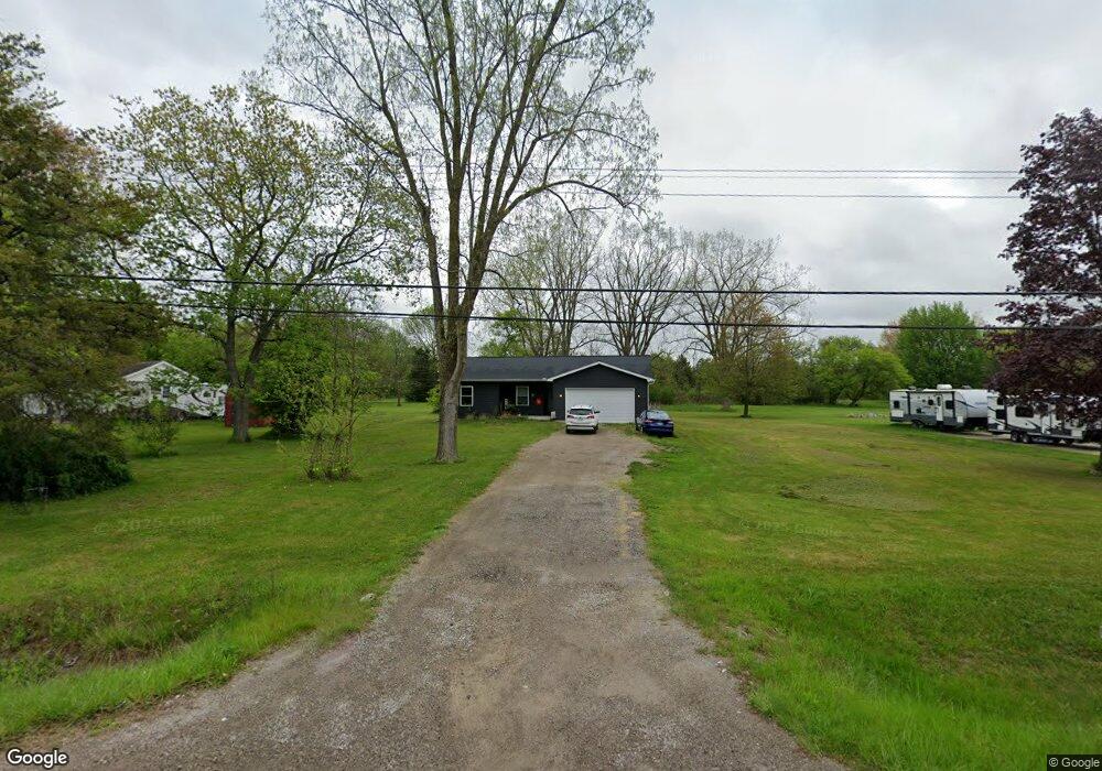
This home is located at 1283 S Dye Rd, Flint, MI 48532 and is currently estimated at $207,570, approximately $154 per square foot. 1283 S Dye Rd is a home located in Genesee County with nearby schools including Carman-Ainsworth High School, Genesee STEM Academy, and St. Paul Lutheran School.
Ownership History
Date
Name
Owned For
Owner Type
Purchase Details
Closed on
Jan 5, 2021
Sold by
Guerra John Steven and Clark Angela Lynn
Bought by
Guerra Christopher P and Guerra Joseph Allison
Current Estimated Value
Home Financials for this Owner
Home Financials are based on the most recent Mortgage that was taken out on this home.
Original Mortgage
$49,000
Outstanding Balance
$35,783
Interest Rate
2.65%
Mortgage Type
New Conventional
Estimated Equity
$171,787
Purchase Details
Closed on
Sep 4, 2020
Sold by
Forsleff Matthew and Estate Of Celia D Guerra
Bought by
Guerra John Steven and Guerra Christopher P
Create a Home Valuation Report for This Property
The Home Valuation Report is an in-depth analysis detailing your home's value as well as a comparison with similar homes in the area
Home Values in the Area
Average Home Value in this Area
Purchase History
| Date | Buyer | Sale Price | Title Company |
|---|---|---|---|
| Guerra Christopher P | -- | Homeland Title Llc | |
| Guerra John Steven | -- | None Available |
Source: Public Records
Mortgage History
| Date | Status | Borrower | Loan Amount |
|---|---|---|---|
| Open | Guerra Christopher P | $49,000 |
Source: Public Records
Tax History
| Year | Tax Paid | Tax Assessment Tax Assessment Total Assessment is a certain percentage of the fair market value that is determined by local assessors to be the total taxable value of land and additions on the property. | Land | Improvement |
|---|---|---|---|---|
| 2025 | $3,721 | $95,600 | $0 | $0 |
| 2024 | $2,496 | $92,500 | $0 | $0 |
| 2023 | $3,118 | $80,300 | $0 | $0 |
| 2022 | $1,104 | $60,300 | $0 | $0 |
| 2021 | $3,268 | $54,000 | $0 | $0 |
| 2020 | $1,406 | $54,000 | $0 | $0 |
| 2019 | $1,190 | $53,400 | $0 | $0 |
| 2018 | $851 | $43,600 | $0 | $0 |
| 2017 | $1,715 | $43,600 | $0 | $0 |
| 2016 | $1,766 | $41,600 | $0 | $0 |
| 2015 | $1,614 | $41,600 | $0 | $0 |
| 2014 | $958 | $40,200 | $0 | $0 |
| 2012 | -- | $41,700 | $41,700 | $0 |
Source: Public Records
Map
Nearby Homes
- 1161 S Dye Rd
- 1460 S Dye Rd
- 0000 Reuben Reuben St
- 3.9 Acres W Court St
- 1417 Grassmere Ave
- 2052 S Dye Rd
- 2 Charter Dr
- 0 Charter Dr Unit 50153638
- 4480 Corunna Rd
- 5423 Meadowcrest Dr
- 4474 Corunna Rd
- 5526 Corunna Rd
- 5323 Elmsford Dr
- 1455 S Linden Rd
- 5227 Dania St
- 6090 Lancaster Dr
- 6007 Corunna Rd
- 5290 Brobeck St
- 5200 Elko St
- 5151 Brobeck St
- 1271 S Dye Rd
- 1309 S Dye Rd
- 1297 S Dye Rd
- 1265 S Dye Rd
- 1329 S Dye Rd
- 1249 S Dye Rd
- 1333 S Dye Rd
- 5343 Birchtree Ct
- 5282 Mapletree Dr
- 5214 W Court St
- 5347 Birchtree Ct
- 1341 S Dye Rd
- 5202 W Court St
- 5222 W Court St
- 5232 W Court St
- 5331 S Dyewood Dr
- 5321 S Dyewood Dr
- 5341 Birchtree Ct
- 5292 Mapletree Dr
- 5281 Mapletree Dr
Your Personal Tour Guide
Ask me questions while you tour the home.