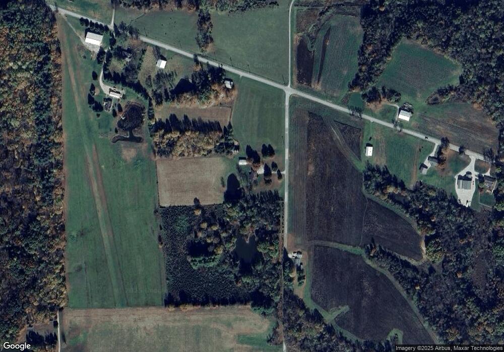
12833 Pollard Rd Unit RS Moores Hill, IN 47032
Estimated Value: $212,000 - $352,879
3
Beds
2
Baths
1,440
Sq Ft
$209/Sq Ft
Est. Value
About This Home
This home is located at 12833 Pollard Rd Unit RS, Moores Hill, IN 47032 and is currently estimated at $300,720, approximately $208 per square foot. 12833 Pollard Rd Unit RS is a home located in Dearborn County with nearby schools including Moores Hill Elementary School, South Dearborn Middle School, and South Dearborn High School.
Ownership History
Date
Name
Owned For
Owner Type
Purchase Details
Closed on
Feb 7, 2024
Sold by
Tedesco Margo L and Tedesco Abbey L
Bought by
Mat Revocable Trust
Current Estimated Value
Purchase Details
Closed on
Mar 7, 2018
Sold by
Armbruster James G
Bought by
Jeffrey Venters
Create a Home Valuation Report for This Property
The Home Valuation Report is an in-depth analysis detailing your home's value as well as a comparison with similar homes in the area
Home Values in the Area
Average Home Value in this Area
Purchase History
| Date | Buyer | Sale Price | Title Company |
|---|---|---|---|
| Mat Revocable Trust | -- | None Listed On Document | |
| Jeffrey Venters | $180,000 | -- | |
| Venters Jeffrey | $180,000 | Ewbank Land Title, Inc |
Source: Public Records
Tax History Compared to Growth
Tax History
| Year | Tax Paid | Tax Assessment Tax Assessment Total Assessment is a certain percentage of the fair market value that is determined by local assessors to be the total taxable value of land and additions on the property. | Land | Improvement |
|---|---|---|---|---|
| 2024 | $2,038 | $197,900 | $30,200 | $167,700 |
| 2023 | $2,080 | $191,800 | $28,800 | $163,000 |
| 2022 | $2,043 | $184,500 | $27,400 | $157,100 |
| 2021 | $1,788 | $164,800 | $26,600 | $138,200 |
| 2020 | $1,716 | $162,800 | $26,600 | $136,200 |
| 2019 | $3,303 | $165,200 | $27,300 | $137,900 |
| 2018 | $1,721 | $165,300 | $27,400 | $137,900 |
| 2017 | $1,490 | $146,100 | $28,300 | $117,800 |
| 2016 | $1,509 | $148,600 | $28,600 | $120,000 |
| 2014 | $1,440 | $152,700 | $28,900 | $123,800 |
Source: Public Records
Map
Nearby Homes
- 10 Goff Ln
- 12535 Steele Rd
- 11600 Long Branch Rd
- 13371 Long Branch Rd
- 10334 U S 50
- 10334 Us Highway 50
- 10041 Us Highway 50
- 15280 Klein Acres Rd
- 8268 Old State Road 350
- 0 Links Unit 204328
- 12459 North St
- 10625 St Rd 262
- 8873 U S 50
- 13220 Bank St
- 0 Liana Dr Unit 196417
- 0 Liana Dr Unit 196419
- 0 Liana Dr Unit 196416
- 0 Liana Dr Unit 196420
- 0 Liana Dr Unit 196421
- 10311 Liana Dr
- 11605 Chesterville Rd
- 11374 Chesterville Rd
- 11659 Chesterville Rd
- 11319 Chesterville Rd
- 11285 Chesterville Rd
- 11490 Chesterville Rd
- 11816 Chesterville Rd
- 12797 Forest Ln
- 12633 Pollard Rd
- 12529 Lake Forest Ct
- 12895 Forest Ln
- 11142 Chesterville Rd
- 11135 Chesterville Rd
- 12887 Forest Ln
- 11088 Chesterville Rd
- 12974 Goff Ln
- 0 Goff Ln Unit 1749596
- 0 Goff Ln
- 12228 Pollard Rd
- 10778 Chesterville Rd
