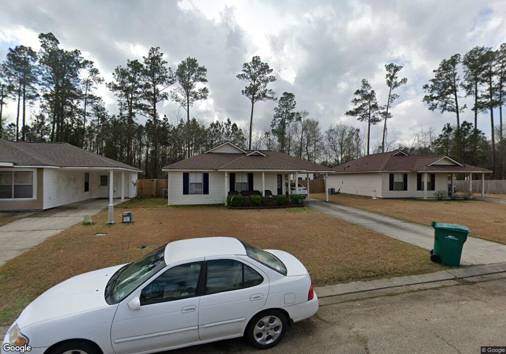
12838 Mulberry Dr Denham Springs, LA 70726
Estimated Value: $197,000 - $220,796
--
Bed
--
Bath
--
Sq Ft
7,971
Sq Ft Lot
About This Home
This home is located at 12838 Mulberry Dr, Denham Springs, LA 70726 and is currently estimated at $208,699. 12838 Mulberry Dr is a home located in Livingston Parish with nearby schools including South Walker Elementary School, Westside Junior High School, and Walker High School.
Ownership History
Date
Name
Owned For
Owner Type
Purchase Details
Closed on
Dec 8, 2018
Sold by
Ragas Bruce A and Ragas Trella A
Bought by
Ragas Bruce A and Ragas Trella A
Current Estimated Value
Purchase Details
Closed on
May 29, 2007
Sold by
D R Horton Inc Gulf Coast
Bought by
Ragas Bruce Allen and Ragas Trella Ann
Home Financials for this Owner
Home Financials are based on the most recent Mortgage that was taken out on this home.
Original Mortgage
$127,500
Interest Rate
6.16%
Mortgage Type
New Conventional
Create a Home Valuation Report for This Property
The Home Valuation Report is an in-depth analysis detailing your home's value as well as a comparison with similar homes in the area
Home Values in the Area
Average Home Value in this Area
Purchase History
| Date | Buyer | Sale Price | Title Company |
|---|---|---|---|
| Ragas Bruce A | -- | -- | |
| Ragas Bruce Allen | $125,000 | Dhi Title Company |
Source: Public Records
Mortgage History
| Date | Status | Borrower | Loan Amount |
|---|---|---|---|
| Previous Owner | Ragas Bruce Allen | $127,500 |
Source: Public Records
Tax History Compared to Growth
Tax History
| Year | Tax Paid | Tax Assessment Tax Assessment Total Assessment is a certain percentage of the fair market value that is determined by local assessors to be the total taxable value of land and additions on the property. | Land | Improvement |
|---|---|---|---|---|
| 2024 | $1,895 | $18,022 | $2,900 | $15,122 |
| 2023 | $1,612 | $13,210 | $2,900 | $10,310 |
| 2022 | $1,623 | $13,210 | $2,900 | $10,310 |
| 2021 | $1,430 | $13,210 | $2,900 | $10,310 |
| 2020 | $1,423 | $13,210 | $2,900 | $10,310 |
| 2019 | $1,525 | $13,800 | $2,900 | $10,900 |
| 2018 | $1,538 | $13,800 | $2,900 | $10,900 |
| 2017 | $1,573 | $13,800 | $2,900 | $10,900 |
| 2015 | $689 | $13,250 | $2,900 | $10,350 |
| 2014 | $700 | $13,250 | $2,900 | $10,350 |
Source: Public Records
Map
Nearby Homes
- 26101 Glenbrooke Dr
- 12943 Hazlewood Dr
- 26158 Glenbrooke Dr
- 12738 Bonnie Bleu Dr
- 12789 Bonnie Bleu Dr
- 12819 Bonnie Bleu Dr
- 13460 Wynnewood Ave
- 26414 Maplewood Dr
- 26407 Millstone Dr
- 25914 Bronzewood St
- 26559 Parkwood Dr
- 25672 Buffwood St
- 26100 Walker Rd S
- 30045 Sanctuary Blvd
- 30168 Sanctuary Blvd
- 12495 Buddy Ellis Rd
- 25868 Walker Rd S
- 26579 Old Barnwood Ave
- Edison Plan at Indigo Trails
- Cameron Plan at Indigo Trails
- 12842 Mulberry Dr
- 12834 Mulberry Dr
- 12850 Mulberry Dr
- 12846 Mulberry Dr
- 12854 Mulberry Dr
- 12837 Mulberry Dr
- 12841 Mulberry Dr
- 12829 Hazlewood Dr
- 12835 Hazlewood Dr
- 12481 Mulberry Dr
- 12823 Hazlewood Dr
- 12845 Mulberry Dr
- 12835 Hazlewood Dr
- 26042 Glenbrooke Dr
- 26042 Glenbrook Dr
- 12841 Hazlewood Dr
- 26024 Glenbrooke Dr
- 12849 Mulberry Dr
- 12858 Mulberry Dr
- 12853 Mulberry Dr