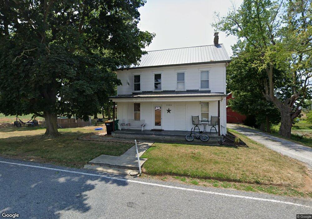
1284 Milnor Rd Greencastle, PA 17225
Estimated Value: $159,506 - $340,000
--
Bed
--
Bath
1,960
Sq Ft
$134/Sq Ft
Est. Value
About This Home
This home is located at 1284 Milnor Rd, Greencastle, PA 17225 and is currently estimated at $262,877, approximately $134 per square foot. 1284 Milnor Rd is a home located in Franklin County with nearby schools including Greencastle-Antrim Primary School, Greencastle-Antrim Elementary School, and Greencastle-Antrim Middle School.
Ownership History
Date
Name
Owned For
Owner Type
Purchase Details
Closed on
Mar 10, 2009
Sold by
Peterson James G
Bought by
Hessong Edward and Hessong Betty L
Current Estimated Value
Home Financials for this Owner
Home Financials are based on the most recent Mortgage that was taken out on this home.
Original Mortgage
$152,000
Outstanding Balance
$96,907
Interest Rate
5.18%
Mortgage Type
New Conventional
Estimated Equity
$165,970
Purchase Details
Closed on
Jun 11, 2008
Sold by
Estate Of Glenn S Burkholder
Bought by
Pererson James G
Home Financials for this Owner
Home Financials are based on the most recent Mortgage that was taken out on this home.
Original Mortgage
$140,000
Interest Rate
6.13%
Mortgage Type
Purchase Money Mortgage
Create a Home Valuation Report for This Property
The Home Valuation Report is an in-depth analysis detailing your home's value as well as a comparison with similar homes in the area
Home Values in the Area
Average Home Value in this Area
Purchase History
| Date | Buyer | Sale Price | Title Company |
|---|---|---|---|
| Hessong Edward | $190,000 | None Available | |
| Pererson James G | $190,000 | None Available |
Source: Public Records
Mortgage History
| Date | Status | Borrower | Loan Amount |
|---|---|---|---|
| Open | Hessong Edward | $152,000 | |
| Previous Owner | Pererson James G | $140,000 |
Source: Public Records
Tax History Compared to Growth
Tax History
| Year | Tax Paid | Tax Assessment Tax Assessment Total Assessment is a certain percentage of the fair market value that is determined by local assessors to be the total taxable value of land and additions on the property. | Land | Improvement |
|---|---|---|---|---|
| 2025 | $1,594 | $9,530 | $700 | $8,830 |
| 2024 | $1,446 | $9,530 | $700 | $8,830 |
| 2023 | $1,429 | $9,530 | $700 | $8,830 |
| 2022 | $1,429 | $9,530 | $700 | $8,830 |
| 2021 | $1,402 | $9,530 | $700 | $8,830 |
| 2020 | $1,365 | $9,530 | $700 | $8,830 |
| 2019 | $1,334 | $9,530 | $700 | $8,830 |
| 2018 | $1,320 | $9,530 | $700 | $8,830 |
| 2017 | $1,286 | $9,530 | $700 | $8,830 |
| 2016 | $273 | $9,530 | $700 | $8,830 |
| 2015 | $254 | $9,530 | $700 | $8,830 |
| 2014 | $254 | $9,530 | $700 | $8,830 |
Source: Public Records
Map
Nearby Homes
- 12689 Williamsport Pike
- 10135 Jasper Dr
- 642 Milnor Rd
- 2428 Pikeside Dr
- 270 Paradise View Dr
- 460 Paradise View Dr
- Lot # 6-36 Paradise View Dr
- 10937 Grant Shook Rd
- 10925 Grant Shook Rd
- 20 Helens Dr
- 226 Milnor Rd
- 12976 Daybreak Ln
- 763 Joy Dr
- 11765 Melrose Ave
- 707 Shook Ct W
- 0 Molly Pitcher Hwy Unit PAFL178468
- 0 Molly Pitcher Hwy Unit PAFL2030380
- 281 Toms Ln
- 0 Hykes Rd
- 14433 Williamsport Pike
- 1378 Milnor Rd
- 1422 Milnor Rd
- 1093 Milnor Rd
- 13082 Williamsport Pike
- 1070 Milnor Rd
- 12704 Williamsport Pike
- 966 Milnor Rd
- 952 Milnor Rd
- 1075 Milnor Rd
- 1075 Milnor Rd
- 934 Milnor Rd
- 929 Milnor Rd
- 26 Jasper Dr S
- 31 Jasper Dr S
- 28 Jasper Dr S
- 12944 Williamsport Pike
- 12946 Williamsport Pike
- 12960 Williamsport Pike
- 12935 Williamsport Pike
- 12963 Williamsport Pike