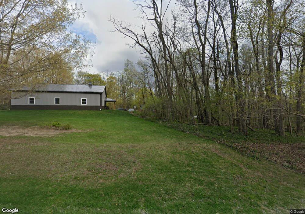
12841 Macon Hwy Clinton, MI 49236
Estimated Value: $454,692 - $665,000
3
Beds
3
Baths
1,752
Sq Ft
$306/Sq Ft
Est. Value
About This Home
This home is located at 12841 Macon Hwy, Clinton, MI 49236 and is currently estimated at $536,231, approximately $306 per square foot. 12841 Macon Hwy is a home located in Lenawee County with nearby schools including Tecumseh Middle School, Herrick Park Intermediate Learning Center, and Tecumseh High School.
Ownership History
Date
Name
Owned For
Owner Type
Purchase Details
Closed on
Mar 24, 2017
Sold by
Thompson Steven J and Thompson Autumn N
Bought by
Belcher Phillip and Belcher Sandra
Current Estimated Value
Purchase Details
Closed on
Nov 21, 2013
Sold by
Thompson Steven J and Thompson Autumn T
Bought by
Thompson Steven J and Thompson Autumn N
Home Financials for this Owner
Home Financials are based on the most recent Mortgage that was taken out on this home.
Original Mortgage
$191,955
Interest Rate
4.3%
Mortgage Type
VA
Purchase Details
Closed on
Sep 15, 2011
Sold by
Camburn Keith E and George F & Wilma A Camburn Tru
Bought by
Thompson Steven J
Home Financials for this Owner
Home Financials are based on the most recent Mortgage that was taken out on this home.
Original Mortgage
$195,106
Interest Rate
4.14%
Mortgage Type
VA
Create a Home Valuation Report for This Property
The Home Valuation Report is an in-depth analysis detailing your home's value as well as a comparison with similar homes in the area
Home Values in the Area
Average Home Value in this Area
Purchase History
| Date | Buyer | Sale Price | Title Company |
|---|---|---|---|
| Belcher Phillip | $295,000 | None Available | |
| Thompson Steven J | -- | Crossroads Title Agency | |
| Thompson Steven J | $191,000 | None Available |
Source: Public Records
Mortgage History
| Date | Status | Borrower | Loan Amount |
|---|---|---|---|
| Previous Owner | Thompson Steven J | $191,955 | |
| Previous Owner | Thompson Steven J | $195,106 |
Source: Public Records
Tax History Compared to Growth
Tax History
| Year | Tax Paid | Tax Assessment Tax Assessment Total Assessment is a certain percentage of the fair market value that is determined by local assessors to be the total taxable value of land and additions on the property. | Land | Improvement |
|---|---|---|---|---|
| 2025 | $5,029 | $210,800 | $0 | $0 |
| 2024 | $3,341 | $199,000 | $0 | $0 |
| 2023 | $4,815 | $185,900 | $0 | $0 |
| 2022 | $3,534 | $173,400 | $0 | $0 |
| 2021 | $4,921 | $155,500 | $0 | $0 |
| 2020 | $4,547 | $143,800 | $0 | $0 |
| 2019 | $319,494 | $144,500 | $0 | $0 |
| 2018 | $4,574 | $144,452 | $0 | $0 |
| 2017 | $3,339 | $161,078 | $0 | $0 |
| 2016 | $3,317 | $136,793 | $0 | $0 |
| 2014 | -- | $129,954 | $0 | $0 |
Source: Public Records
Map
Nearby Homes
- 13187 Macon Rd
- 6070 Clinton MacOn Rd
- 5665 Braun Rd
- 13293 E Michigan Ave
- 0 W Braun Rd Unit 25009478
- 9991 Kaiser Rd
- VL 25A Klager Rd
- 9265 Schill Rd
- 3679 Tamerry Ct
- 112 Cass Ave
- 10603 Milwaukee Rd
- 3300 Oak Park Dr
- 8917 Hawthorne Dr
- Parcel B Fieldstone Dr
- 6 Wheatland Dr
- 9253 W Michigan Ave
- 10000 Meads Hwy
- 310 Colebrook Dr
- 395 Burt St
- 7957 E Monroe Rd