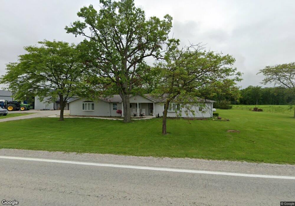
12847 State Route 637 Paulding, OH 45879
Estimated Value: $344,000 - $463,000
4
Beds
4
Baths
3,060
Sq Ft
$132/Sq Ft
Est. Value
About This Home
This home is located at 12847 State Route 637, Paulding, OH 45879 and is currently estimated at $403,529, approximately $131 per square foot. 12847 State Route 637 is a home located in Paulding County with nearby schools including Paulding High School.
Ownership History
Date
Name
Owned For
Owner Type
Purchase Details
Closed on
Sep 27, 2017
Sold by
Mcdougle Harold E and Mcdougle Jacqueline K
Bought by
Schlatter Edward J and Schlatter Cheryl J
Current Estimated Value
Home Financials for this Owner
Home Financials are based on the most recent Mortgage that was taken out on this home.
Original Mortgage
$240,000
Outstanding Balance
$130,727
Interest Rate
3.89%
Mortgage Type
Future Advance Clause Open End Mortgage
Estimated Equity
$272,802
Purchase Details
Closed on
Feb 24, 1987
Bought by
Schlatter Edward J Schlatter Cheryl
Create a Home Valuation Report for This Property
The Home Valuation Report is an in-depth analysis detailing your home's value as well as a comparison with similar homes in the area
Home Values in the Area
Average Home Value in this Area
Purchase History
| Date | Buyer | Sale Price | Title Company |
|---|---|---|---|
| Schlatter Edward J | $240,000 | None Available | |
| Schlatter Edward J Schlatter Cheryl | $39,000 | -- |
Source: Public Records
Mortgage History
| Date | Status | Borrower | Loan Amount |
|---|---|---|---|
| Open | Schlatter Edward J | $240,000 |
Source: Public Records
Tax History Compared to Growth
Tax History
| Year | Tax Paid | Tax Assessment Tax Assessment Total Assessment is a certain percentage of the fair market value that is determined by local assessors to be the total taxable value of land and additions on the property. | Land | Improvement |
|---|---|---|---|---|
| 2024 | $4,082 | $114,030 | $9,240 | $104,790 |
| 2023 | $4,082 | $114,030 | $9,240 | $104,790 |
| 2022 | $3,890 | $114,030 | $9,240 | $104,790 |
| 2021 | $3,695 | $91,460 | $9,240 | $82,220 |
| 2020 | $3,579 | $91,460 | $9,240 | $82,220 |
| 2019 | $3,612 | $54,150 | $9,240 | $44,910 |
| 2018 | $2,141 | $54,150 | $9,240 | $44,910 |
| 2017 | $2,048 | $49,880 | $9,240 | $40,640 |
| 2016 | $1,922 | $49,880 | $9,240 | $40,640 |
| 2015 | $1,857 | $48,970 | $8,790 | $40,180 |
| 2014 | $1,847 | $48,970 | $8,790 | $40,180 |
| 2013 | $2,009 | $48,970 | $8,790 | $40,180 |
Source: Public Records
Map
Nearby Homes
- 0 Tract 3 - Rr 111 Unit 10000391
- 0 Tract 5 - Rr 111 Unit 10000394
- 0
- 14817 Road 171
- 11785 Road 171
- 12288 Road 179
- 18228
- 14255 Road 126
- 13688 Kay St
- 17341 Road 139
- 825 Johnson Rd
- 1065 Emerald Rd
- 1045 Emerald Rd
- 741 Tom Tim Dr
- 726 N Main St
- Tract 2 - 0000 Ohio 111
- 0000 Ohio 111
- 301 N Main St
- 16765 Road 115
- 516 N Williams St
- 17972 Road 156
- 18025 Road 156
- 17868 Road 156
- 17830 County Road 156
- 17830 Co Rd 156
- 17830 Road 156
- 18133 Road 156
- 12517 State Route 637
- 18221 Road 156
- 17707 Road 156
- 18401 Road 156
- 17572 Road 156
- 18697 Road 156
- 17722 Road 168
- 17624 Road 168
- 18637 Road 156
- 18551 Road 156
- 18112 Road 168
- 17601 Road 168
- 18609 Road 156