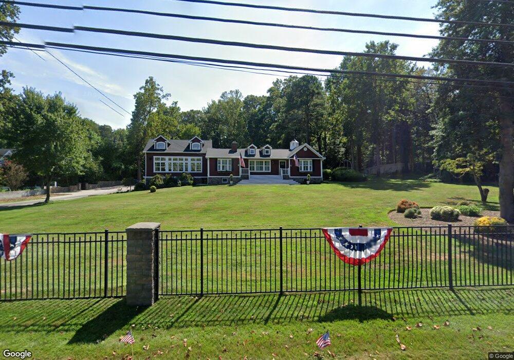
1285 Defense Hwy Gambrills, MD 21054
Davidsonville NeighborhoodEstimated Value: $592,000 - $803,085
--
Bed
2
Baths
3,408
Sq Ft
$199/Sq Ft
Est. Value
About This Home
This home is located at 1285 Defense Hwy, Gambrills, MD 21054 and is currently estimated at $676,771, approximately $198 per square foot. 1285 Defense Hwy is a home located in Anne Arundel County with nearby schools including Crofton Woods Elementary School, Crofton Middle School, and Crofton High School.
Ownership History
Date
Name
Owned For
Owner Type
Purchase Details
Closed on
Oct 31, 2014
Sold by
Rossback George Thomas and Rossback Rebecca May
Bought by
Jeffries Ryan James
Current Estimated Value
Home Financials for this Owner
Home Financials are based on the most recent Mortgage that was taken out on this home.
Original Mortgage
$294,500
Outstanding Balance
$227,003
Interest Rate
4.17%
Mortgage Type
New Conventional
Estimated Equity
$449,768
Create a Home Valuation Report for This Property
The Home Valuation Report is an in-depth analysis detailing your home's value as well as a comparison with similar homes in the area
Home Values in the Area
Average Home Value in this Area
Purchase History
| Date | Buyer | Sale Price | Title Company |
|---|---|---|---|
| Jeffries Ryan James | $310,000 | First American Title Ins Co |
Source: Public Records
Mortgage History
| Date | Status | Borrower | Loan Amount |
|---|---|---|---|
| Open | Jeffries Ryan James | $294,500 |
Source: Public Records
Tax History Compared to Growth
Tax History
| Year | Tax Paid | Tax Assessment Tax Assessment Total Assessment is a certain percentage of the fair market value that is determined by local assessors to be the total taxable value of land and additions on the property. | Land | Improvement |
|---|---|---|---|---|
| 2025 | $6,344 | $550,367 | -- | -- |
| 2024 | $6,344 | $519,033 | $0 | $0 |
| 2023 | $5,953 | $487,700 | $244,000 | $243,700 |
| 2022 | $5,320 | $453,633 | $0 | $0 |
| 2021 | $9,928 | $419,567 | $0 | $0 |
| 2020 | $4,569 | $385,500 | $244,000 | $141,500 |
| 2019 | $4,479 | $376,533 | $0 | $0 |
| 2018 | $3,727 | $367,567 | $0 | $0 |
| 2017 | $4,182 | $358,600 | $0 | $0 |
| 2016 | -- | $340,667 | $0 | $0 |
| 2015 | -- | $322,733 | $0 | $0 |
| 2014 | -- | $304,800 | $0 | $0 |
Source: Public Records
Map
Nearby Homes
- 2057 Liza Way
- 1816 Whites Ferry Place Unit 6
- 2033 Huntwood Dr
- 1782 Shaftsbury Ave
- 1822 Foxdale Ct
- 1722 Tedbury St
- 1764 Sharwood Place
- 1745 Leisure Way
- 2103 Higher Ct
- 1804 Aberdeen Cir
- 1704 Tarleton Way
- 3154 Gosheff Ln
- 2241 Aberdeen Dr
- 1603 Huntcliff Way
- 1677 Hart Ct
- 1723 Fillmore Ct
- 1746 Floral Ct
- 1557 Farlow Ave
- 1729 Dana St Unit 6
- 1503 Carlyle Dr
- 1295 Defense Hwy
- 1275 Defense Hwy
- 1288 Defense Hwy
- 1301 Defense Hwy
- 1300 Defense Hwy
- 1265 Defense Hwy
- 1307 Defense Hwy
- 1290 Defense Hwy
- 1274 Defense Hwy
- 1262 Defense Hwy
- 1260 Defense Hwy
- 1257 Defense Hwy
- 1315 Defense Hwy
- 0 Defense Hwy Unit 1006747604
- 0 Defense Hwy Unit 1006649808
- 0 Defense Hwy Unit 1006564990
- 0 Defense Hwy Unit 1006558694
- 0 Defense Hwy Unit MDAA2109102
- 0 Defense Hwy Unit AA7428009
- 0 Defense Hwy Unit 1001266389