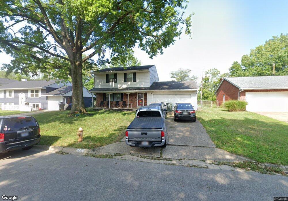
1285 Gresham Rd Columbus, OH 43204
Brookshire NeighborhoodEstimated Value: $253,032 - $261,000
3
Beds
3
Baths
1,512
Sq Ft
$169/Sq Ft
Est. Value
About This Home
This home is located at 1285 Gresham Rd, Columbus, OH 43204 and is currently estimated at $256,008, approximately $169 per square foot. 1285 Gresham Rd is a home located in Franklin County with nearby schools including Binns Elementary School, Wedgewood Middle School, and Briggs High School.
Ownership History
Date
Name
Owned For
Owner Type
Purchase Details
Closed on
Aug 14, 2000
Sold by
Hansher Frances L
Bought by
Armstrong Michael A and Armstrong Holly A
Current Estimated Value
Home Financials for this Owner
Home Financials are based on the most recent Mortgage that was taken out on this home.
Original Mortgage
$93,661
Interest Rate
8.16%
Mortgage Type
FHA
Create a Home Valuation Report for This Property
The Home Valuation Report is an in-depth analysis detailing your home's value as well as a comparison with similar homes in the area
Home Values in the Area
Average Home Value in this Area
Purchase History
| Date | Buyer | Sale Price | Title Company |
|---|---|---|---|
| Armstrong Michael A | $94,000 | Chicago Title |
Source: Public Records
Mortgage History
| Date | Status | Borrower | Loan Amount |
|---|---|---|---|
| Closed | Armstrong Michael A | $93,661 |
Source: Public Records
Tax History
| Year | Tax Paid | Tax Assessment Tax Assessment Total Assessment is a certain percentage of the fair market value that is determined by local assessors to be the total taxable value of land and additions on the property. | Land | Improvement |
|---|---|---|---|---|
| 2025 | $3,591 | $80,020 | $14,810 | $65,210 |
| 2024 | $3,591 | $80,020 | $14,810 | $65,210 |
| 2023 | $3,545 | $80,010 | $14,805 | $65,205 |
| 2022 | $2,402 | $46,310 | $7,070 | $39,240 |
| 2021 | $2,687 | $46,310 | $7,070 | $39,240 |
| 2020 | $2,409 | $46,310 | $7,070 | $39,240 |
| 2019 | $2,399 | $39,550 | $6,160 | $33,390 |
| 2018 | $2,138 | $39,550 | $6,160 | $33,390 |
| 2017 | $2,398 | $39,550 | $6,160 | $33,390 |
| 2016 | $2,073 | $31,290 | $5,600 | $25,690 |
| 2015 | $1,882 | $31,290 | $5,600 | $25,690 |
| 2014 | $1,886 | $31,290 | $5,600 | $25,690 |
| 2013 | $1,094 | $36,785 | $6,580 | $30,205 |
Source: Public Records
Map
Nearby Homes
- 2937 Rundell Dr
- 2870 Chesfield Dr
- 2856 Chesfield Dr
- 1147 Parma Ave
- 1638 Tall Meadows Dr
- 1335 Hafton Woods Dr
- 1360 Hafton Woods Dr
- 988 S Roys Ave
- 3029 Rosedale Ave
- 903 S Harris Ave
- 894 Binns Blvd
- 884 S Hague Ave
- 2757 Bernadette Rd
- 2600 Plainview Ave
- 2856 Vanderberg Ave Unit 858
- 2743 Bernadette Rd
- 1605 Greenville Rd
- 857 Regina Ct
- 2692 Regina Ave
- 814 Chestershire Rd
- 1277 Gresham Rd
- 1269 Gresham Rd
- 2982 Rundell Dr
- 1284 Gresham Rd
- 1292 Gresham Rd
- 1261 Gresham Rd
- 2960 Rundell Dr
- 1268 Gresham Rd
- 1249 Gresham Rd
- 1260 Gresham Rd
- 2981 Rundell Dr
- 1295 Bellflower Ave
- 2989 Rundell Dr
- 1303 Bellflower Ave
- 2973 Rundell Dr
- 2944 Rundell Dr
- 1279 Bellflower Ave
- 1241 Gresham Rd
- 2965 Rundell Dr
- 2957 Rundell Dr
Your Personal Tour Guide
Ask me questions while you tour the home.