Estimated Value: $118,000 - $135,000
2
Beds
1
Bath
884
Sq Ft
$141/Sq Ft
Est. Value
About This Home
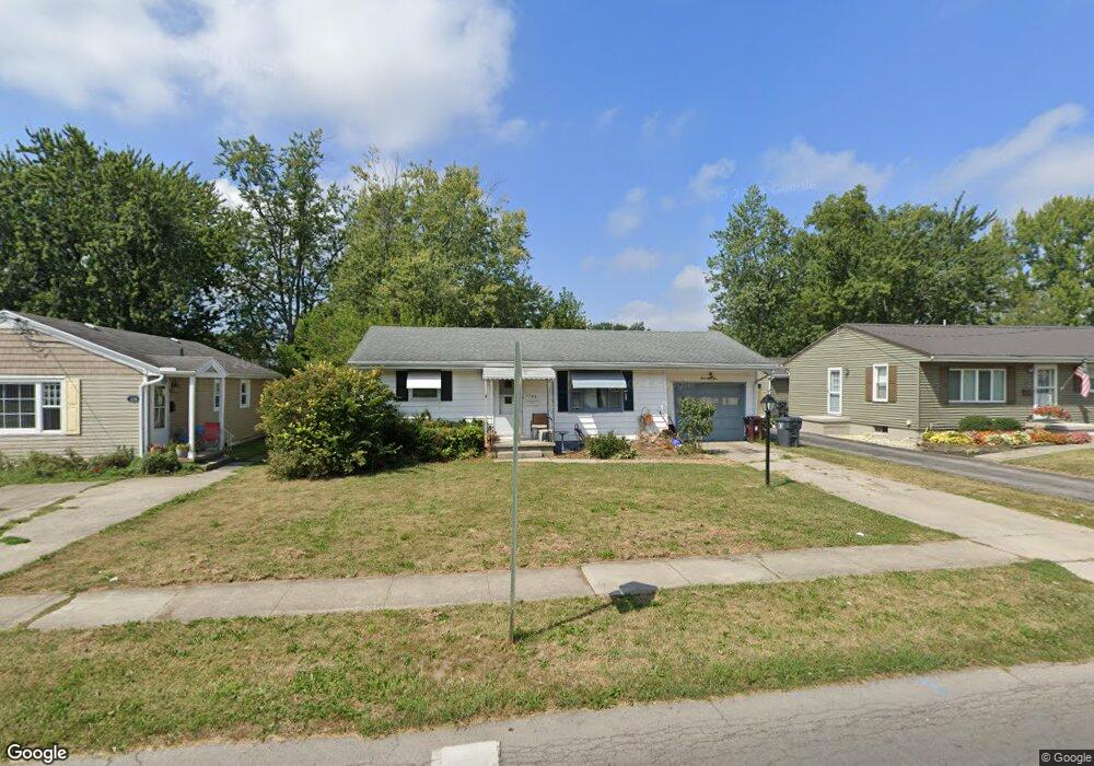
This home is located at 1285 N Metcalf St, Lima, OH 45801 and is currently estimated at $124,333, approximately $140 per square foot. 1285 N Metcalf St is a home located in Allen County with nearby schools including Independence Elementary School, Lima North Middle School, and Lima West Middle School.
Ownership History
Date
Name
Owned For
Owner Type
Purchase Details
Closed on
Jan 31, 2008
Sold by
Harrod James R and Harrod Helen G
Bought by
Vision 2 Investments Llc
Current Estimated Value
Purchase Details
Closed on
Apr 1, 1974
Bought by
Harrod Raymond D
Create a Home Valuation Report for This Property
The Home Valuation Report is an in-depth analysis detailing your home's value as well as a comparison with similar homes in the area
Home Values in the Area
Average Home Value in this Area
Purchase History
| Date | Buyer | Sale Price | Title Company |
|---|---|---|---|
| Vision 2 Investments Llc | $48,000 | Attorney | |
| Harrod Raymond D | $26,000 | -- |
Source: Public Records
Tax History Compared to Growth
Tax History
| Year | Tax Paid | Tax Assessment Tax Assessment Total Assessment is a certain percentage of the fair market value that is determined by local assessors to be the total taxable value of land and additions on the property. | Land | Improvement |
|---|---|---|---|---|
| 2024 | $1,177 | $31,750 | $4,760 | $26,990 |
| 2023 | $925 | $21,460 | $3,220 | $18,240 |
| 2022 | $930 | $21,460 | $3,220 | $18,240 |
| 2021 | $986 | $21,460 | $3,220 | $18,240 |
| 2020 | $976 | $18,800 | $3,120 | $15,680 |
| 2019 | $976 | $18,800 | $3,120 | $15,680 |
| 2018 | $934 | $18,800 | $3,120 | $15,680 |
| 2017 | $903 | $17,230 | $3,120 | $14,110 |
| 2016 | $915 | $17,230 | $3,120 | $14,110 |
| 2015 | $786 | $17,230 | $3,120 | $14,110 |
| 2014 | $786 | $14,390 | $2,980 | $11,410 |
| 2013 | $766 | $14,390 | $2,980 | $11,410 |
Source: Public Records
Map
Nearby Homes
- 608 W O'Connor Ave
- 1116 Belvidere Ave
- 765 W O'Connor Ave
- 576 Cortlandt Ave
- 610 W Robb Ave
- 939 N West St
- 849 Runyan Ave
- 340 W Robb Ave
- 676 Cortlandt Ave
- 222 W Grand Ave
- 416 Hazel Ave
- 638 Hazel Ave
- 648 Hazel Ave
- 631 Hazel Ave
- 708 N Metcalf St
- 820 N Main St
- 612 N Metcalf St
- 606 N West St
- 1200 N Main St
- 123 Flanders Ave