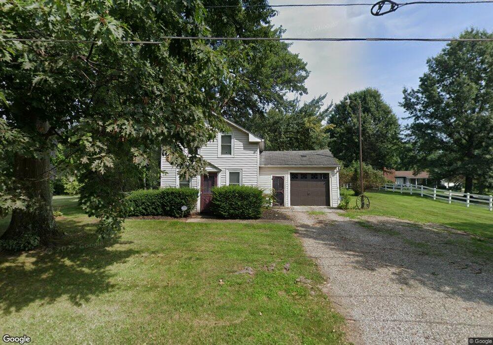
1285 Norton Rd Hudson, OH 44236
Estimated Value: $190,675 - $394,000
2
Beds
1
Bath
612
Sq Ft
$481/Sq Ft
Est. Value
About This Home
This home is located at 1285 Norton Rd, Hudson, OH 44236 and is currently estimated at $294,669, approximately $481 per square foot. 1285 Norton Rd is a home located in Summit County with nearby schools including Ellsworth Hill Elementary School, East Woods Intermediate School, and Hudson Middle School.
Ownership History
Date
Name
Owned For
Owner Type
Purchase Details
Closed on
Nov 23, 1998
Sold by
Brislinger Kay Elizabeth
Bought by
J & K Properties Inc
Current Estimated Value
Home Financials for this Owner
Home Financials are based on the most recent Mortgage that was taken out on this home.
Original Mortgage
$120,000
Outstanding Balance
$27,047
Interest Rate
6.96%
Estimated Equity
$267,622
Create a Home Valuation Report for This Property
The Home Valuation Report is an in-depth analysis detailing your home's value as well as a comparison with similar homes in the area
Home Values in the Area
Average Home Value in this Area
Purchase History
| Date | Buyer | Sale Price | Title Company |
|---|---|---|---|
| J & K Properties Inc | $155,000 | Buckeye Reserve Title Agency |
Source: Public Records
Mortgage History
| Date | Status | Borrower | Loan Amount |
|---|---|---|---|
| Open | J & K Properties Inc | $120,000 |
Source: Public Records
Tax History Compared to Growth
Tax History
| Year | Tax Paid | Tax Assessment Tax Assessment Total Assessment is a certain percentage of the fair market value that is determined by local assessors to be the total taxable value of land and additions on the property. | Land | Improvement |
|---|---|---|---|---|
| 2025 | $3,148 | $60,956 | $32,396 | $28,560 |
| 2024 | $3,148 | $60,956 | $32,396 | $28,560 |
| 2023 | $3,148 | $60,956 | $32,396 | $28,560 |
| 2022 | $2,470 | $42,627 | $22,656 | $19,971 |
| 2021 | $2,474 | $42,627 | $22,656 | $19,971 |
| 2020 | $2,431 | $42,630 | $22,660 | $19,970 |
| 2019 | $2,318 | $37,630 | $25,680 | $11,950 |
| 2018 | $2,311 | $37,630 | $25,680 | $11,950 |
| 2017 | $2,382 | $37,630 | $25,680 | $11,950 |
| 2016 | $2,399 | $37,630 | $25,680 | $11,950 |
| 2015 | $2,382 | $37,630 | $25,680 | $11,950 |
| 2014 | $2,389 | $37,630 | $25,680 | $11,950 |
| 2013 | $2,414 | $37,140 | $25,680 | $11,460 |
Source: Public Records
Map
Nearby Homes
- V/L Lawnmark Dr
- 1470 Mac Dr
- 4891 Cedar Crest Ln
- 1525 Spruce Hill Dr
- 4877 Cedar Crest Ln
- 0 Hibbard Dr
- 1668 Cypress Ct
- 1664 Cypress Ct
- 1620 Sapphire Dr
- 1808 Higby Dr Unit A
- 1627 Cypress Ct
- 1511 Apollo Dr
- 1938 Higby Dr
- 4630 Red Willow Rd
- 1884 Village Ct Unit X66
- V/L Norton Rd
- V/L Housley Rd
- 5217 Beckett Ridge
- 734 Barlow Rd
- 1590 Amboy Dr
- 1290 Norton Rd
- 1307 Norton Rd
- 1280 Norton Rd
- 1270 Norton Rd
- 5081 Stone Meadow Run
- 5071 Stone Meadow Run
- 5078 Stone Meadow Run
- 1240 Norton Rd
- 5070 Stone Meadow Run
- 1334 Norton Rd Unit 1336
- 1334 1336 Norton Rd
- 1342 Norton Rd
- 1342 Norton Rd Unit 1344
- 5062 Stone Meadow Run
- 1317 Mac Dr
- 5001 Stone Meadow Run
- 5053 Stone Meadow Run
- 1358 Norton Rd
- 5009 Stone Meadow Run
- 5058 Stone Meadow Run