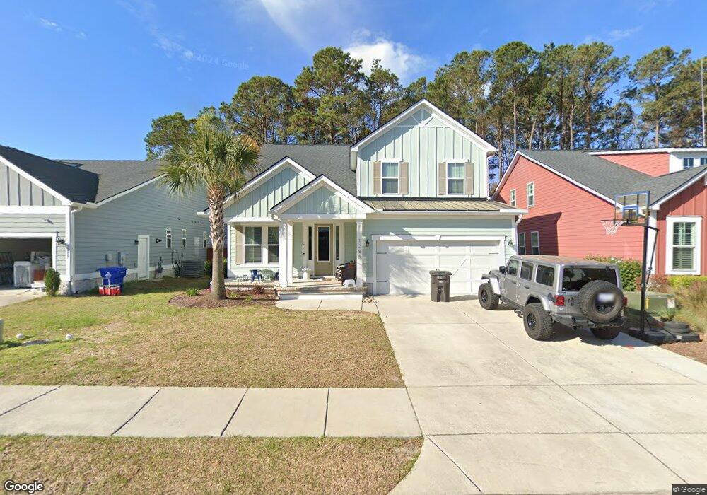
1285 Pearwood Ct Mount Pleasant, SC 29466
Six Mile NeighborhoodEstimated Value: $992,000 - $1,133,383
4
Beds
4
Baths
2,880
Sq Ft
$367/Sq Ft
Est. Value
About This Home
This home is located at 1285 Pearwood Ct, Mount Pleasant, SC 29466 and is currently estimated at $1,057,846, approximately $367 per square foot. 1285 Pearwood Ct is a home located in Charleston County with nearby schools including Jennie Moore Elementary School, Laing Middle School, and Wando High School.
Ownership History
Date
Name
Owned For
Owner Type
Purchase Details
Closed on
Aug 27, 2017
Sold by
Roeger Anton
Bought by
Atkinson Joshua E and Atkinson Aubrey C
Current Estimated Value
Home Financials for this Owner
Home Financials are based on the most recent Mortgage that was taken out on this home.
Original Mortgage
$382,500
Outstanding Balance
$319,672
Interest Rate
3.93%
Mortgage Type
New Conventional
Estimated Equity
$738,174
Purchase Details
Closed on
Jul 18, 2017
Sold by
Beazer Homes Llc
Bought by
Roeger Anton
Home Financials for this Owner
Home Financials are based on the most recent Mortgage that was taken out on this home.
Original Mortgage
$382,500
Outstanding Balance
$319,672
Interest Rate
3.93%
Mortgage Type
New Conventional
Estimated Equity
$738,174
Create a Home Valuation Report for This Property
The Home Valuation Report is an in-depth analysis detailing your home's value as well as a comparison with similar homes in the area
Home Values in the Area
Average Home Value in this Area
Purchase History
| Date | Buyer | Sale Price | Title Company |
|---|---|---|---|
| Atkinson Joshua E | $510,000 | None Available | |
| Roeger Anton | $486,695 | None Available |
Source: Public Records
Mortgage History
| Date | Status | Borrower | Loan Amount |
|---|---|---|---|
| Open | Atkinson Joshua E | $382,500 |
Source: Public Records
Tax History Compared to Growth
Tax History
| Year | Tax Paid | Tax Assessment Tax Assessment Total Assessment is a certain percentage of the fair market value that is determined by local assessors to be the total taxable value of land and additions on the property. | Land | Improvement |
|---|---|---|---|---|
| 2024 | $2,168 | $21,720 | $0 | $0 |
| 2023 | $2,168 | $21,720 | $0 | $0 |
| 2022 | $1,994 | $21,720 | $0 | $0 |
| 2021 | $2,194 | $21,720 | $0 | $0 |
| 2020 | $2,269 | $21,720 | $0 | $0 |
| 2019 | -- | $21,360 | $0 | $0 |
Source: Public Records
Map
Nearby Homes
- 0 N Rifle Range Rd Unit (Lot 1 & 2)
- 0 N Rifle Range Rd Unit 24028206
- 2276 Minifarm Way Unit 530
- 1750 Cultivation Ln
- 2336 Minifarm Way Unit 507
- 2284 Minifarm Way
- 2336 Minifarm Way
- 2276 Minifarm Way
- 0 Rifle Range Rd Unit (Lot 2)
- 0 Rifle Range Rd Unit (Lot 1)
- 2251 Show Basket Way
- Bridgeside Plan at Norwood Oaks
- 3104 Sandy Pearl Way
- 3116 Sandy Pearl Way
- 2182 Gulf Dr
- 2173 Annie Laura Ln
- 0 Lucys Ln Unit 24029805
- Wando Plan at Liberty Hill Farm
- Hamlin Plan at Liberty Hill Farm
- Capers Plan at Liberty Hill Farm
- 1281 Pearwood Ct
- 1289 Pearwood Ct
- 2272 Spring Hope Dr
- 2277 Spring Hope Dr
- 1273 Pearwood Ct
- 2263 Spring Hope Dr
- 2276 Spring Hope Dr
- 0 Harry Robinson Rd
- 1269 Pearwood Ct
- 2259 Spring Hope Dr
- 2267 Spring Hope Dr
- 1278 Pearwood Ct
- 2255 Spring Hope Dr
- 2271 Spring Hope Dr
- 2244 Spring Hope Dr
- 1274 Pearwood Ct
- 2275 Spring Hope Dr
- 1265 Pearwood Ct
- 1270 Pearwood Ct
- 2247 Spring Hope Dr