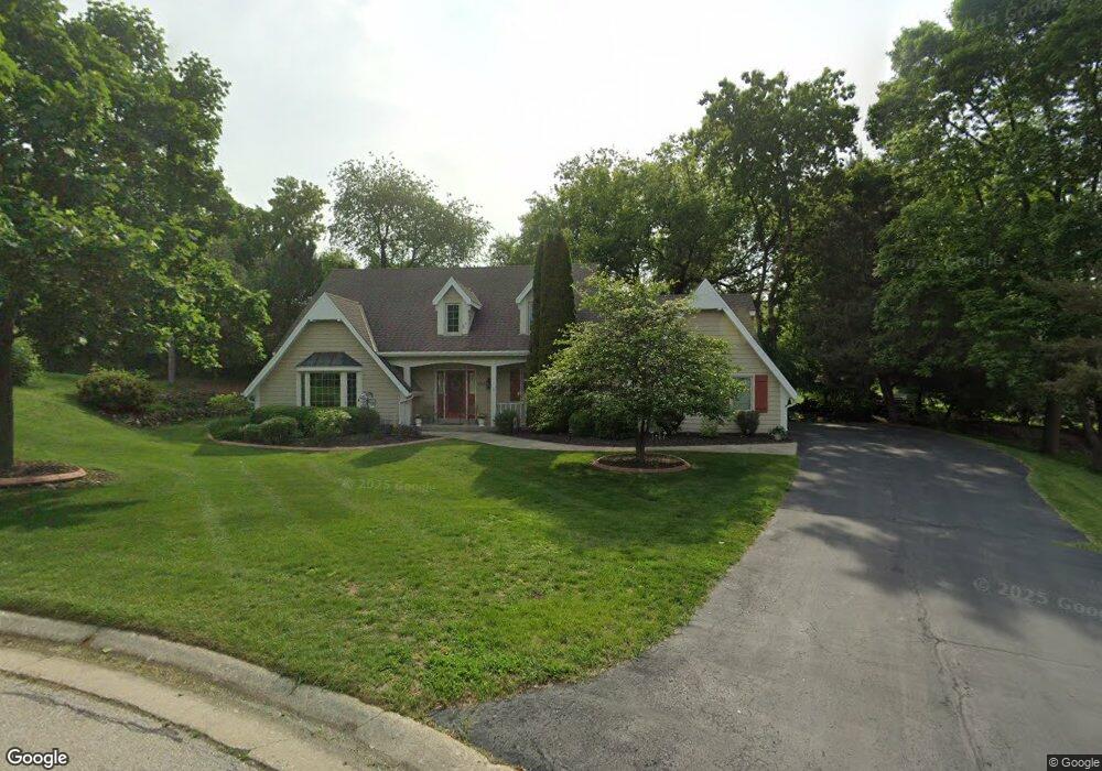
1285 Poplar Ridge Ct Brookfield, WI 53045
Brookfield Town NeighborhoodEstimated Value: $510,802 - $596,000
--
Bed
--
Bath
--
Sq Ft
0.38
Acres
About This Home
This home is located at 1285 Poplar Ridge Ct, Brookfield, WI 53045 and is currently estimated at $551,201. 1285 Poplar Ridge Ct is a home located in Waukesha County with nearby schools including John F. Miller School, Hillcrest Elementary School, and Horning Middle School.
Ownership History
Date
Name
Owned For
Owner Type
Purchase Details
Closed on
Jul 24, 2024
Sold by
Manthei James M and Manthei Susan J
Bought by
James M And Susan J Manthei Revocable Trust and Manthei
Current Estimated Value
Purchase Details
Closed on
Jun 25, 1998
Sold by
Vanmeter Richard E and Vanmeter Darlene
Bought by
Manthei James M and Manthei Susan J
Home Financials for this Owner
Home Financials are based on the most recent Mortgage that was taken out on this home.
Original Mortgage
$100,000
Interest Rate
7.15%
Mortgage Type
Purchase Money Mortgage
Create a Home Valuation Report for This Property
The Home Valuation Report is an in-depth analysis detailing your home's value as well as a comparison with similar homes in the area
Home Values in the Area
Average Home Value in this Area
Purchase History
| Date | Buyer | Sale Price | Title Company |
|---|---|---|---|
| James M And Susan J Manthei Revocable Trust | -- | None Listed On Document | |
| Manthei James M | $257,000 | -- |
Source: Public Records
Mortgage History
| Date | Status | Borrower | Loan Amount |
|---|---|---|---|
| Previous Owner | Manthei James M | $100,000 | |
| Closed | Manthei James M | $50,000 |
Source: Public Records
Tax History Compared to Growth
Tax History
| Year | Tax Paid | Tax Assessment Tax Assessment Total Assessment is a certain percentage of the fair market value that is determined by local assessors to be the total taxable value of land and additions on the property. | Land | Improvement |
|---|---|---|---|---|
| 2024 | $3,894 | $408,600 | $92,600 | $316,000 |
| 2023 | $3,925 | $408,600 | $92,600 | $316,000 |
| 2022 | $4,140 | $408,600 | $92,600 | $316,000 |
| 2021 | $4,256 | $347,100 | $77,200 | $269,900 |
| 2020 | $4,386 | $347,100 | $77,200 | $269,900 |
| 2019 | $4,464 | $347,100 | $77,200 | $269,900 |
| 2018 | $3,949 | $310,000 | $73,500 | $236,500 |
| 2017 | $3,952 | $310,000 | $73,500 | $236,500 |
| 2016 | $3,951 | $293,100 | $73,500 | $219,600 |
| 2015 | $3,998 | $293,100 | $73,500 | $219,600 |
| 2014 | $4,348 | $293,100 | $73,500 | $219,600 |
| 2013 | $4,348 | $292,000 | $73,500 | $218,500 |
Source: Public Records
Map
Nearby Homes
- 1155 Gray Fox Hollow Ct
- 950 N Barker Rd
- 1930 Cotton Tail Ln
- 1660 Constitution Dr
- 21905 W North Ave
- 1825 Derrin Ln
- 2423 Kossow Rd
- N19W22081 Foxview Ct Unit 2B
- 19775 Trilby Ct
- 21300 Astolat Dr
- 21710 Astolat Dr
- 19250 Benington Dr
- 2480 Lionel Ct
- 19145 Arlyne Ct
- 1620 Greenview Dr
- W222N2310 Glenwood Ln
- 2550 Harmony Cir
- 335 Kossow Rd
- N18W22670 Watertown Rd Unit Bld 1,2,3
- 1485 N Brookfield Rd
- 1270 Poplar Ridge Ct
- 1330 Jaclyn Dr
- 1325 Poplar Ridge Ct
- 1250 Poplar Ridge Ct
- 1360 Jaclyn Dr
- 1320 Poplar Ridge Ct
- 1240 Jaclyn Dr
- 1225 Hawthorne Ridge Dr
- 1235 Hawthorne Ridge Dr
- 1365 Poplar Ridge Ct
- 20985 Mary Lynn Dr
- 1360 Poplar Ridge Ct
- 1255 Hawthorne Ridge Dr
- 1215 Hawthorne Ridge Dr
- 21005 Mary Lynn Dr
- 1275 Hawthorne Ridge Dr
- 1220 Jaclyn Dr
- 1325 Hawthorne Ridge Dr
- 21090 Sierra Dr
- 1295 Jaclyn Dr