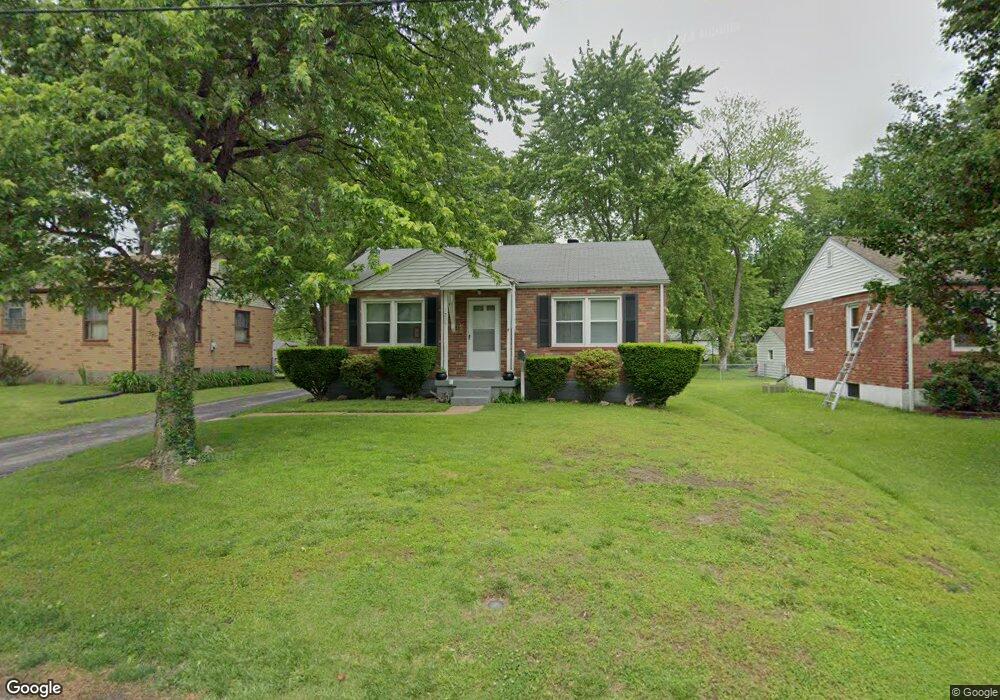
1285 Saint Francois St Florissant, MO 63031
Estimated Value: $128,455 - $139,000
2
Beds
1
Bath
792
Sq Ft
$170/Sq Ft
Est. Value
About This Home
This home is located at 1285 Saint Francois St, Florissant, MO 63031 and is currently estimated at $134,614, approximately $169 per square foot. 1285 Saint Francois St is a home located in St. Louis County with nearby schools including Duchesne Elementary School, Cross Keys Middle School, and McCluer North High School.
Ownership History
Date
Name
Owned For
Owner Type
Purchase Details
Closed on
Jul 18, 2007
Sold by
Pollock Patricia A
Bought by
Pollock Patricia A
Current Estimated Value
Home Financials for this Owner
Home Financials are based on the most recent Mortgage that was taken out on this home.
Original Mortgage
$181,500
Interest Rate
6.04%
Mortgage Type
Reverse Mortgage Home Equity Conversion Mortgage
Purchase Details
Closed on
Oct 2, 2003
Sold by
Pollock Patricia A
Bought by
Pollock Patricia A
Create a Home Valuation Report for This Property
The Home Valuation Report is an in-depth analysis detailing your home's value as well as a comparison with similar homes in the area
Home Values in the Area
Average Home Value in this Area
Purchase History
| Date | Buyer | Sale Price | Title Company |
|---|---|---|---|
| Pollock Patricia A | -- | None Available | |
| Pollock Patricia A | -- | -- |
Source: Public Records
Mortgage History
| Date | Status | Borrower | Loan Amount |
|---|---|---|---|
| Closed | Pollock Patricia A | $181,500 |
Source: Public Records
Tax History Compared to Growth
Tax History
| Year | Tax Paid | Tax Assessment Tax Assessment Total Assessment is a certain percentage of the fair market value that is determined by local assessors to be the total taxable value of land and additions on the property. | Land | Improvement |
|---|---|---|---|---|
| 2025 | $1,651 | $24,280 | $4,290 | $19,990 |
| 2024 | $1,651 | $21,140 | $2,960 | $18,180 |
| 2023 | $1,651 | $21,140 | $2,960 | $18,180 |
| 2022 | $1,339 | $15,040 | $4,290 | $10,750 |
| 2021 | $1,317 | $15,040 | $4,290 | $10,750 |
| 2020 | $1,280 | $13,830 | $3,800 | $10,030 |
| 2019 | $1,255 | $13,830 | $3,800 | $10,030 |
| 2018 | $1,196 | $11,760 | $2,110 | $9,650 |
| 2017 | $1,190 | $11,760 | $2,110 | $9,650 |
| 2016 | $1,370 | $13,240 | $4,010 | $9,230 |
| 2015 | $1,378 | $13,240 | $4,010 | $9,230 |
| 2014 | $1,503 | $14,940 | $3,670 | $11,270 |
Source: Public Records
Map
Nearby Homes
- 629 Aubuchon St
- 1290 Saint Louis St
- 1130 Saint Francois St
- 1023 Saint Denis St
- 1090 Saint Joseph St
- 1965 Saint Catherine St
- 865 Boone St
- 940 Harrison St
- 1040 Bluefield Dr
- 1148 Boone St
- 175 Clark St
- 505 Ridge Dr
- 1200 Bluefield Dr
- 1980 Parker Rd
- 150 Saint Daniel Ln
- 675 Pimlico Dr
- 260 N Jefferson St
- 2240 Brook Dr
- 2340 Saint Catherine St
- 580 Saint Marie St
- 1295 Saint Francois St
- 1265 Saint Francois St
- 1245 Saint Francois St
- 1305 Saint Francois St
- 1225 Saint Francois St
- 1280 Saint Francois St
- 1250 Saint Louis St
- 1325 Saint Francois St
- 1230 Saint Louis St
- 1205 Saint Francois St
- 1310 Saint Louis St
- 1240 Saint Francois St
- 1304 Saint Francois St
- 1345 Saint Francois St
- 1200 Saint Louis St
- 1220 Saint Francois St
- 1316 Saint Louis St
- 1320 Saint Francois St
- 1200 Saint Francois St
- 1365 Saint Francois St