
Seller's Agent in 2025
Jessica Hillyer
Coldwell Banker Professionals-Delta
(517) 492-3410
1 in this area
193 Total Sales
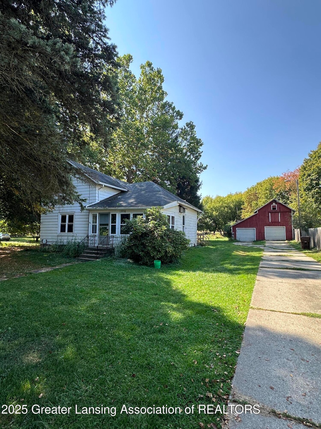


Highest and best due 09-22 at 5pm. Welcome to 12850 Wacousta Rd in Eagle! This home has a barn and is nestled on just over an acre! Home has suffered from fire damage. Sold as is. Cash only.
Last Agent to Sell the Property
Coldwell Banker Professionals-Delta License #6506047675 Listed on: 09/18/2025
| Date | Type | Sale Price | Title Company |
|---|---|---|---|
| Warranty Deed | $32,000 | Ata National Title Group | |
| Quit Claim Deed | -- | None Listed On Document | |
| Sheriffs Deed | $83,731 | None Available | |
| Warranty Deed | $121,000 | Fatic |
| Date | Status | Loan Amount | Loan Type |
|---|---|---|---|
| Previous Owner | $121,000 | Purchase Money Mortgage |
| Date | Event | Price | List to Sale | Price per Sq Ft |
|---|---|---|---|---|
| 10/17/2025 10/17/25 | Sold | $32,000 | +7.0% | $30 / Sq Ft |
| 09/23/2025 09/23/25 | Pending | -- | -- | -- |
| 09/18/2025 09/18/25 | For Sale | $29,900 | -- | $28 / Sq Ft |
| Year | Tax Paid | Tax Assessment Tax Assessment Total Assessment is a certain percentage of the fair market value that is determined by local assessors to be the total taxable value of land and additions on the property. | Land | Improvement |
|---|---|---|---|---|
| 2025 | $1,675 | $57,400 | $25,550 | $31,850 |
| 2024 | $4 | $53,150 | $23,250 | $29,900 |
| 2023 | $351 | $46,250 | $0 | $0 |
| 2022 | $1,493 | $42,950 | $18,350 | $24,600 |
| 2021 | $1,445 | $41,850 | $18,450 | $23,400 |
| 2020 | $1,373 | $39,350 | $17,400 | $21,950 |
| 2019 | $1,331 | $36,750 | $16,400 | $20,350 |
| 2018 | $1,243 | $29,000 | $9,700 | $19,300 |
| 2017 | $1,226 | $28,850 | $9,600 | $19,250 |
| 2016 | $1,226 | $27,550 | $9,050 | $18,500 |
| 2015 | $1,235 | $25,100 | $0 | $0 |
| 2011 | -- | $38,350 | $0 | $0 |
Seller's Agent in 2025
Jessica Hillyer
Coldwell Banker Professionals-Delta
(517) 492-3410
1 in this area
193 Total Sales
Buyer's Agent in 2025
Jerri Osmar
Berkshire Hathaway HomeServices
(517) 802-8569
1 in this area
28 Total Sales
Source: Greater Lansing Association of Realtors®
MLS Number: 291374
APN: 150-007-400-100-00
Disclaimer: Certain information contained herein is derived from information provided by parties other than Homes.com. All information provided is deemed reliable, but is not guaranteed to be accurate and should be independently verified.
![]() IDX information is provided exclusively for Consumers'
IDX information is provided exclusively for Consumers'
personal, non-commercial use, that it may not be used for any purpose other than to identify prospective properties Consumers may be interested in purchasing. Data is deemed reliable but is not guaranteed accurate by the MLS.
Copyright © 2026 Greater Lansing Association of REALTORS®
Ask me questions while you tour the home.