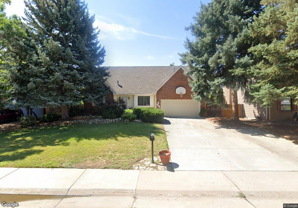
12854 E Villanova Dr Aurora, CO 80014
Heather Ridge NeighborhoodEstimated Value: $538,630 - $637,000
4
Beds
5
Baths
2,355
Sq Ft
$253/Sq Ft
Est. Value
About This Home
This home is located at 12854 E Villanova Dr, Aurora, CO 80014 and is currently estimated at $594,658, approximately $252 per square foot. 12854 E Villanova Dr is a home located in Arapahoe County with nearby schools including Ponderosa Elementary School, Prairie Middle School, and Overland High School.
Ownership History
Date
Name
Owned For
Owner Type
Purchase Details
Closed on
Oct 9, 2025
Sold by
Webb Stephen S and Webb Randee
Bought by
Webb Family Trust
Current Estimated Value
Purchase Details
Closed on
Aug 10, 1994
Sold by
Henry Daniel G and Henry Dawn Noelle
Bought by
Webb Stephen S and Webb Randee
Home Financials for this Owner
Home Financials are based on the most recent Mortgage that was taken out on this home.
Original Mortgage
$80,000
Interest Rate
8.51%
Purchase Details
Closed on
Nov 1, 1982
Sold by
Conversion Arapco
Bought by
Conversion Arapco
Purchase Details
Closed on
Feb 1, 1979
Sold by
Conversion Arapco
Bought by
Conversion Arapco
Purchase Details
Closed on
Jul 4, 1776
Bought by
Conversion Arapco
Create a Home Valuation Report for This Property
The Home Valuation Report is an in-depth analysis detailing your home's value as well as a comparison with similar homes in the area
Home Values in the Area
Average Home Value in this Area
Purchase History
| Date | Buyer | Sale Price | Title Company |
|---|---|---|---|
| Webb Family Trust | -- | None Listed On Document | |
| Webb Stephen S | $198,500 | Security Title Guaranty Co | |
| Conversion Arapco | -- | -- | |
| Conversion Arapco | -- | -- | |
| Conversion Arapco | -- | -- |
Source: Public Records
Mortgage History
| Date | Status | Borrower | Loan Amount |
|---|---|---|---|
| Previous Owner | Webb Stephen S | $80,000 |
Source: Public Records
Tax History Compared to Growth
Tax History
| Year | Tax Paid | Tax Assessment Tax Assessment Total Assessment is a certain percentage of the fair market value that is determined by local assessors to be the total taxable value of land and additions on the property. | Land | Improvement |
|---|---|---|---|---|
| 2024 | $2,008 | $35,731 | -- | -- |
| 2023 | $2,008 | $35,731 | $0 | $0 |
| 2022 | $1,797 | $31,351 | $0 | $0 |
| 2021 | $1,779 | $31,351 | $0 | $0 |
| 2020 | $1,675 | $30,051 | $0 | $0 |
| 2019 | $1,617 | $30,051 | $0 | $0 |
| 2018 | $1,525 | $27,475 | $0 | $0 |
| 2017 | $1,503 | $27,475 | $0 | $0 |
| 2016 | $2,703 | $24,182 | $0 | $0 |
| 2015 | $2,682 | $24,182 | $0 | $0 |
| 2014 | -- | $20,202 | $0 | $0 |
| 2013 | -- | $23,400 | $0 | $0 |
Source: Public Records
Map
Nearby Homes
- 13150 E Linvale Place
- 13020 E Linvale Place
- 2617 S Troy Ct
- 13184 E Linvale Place
- 2812 S Ursula Ct
- 2558 S Vaughn Way Unit C
- 2496 S Vaughn Way Unit A
- 2864 S Vaughn Way
- 2894 S Ursula St
- 12280 E Vassar Dr
- 13019 E Bethany Place
- 2888 S Ursula St
- 2693 S Xanadu Way Unit C
- 12671 E Bates Cir
- 12316 E Bates Cir
- 2853 S Xanadu Way
- 2855 S Xanadu Way Unit 20147
- 12886 E Wesley Place
- 12335 E Bates Cir
- 2829 S Xanadu Way
- 12804 E Villanova Dr
- 12894 E Villanova Dr
- 12792 E Villanova Dr
- 12906 E Villanova Dr
- 12853 E Villanova Dr
- 12996 E Villanova Dr
- 12803 E Villanova Dr
- 12752 E Villanova Dr
- 12484 E Amherst Cir
- 12482 E Amherst Cir
- 12993 E Vassar Dr
- 12486 E Amherst Cir
- 12791 E Villanova Dr
- 12480 E Amherst Cir
- 12488 E Amherst Cir
- 12702 E Villanova Dr
- 12490 E Amherst Cir
- 12903 E Vassar Dr
- 12852 E Vassar Dr
- 12751 E Villanova Dr