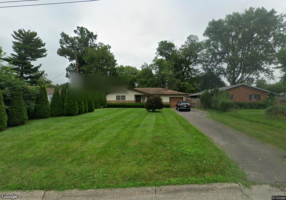
1286 Lancelot Rd Columbus, OH 43227
Shady Lane NeighborhoodEstimated Value: $228,000 - $244,000
3
Beds
2
Baths
1,378
Sq Ft
$173/Sq Ft
Est. Value
About This Home
This home is located at 1286 Lancelot Rd, Columbus, OH 43227 and is currently estimated at $237,845, approximately $172 per square foot. 1286 Lancelot Rd is a home located in Franklin County with nearby schools including Shady Lane Elementary School, Sherwood Middle School, and Walnut Ridge High School.
Ownership History
Date
Name
Owned For
Owner Type
Purchase Details
Closed on
May 30, 2025
Sold by
Curl Elsie and Biles Elsie M
Bought by
Elsie Mcdearmon Curl Irrevocable Trust and Thomas
Current Estimated Value
Purchase Details
Closed on
May 22, 1998
Sold by
Josivoski Louis and Josivoski Rada
Bought by
Biles Elsie M
Home Financials for this Owner
Home Financials are based on the most recent Mortgage that was taken out on this home.
Original Mortgage
$78,800
Interest Rate
7.27%
Create a Home Valuation Report for This Property
The Home Valuation Report is an in-depth analysis detailing your home's value as well as a comparison with similar homes in the area
Home Values in the Area
Average Home Value in this Area
Purchase History
| Date | Buyer | Sale Price | Title Company |
|---|---|---|---|
| Elsie Mcdearmon Curl Irrevocable Trust | -- | None Listed On Document | |
| Biles Elsie M | $98,500 | Gahanna Title |
Source: Public Records
Mortgage History
| Date | Status | Borrower | Loan Amount |
|---|---|---|---|
| Previous Owner | Biles Elsie M | $78,800 |
Source: Public Records
Tax History Compared to Growth
Tax History
| Year | Tax Paid | Tax Assessment Tax Assessment Total Assessment is a certain percentage of the fair market value that is determined by local assessors to be the total taxable value of land and additions on the property. | Land | Improvement |
|---|---|---|---|---|
| 2024 | $2,863 | $72,880 | $21,390 | $51,490 |
| 2023 | $2,823 | $72,870 | $21,385 | $51,485 |
| 2022 | $1,799 | $43,440 | $7,770 | $35,670 |
| 2021 | $1,802 | $43,440 | $7,770 | $35,670 |
| 2020 | $1,871 | $43,440 | $7,770 | $35,670 |
| 2019 | $1,574 | $34,690 | $6,230 | $28,460 |
| 2018 | $1,428 | $34,690 | $6,230 | $28,460 |
| 2017 | $1,495 | $34,690 | $6,230 | $28,460 |
| 2016 | $1,417 | $30,140 | $6,060 | $24,080 |
| 2015 | $1,286 | $30,140 | $6,060 | $24,080 |
| 2014 | $1,289 | $30,140 | $6,060 | $24,080 |
| 2013 | $1,054 | $35,455 | $7,140 | $28,315 |
Source: Public Records
Map
Nearby Homes
- 1130 Little Plum Ln
- 4501 Amesbury Rd
- 4677 E Livingston Ave
- 1320 Nancy Ln
- 4484 Grimsby Rd
- 1281 Maetzel Dr
- 4991 Justin Rd
- 4467 Grimsby Rd
- 4571 Aragon Ave
- 1607 Shady Lane Rd
- 1563 Genoa Place
- 1486 Efner Dr
- 1607 Simpson Dr
- 1571 Baxter Dr
- 4701 Janis Dr
- 1678 Huxley Dr
- 1085 S Hamilton Rd
- 1068 Ross Rd
- 1691 Shady Lane Rd
- 1543 S Hamilton Rd
- 4753 Robinhood Park
- 4761 Robinhood Park
- 1274 Lancelot Rd
- 0 Scarlet St
- 4769 Robinhood Park
- 0 Littlejohn Rd
- 1287 Lancelot Rd
- 1279 Lancelot Rd
- 4777 Robinhood Park
- 1295 Lancelot Rd
- 1271 Lancelot Rd
- 4754 Scarlet St
- 1303 Lancelot Rd
- 4762 Scarlet St
- 4723 Robinhood Park
- 4752 Robinhood Dr
- 4752 Robinhood Park
- 4760 Robinhood Park
- 1291 Littlejohn Dr
- 1299 Littlejohn Dr