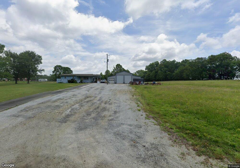
1286 Longstreet Rd Elberton, GA 30635
Estimated Value: $150,000 - $208,069
2
Beds
1
Bath
1,116
Sq Ft
$159/Sq Ft
Est. Value
About This Home
This home is located at 1286 Longstreet Rd, Elberton, GA 30635 and is currently estimated at $177,017, approximately $158 per square foot. 1286 Longstreet Rd is a home located in Elbert County with nearby schools including Elbert County Primary School, Elbert County Elementary School, and Elbert County Middle School.
Ownership History
Date
Name
Owned For
Owner Type
Purchase Details
Closed on
Oct 16, 2014
Sold by
Franklin Minnie Lee
Bought by
Neal Branch William and Branch Betty F
Current Estimated Value
Home Financials for this Owner
Home Financials are based on the most recent Mortgage that was taken out on this home.
Original Mortgage
$44,000
Outstanding Balance
$14,894
Interest Rate
4.29%
Estimated Equity
$162,123
Purchase Details
Closed on
Feb 1, 1984
Purchase Details
Closed on
Oct 1, 1962
Purchase Details
Closed on
Jan 1, 1959
Create a Home Valuation Report for This Property
The Home Valuation Report is an in-depth analysis detailing your home's value as well as a comparison with similar homes in the area
Home Values in the Area
Average Home Value in this Area
Purchase History
| Date | Buyer | Sale Price | Title Company |
|---|---|---|---|
| Neal Branch William | $55,000 | -- | |
| -- | $1,400 | -- | |
| -- | $2,600 | -- | |
| -- | -- | -- | |
| -- | $600 | -- |
Source: Public Records
Mortgage History
| Date | Status | Borrower | Loan Amount |
|---|---|---|---|
| Open | Neal Branch William | $44,000 |
Source: Public Records
Tax History Compared to Growth
Tax History
| Year | Tax Paid | Tax Assessment Tax Assessment Total Assessment is a certain percentage of the fair market value that is determined by local assessors to be the total taxable value of land and additions on the property. | Land | Improvement |
|---|---|---|---|---|
| 2024 | $1,242 | $61,808 | $19,390 | $42,418 |
| 2023 | $1,242 | $61,808 | $19,390 | $42,418 |
| 2022 | $934 | $48,972 | $11,542 | $37,430 |
| 2021 | $936 | $48,972 | $11,542 | $37,430 |
| 2020 | $803 | $39,541 | $9,234 | $30,307 |
| 2019 | $834 | $39,541 | $9,234 | $30,307 |
| 2018 | $860 | $39,541 | $9,234 | $30,307 |
| 2017 | $730 | $33,222 | $9,234 | $23,988 |
| 2016 | $762 | $33,222 | $9,234 | $23,988 |
| 2015 | -- | $26,182 | $9,234 | $16,948 |
| 2014 | -- | $28,785 | $9,234 | $19,551 |
| 2013 | -- | $28,785 | $9,234 | $19,551 |
Source: Public Records
Map
Nearby Homes
- 0 Cherokee Rd Unit 10576301
- 0 Mauldin Rd Unit 10657411
- 1943 Mauldin Rd
- 2914 Cherokee Rd
- 2688 Calhoun Falls Hwy
- 1318 Lincolnton Hwy
- 1385 Lincolnton Hwy
- 0 Flatwoods Rd Unit 10649821
- 2470 Dr George Ward Rd
- 2012 Lakeside Dr Unit LOT 47 / BEAVERDAM L
- 3177 Calhoun Falls Hwy
- 1112 Willis Rdige
- 2557 Washington Hwy
- 3366 Hester Rd
- 2724 Bells Ferry Rd
- 1464 Rousey Rd
- 2995 Heardmont Rd
- 0 Middleton Church Rd Unit 10312309
- 3563 Ernest Brown Rd
- 3831 Childston Dr
- 1272 Longstreet Rd
- 1244 Longstreet Rd
- 1330 Longstreet Rd
- 1232 Longstreet Rd
- 22 acres Cherokee Road 22 Acres
- 00000000 Longstreet Rd
- 0 Cherokee Rd Unit 3277115
- 0 Cherokee Rd Unit 7020738
- 0 Cherokee Rd Unit 3205240
- 0 Cherokee Rd Unit 7012318
- 0 Cherokee Rd Unit 7371541
- 0 Cherokee Rd Unit 7491068
- 0 Cherokee Rd Unit CM926744
- 0 Cherokee Rd Unit 20147152
- 0 Cherokee Rd Unit 20099915
- 0 Cherokee Rd Unit 6616060
- 0 Cherokee Rd Unit 8535248
- 1203 Longstreet Rd
- 1183 Longstreet Rd
- 2699 Cherokee Rd