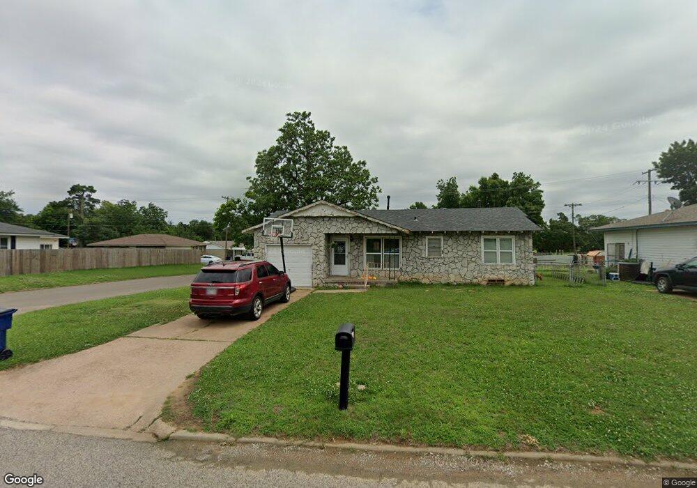
1286 Tim Holt Dr Harrah, OK 73045
Estimated Value: $109,000 - $121,000
3
Beds
1
Bath
816
Sq Ft
$139/Sq Ft
Est. Value
About This Home
This home is located at 1286 Tim Holt Dr, Harrah, OK 73045 and is currently estimated at $113,471, approximately $139 per square foot. 1286 Tim Holt Dr is a home located in Oklahoma County with nearby schools including Virginia Smith Elementary School, Russell Babb Elementary School, and Clara Reynolds Elementary School.
Ownership History
Date
Name
Owned For
Owner Type
Purchase Details
Closed on
Apr 23, 2004
Sold by
Thompson Leo R and Leo R Thompson Revocable Trust
Bought by
Butler Tammy J
Current Estimated Value
Purchase Details
Closed on
Jul 20, 2001
Sold by
Thompson Leo R and Thompson Leo Ray
Bought by
Leo R Thompson Revocable Trust
Purchase Details
Closed on
Sep 9, 2000
Sold by
Coffman Steven Howard and Coffman Christy Lynn
Bought by
Thompson Leo R and Thompson Helen L
Purchase Details
Closed on
Aug 13, 1999
Sold by
Thompson Leo R and Thompson Helen L
Bought by
Coffman Steven Howard and Coffman Christy Lynn
Home Financials for this Owner
Home Financials are based on the most recent Mortgage that was taken out on this home.
Original Mortgage
$42,000
Interest Rate
7.71%
Mortgage Type
Seller Take Back
Create a Home Valuation Report for This Property
The Home Valuation Report is an in-depth analysis detailing your home's value as well as a comparison with similar homes in the area
Home Values in the Area
Average Home Value in this Area
Purchase History
| Date | Buyer | Sale Price | Title Company |
|---|---|---|---|
| Butler Tammy J | $42,000 | Capitol Abstract & Title | |
| Leo R Thompson Revocable Trust | -- | -- | |
| Thompson Leo R | -- | -- | |
| Coffman Steven Howard | $43,000 | -- |
Source: Public Records
Mortgage History
| Date | Status | Borrower | Loan Amount |
|---|---|---|---|
| Previous Owner | Coffman Steven Howard | $42,000 |
Source: Public Records
Tax History
| Year | Tax Paid | Tax Assessment Tax Assessment Total Assessment is a certain percentage of the fair market value that is determined by local assessors to be the total taxable value of land and additions on the property. | Land | Improvement |
|---|---|---|---|---|
| 2025 | $774 | $8,232 | $1,591 | $6,641 |
| 2023 | $662 | $7,760 | $1,695 | $6,065 |
| 2022 | $650 | $7,534 | $1,814 | $5,720 |
| 2021 | $628 | $7,315 | $1,326 | $5,989 |
| 2020 | $625 | $7,116 | $1,271 | $5,845 |
| 2019 | $603 | $6,908 | $1,225 | $5,683 |
| 2018 | $593 | $6,708 | $0 | $0 |
| 2017 | $562 | $6,512 | $1,047 | $5,465 |
| 2016 | $552 | $6,322 | $1,093 | $5,229 |
| 2015 | $528 | $6,138 | $1,132 | $5,006 |
| 2014 | $536 | $6,235 | $1,132 | $5,103 |
Source: Public Records
Map
Nearby Homes
- 20851 Silver St
- 20699 Hensel St
- 972 Tim Holt Dr
- 1650 N 1st St
- 20687 Brush Creek Blvd
- 20661 Brush Creek Blvd
- 20657 Brush Creek Blvd
- 20653 Brush Creek Blvd
- 20649 Brush Creek Blvd
- 20645 Brush Creek Blvd
- 20831 Navarre
- 20684 Brush Creek Blvd
- 20674 Brush Creek Blvd
- 20658 Brush Creek Blvd
- 20652 Brush Creek Blvd
- 20648 Brush Creek Blvd
- 20640 Brush Creek Blvd
- 20544 Brush Creek Blvd
- 866 Harrison St
- 2220 Church Ave
- 1270 Tim Holt Dr
- 20788 Silver St
- 1318 Tim Holt Dr
- 1254 Tim Holt Dr
- 20800 Silver St
- 20787 Silver St
- 1330 Tim Holt Dr
- 1238 Tim Holt Dr
- 1297 Tim Holt Dr
- 1267 Tim Holt Dr
- 20799 Silver St
- 20810 Silver St
- 1263 Tim Holt Dr
- 1321 Tim Holt Dr
- 1350 Tim Holt Dr
- 20809 Silver St
- 20820 Silver St
- 1337 Tim Holt Dr
- 20819 Silver St
- 1208 Tim Holt Dr
Your Personal Tour Guide
Ask me questions while you tour the home.