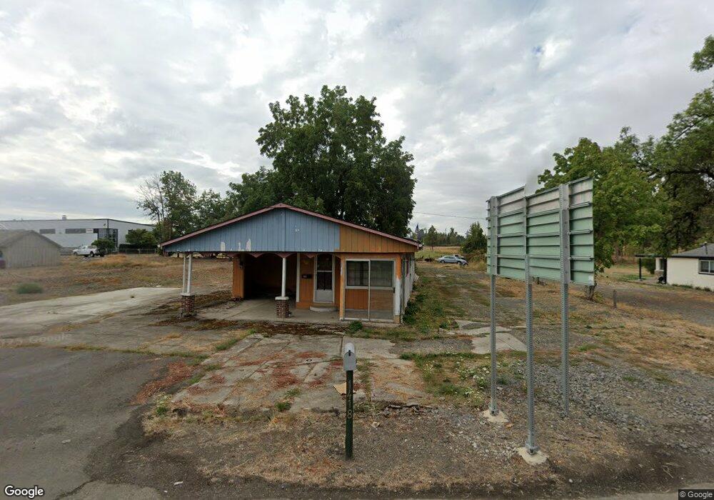
12860 S Highway 211 Molalla, OR 97038
Estimated Value: $283,000 - $461,000
2
Beds
1
Bath
840
Sq Ft
$432/Sq Ft
Est. Value
About This Home
This home is located at 12860 S Highway 211, Molalla, OR 97038 and is currently estimated at $363,246, approximately $432 per square foot. 12860 S Highway 211 is a home located in Clackamas County with nearby schools including Oregon Outreach - Molalla Pride.
Ownership History
Date
Name
Owned For
Owner Type
Purchase Details
Closed on
Mar 23, 2021
Sold by
Isiordia Luis Amaral and De Amaral Anabel
Bought by
Servin Jeronimo Morales and Maira Mejia R
Current Estimated Value
Purchase Details
Closed on
Jul 29, 2019
Sold by
Fannie Mae
Bought by
Martinez Isiordia Luis Amarai and Martinez De Amaral Anabel
Purchase Details
Closed on
Aug 10, 2018
Sold by
Philpot Fred
Bought by
Federal National Mortgage Association
Purchase Details
Closed on
Jan 12, 2006
Sold by
Philpot Gerline
Bought by
Philpot Fred
Create a Home Valuation Report for This Property
The Home Valuation Report is an in-depth analysis detailing your home's value as well as a comparison with similar homes in the area
Home Values in the Area
Average Home Value in this Area
Purchase History
| Date | Buyer | Sale Price | Title Company |
|---|---|---|---|
| Servin Jeronimo Morales | $160,000 | First American | |
| Martinez Isiordia Luis Amarai | $140,000 | Lawyers Title | |
| Federal National Mortgage Association | $175,000 | None Available | |
| Philpot Fred | -- | First American |
Source: Public Records
Tax History Compared to Growth
Tax History
| Year | Tax Paid | Tax Assessment Tax Assessment Total Assessment is a certain percentage of the fair market value that is determined by local assessors to be the total taxable value of land and additions on the property. | Land | Improvement |
|---|---|---|---|---|
| 2025 | $2,503 | $130,664 | -- | -- |
| 2024 | $2,419 | $126,859 | -- | -- |
| 2023 | $2,419 | $123,165 | $0 | $0 |
| 2022 | $1,995 | $119,578 | $0 | $0 |
| 2021 | $1,913 | $116,096 | $0 | $0 |
| 2020 | $1,860 | $112,715 | $0 | $0 |
| 2019 | $1,806 | $109,433 | $0 | $0 |
| 2018 | $1,755 | $106,246 | $0 | $0 |
| 2017 | $1,182 | $103,151 | $0 | $0 |
| 2016 | $1,109 | $100,147 | $0 | $0 |
| 2015 | $1,078 | $97,230 | $0 | $0 |
| 2014 | $1,042 | $94,398 | $0 | $0 |
Source: Public Records
Map
Nearby Homes
- 1406 W Main St
- 1522 W Main St
- 31430 Oregon 213
- 1014 S View Dr
- 33953 Oregon 213
- 902 S View Dr
- 900 Bear Creek Dr
- 340 Doug Fir Ln
- 701 Oriental Ct
- 714 Saint James Place
- 850 N Valley Dr
- 0 W Main St Unit 765814723
- 13434 S Lowe Rd
- 947 Meadowlark Place
- 31514 S Bear Meadow Ct
- 843 Julie Ln
- 30683 S Highway 213
- 863 June Dr
- 569 June Dr
- 13595 S Warrick Rd
- 1418 W Main St
- 12852 S Highway 211
- 1412 W Main St
- 12874 S Highway 211
- 1424 W Main St
- 12888 S Highway 211
- 1400 Fountain Way
- 1400 Fountain Way Unit 1
- 1441 W Main St
- 12798 S Highway 211
- 1436 W Main St
- 0 Fountain Way Unit 2
- 1522 W Main St
- 1515 W Main St Unit Q
- 12843 S Highway 211
- 1585 W Main St Unit 1
- 13001 S Crompton Ln
- 12933 S Highway 211
- 12968 S Highway 211
- 13001 S Crompton's Ln