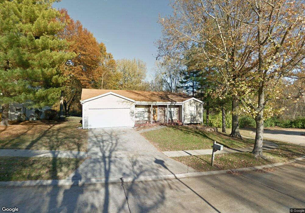
12862 Foxspur Ct Florissant, MO 63033
Estimated Value: $181,000 - $210,000
4
Beds
2
Baths
1,053
Sq Ft
$184/Sq Ft
Est. Value
About This Home
This home is located at 12862 Foxspur Ct, Florissant, MO 63033 and is currently estimated at $193,660, approximately $183 per square foot. 12862 Foxspur Ct is a home located in St. Louis County with nearby schools including Townsend Elementary School, Central Middle School, and Hazelwood Central High School.
Ownership History
Date
Name
Owned For
Owner Type
Purchase Details
Closed on
Aug 31, 2009
Sold by
Wilson Barry K and Roberts Julia
Bought by
Shamily Patricia D
Current Estimated Value
Home Financials for this Owner
Home Financials are based on the most recent Mortgage that was taken out on this home.
Original Mortgage
$91,315
Outstanding Balance
$59,932
Interest Rate
5.26%
Mortgage Type
FHA
Estimated Equity
$133,728
Purchase Details
Closed on
Feb 10, 2009
Sold by
U S Bank National Association
Bought by
Wilson Barry K and Roberts Julia
Home Financials for this Owner
Home Financials are based on the most recent Mortgage that was taken out on this home.
Original Mortgage
$36,500
Interest Rate
5.06%
Mortgage Type
Future Advance Clause Open End Mortgage
Purchase Details
Closed on
Jun 27, 2008
Sold by
Schomburg Jo Ann and Schomburg Lynn R
Bought by
Us Bank Na
Create a Home Valuation Report for This Property
The Home Valuation Report is an in-depth analysis detailing your home's value as well as a comparison with similar homes in the area
Home Values in the Area
Average Home Value in this Area
Purchase History
| Date | Buyer | Sale Price | Title Company |
|---|---|---|---|
| Shamily Patricia D | $93,000 | None Available | |
| Wilson Barry K | -- | None Available | |
| Us Bank Na | $106,305 | None Available |
Source: Public Records
Mortgage History
| Date | Status | Borrower | Loan Amount |
|---|---|---|---|
| Open | Shamily Patricia D | $91,315 | |
| Previous Owner | Wilson Barry K | $36,500 |
Source: Public Records
Tax History Compared to Growth
Tax History
| Year | Tax Paid | Tax Assessment Tax Assessment Total Assessment is a certain percentage of the fair market value that is determined by local assessors to be the total taxable value of land and additions on the property. | Land | Improvement |
|---|---|---|---|---|
| 2025 | $2,326 | $29,540 | $2,960 | $26,580 |
| 2024 | $2,326 | $25,480 | $3,720 | $21,760 |
| 2023 | $2,318 | $25,480 | $3,720 | $21,760 |
| 2022 | $2,105 | $20,560 | $5,570 | $14,990 |
| 2021 | $1,993 | $20,560 | $5,570 | $14,990 |
| 2020 | $2,043 | $19,650 | $4,850 | $14,800 |
| 2019 | $2,011 | $19,650 | $4,850 | $14,800 |
| 2018 | $1,705 | $15,370 | $2,640 | $12,730 |
| 2017 | $1,703 | $15,370 | $2,640 | $12,730 |
| 2016 | $1,727 | $15,330 | $3,020 | $12,310 |
| 2015 | $1,687 | $15,330 | $3,020 | $12,310 |
| 2014 | $1,806 | $16,360 | $3,630 | $12,730 |
Source: Public Records
Map
Nearby Homes
- 6862 Foxbend Ct
- 6803 Foxbend Ct
- 6646 Foothills Ct
- 12670 Verwood Dr
- 12713 Partridge Run Dr
- 6360 Silver Fox Dr
- 1828 Arrowpoint Dr
- 12435 Sea Lane Dr Unit 5
- 12432 Quatre Dr
- 6665 Lakeside Hills Dr
- 12456 Sea Lane Dr Unit A
- 6705 N Highway 67
- 12845 Meadowdale Dr
- 12225 Tarpon Dr
- 6660 Lakeside Hills Dr
- 6587 Dolphin Cir E Unit 110B
- 6595 Dolphin Cir E Unit 131A
- 12750 Needle Point Ct
- 12831 Bellefontaine Rd
- 12518 Woodstream Dr
- 12882 Foxspur Ct
- 12892 Foxspur Ct
- 6878 Finchdale Ct
- 12863 Foxspur Ct
- 12873 Foxspur Ct
- 12853 Foxspur Ct
- 12883 Foxspur Ct
- 6882 Finchdale Ct
- 6858 Finchdale Ct
- 12843 Foxspur Ct
- 6796 Lesli Mari Ct
- 6791 Lesli Mari Ct
- 6848 Finchdale Ct
- 6873 Finchdale Ct
- 6879 Finchdale Ct
- 6869 Finchdale Ct
- 6883 Finchdale Ct
- 6859 Finchdale Ct
- 6838 Finchdale Ct
- 6787 Lesli Mari Ct