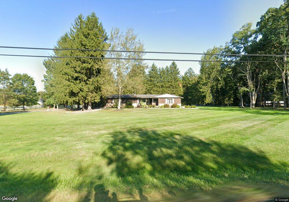
12876 State Route 44 Mantua, OH 44255
Estimated Value: $251,000 - $352,000
3
Beds
2
Baths
1,290
Sq Ft
$245/Sq Ft
Est. Value
About This Home
This home is located at 12876 State Route 44, Mantua, OH 44255 and is currently estimated at $315,862, approximately $244 per square foot. 12876 State Route 44 is a home located in Portage County with nearby schools including Crestwood Primary School, Crestwood Intermediate School, and Crestwood Middle School.
Ownership History
Date
Name
Owned For
Owner Type
Purchase Details
Closed on
Jan 20, 2011
Sold by
Mantua Land Company Inc and Kosar Bernard J
Bought by
Smigelski Richard A
Current Estimated Value
Home Financials for this Owner
Home Financials are based on the most recent Mortgage that was taken out on this home.
Original Mortgage
$128,497
Outstanding Balance
$87,772
Interest Rate
4.82%
Mortgage Type
New Conventional
Estimated Equity
$228,090
Purchase Details
Closed on
Nov 13, 2000
Sold by
Anthony Stachowski
Bought by
Mantua Land Company Inc
Purchase Details
Closed on
Sep 10, 1997
Sold by
Kenney Marie R
Bought by
Stachowski Anthony
Create a Home Valuation Report for This Property
The Home Valuation Report is an in-depth analysis detailing your home's value as well as a comparison with similar homes in the area
Home Values in the Area
Average Home Value in this Area
Purchase History
| Date | Buyer | Sale Price | Title Company |
|---|---|---|---|
| Smigelski Richard A | $124,000 | Attorney | |
| Mantua Land Company Inc | $190,000 | Approved Statewide Title Age | |
| Stachowski Anthony | $128,100 | -- |
Source: Public Records
Mortgage History
| Date | Status | Borrower | Loan Amount |
|---|---|---|---|
| Open | Smigelski Richard A | $128,497 |
Source: Public Records
Tax History Compared to Growth
Tax History
| Year | Tax Paid | Tax Assessment Tax Assessment Total Assessment is a certain percentage of the fair market value that is determined by local assessors to be the total taxable value of land and additions on the property. | Land | Improvement |
|---|---|---|---|---|
| 2024 | $4,259 | $107,670 | $26,570 | $81,100 |
| 2023 | $2,833 | $64,760 | $24,680 | $40,080 |
| 2022 | $2,864 | $64,760 | $24,680 | $40,080 |
| 2021 | $2,882 | $64,760 | $24,680 | $40,080 |
| 2020 | $2,690 | $57,160 | $23,490 | $33,670 |
| 2019 | $2,654 | $57,160 | $23,490 | $33,670 |
| 2018 | $2,410 | $50,340 | $22,580 | $27,760 |
| 2017 | $2,410 | $50,340 | $22,580 | $27,760 |
| 2016 | $2,376 | $50,340 | $22,580 | $27,760 |
| 2015 | $2,408 | $50,340 | $22,580 | $27,760 |
| 2014 | $2,355 | $48,760 | $22,580 | $26,180 |
| 2013 | $2,359 | $48,760 | $22,580 | $26,180 |
Source: Public Records
Map
Nearby Homes
- 12167 Mantua Center Rd
- 18420 May Ct
- 3444 Winchell Rd
- 11945 Ladue Trail
- 18400 Shaw Rd
- 11830 Starbush Ct
- 12845 Vincent Dr
- 11470 Bowen Rd
- 4791 Pioneer Trail
- 11611 E Washington St
- 4620 Pioneer Trail
- 0 Bartholomew Rd Unit 21957397
- 12298 Chamberlain Rd
- 30 Cardinal Dr
- 11131 State Route 44
- 76 Cardinal Dr
- 151 Oaktree Ln
- 142 Oaktree Ln
- 4364 Pioneer Trail
- 19109 Tilden Rd
- 4730 Winchell Rd
- 12859 State Route 44
- 4714 Foxhall Ct
- 4700 Foxhall Ct
- S/L 35 E Point Dr
- S/L 47 E Point Dr
- 4730 Foxhall Ct
- 12905 W Point Dr
- 12841 State Route 44
- S/L 48 E Point Dr
- S/L 44 E Point Dr
- S/L 34 E Point Dr
- S/L 46 E Point Dr
- 3 Foxhall Ct Unit 3
- 1 Foxhall Ct
- S/L 25 W Point Dr
- 4719 Foxhall Ct
- 12925 W Point Dr
- 4705 Foxhall Ct
- 12915 State Route 44