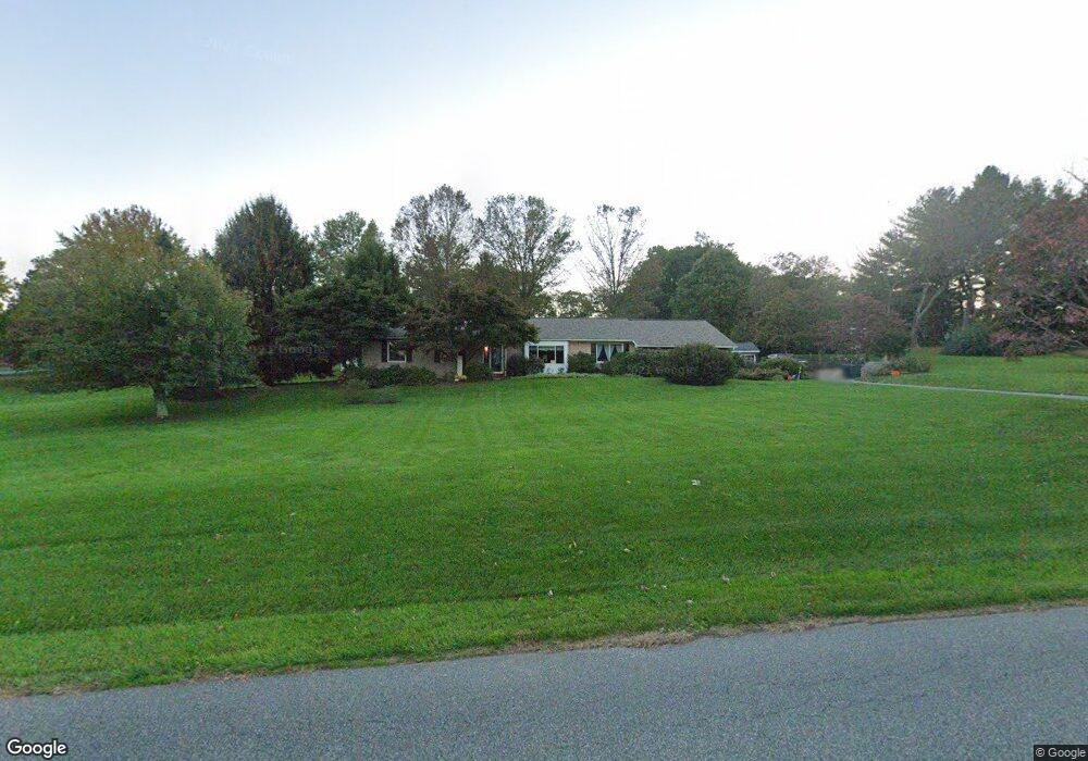
1288 Kulp Rd Pottstown, PA 19465
Estimated Value: $584,347 - $673,000
3
Beds
3
Baths
2,084
Sq Ft
$303/Sq Ft
Est. Value
About This Home
This home is located at 1288 Kulp Rd, Pottstown, PA 19465 and is currently estimated at $631,837, approximately $303 per square foot. 1288 Kulp Rd is a home located in Chester County with nearby schools including East Vincent Elementary School, Owen J Roberts Middle School, and Owen J Roberts High School.
Ownership History
Date
Name
Owned For
Owner Type
Purchase Details
Closed on
Jul 20, 2000
Sold by
Penny David E and Penny Pamela K
Bought by
Francis Earl Rodney and Francis Denise A
Current Estimated Value
Home Financials for this Owner
Home Financials are based on the most recent Mortgage that was taken out on this home.
Original Mortgage
$149,600
Interest Rate
8.1%
Purchase Details
Closed on
May 26, 1998
Sold by
Carlin Mary Ann
Bought by
Penny David E and Penny Pamela K
Home Financials for this Owner
Home Financials are based on the most recent Mortgage that was taken out on this home.
Original Mortgage
$120,000
Interest Rate
7.05%
Create a Home Valuation Report for This Property
The Home Valuation Report is an in-depth analysis detailing your home's value as well as a comparison with similar homes in the area
Home Values in the Area
Average Home Value in this Area
Purchase History
| Date | Buyer | Sale Price | Title Company |
|---|---|---|---|
| Francis Earl Rodney | $187,000 | -- | |
| Penny David E | $170,000 | -- |
Source: Public Records
Mortgage History
| Date | Status | Borrower | Loan Amount |
|---|---|---|---|
| Previous Owner | Francis Earl Rodney | $149,600 | |
| Previous Owner | Penny David E | $120,000 | |
| Closed | Francis Earl Rodney | $28,050 |
Source: Public Records
Tax History
| Year | Tax Paid | Tax Assessment Tax Assessment Total Assessment is a certain percentage of the fair market value that is determined by local assessors to be the total taxable value of land and additions on the property. | Land | Improvement |
|---|---|---|---|---|
| 2025 | $7,991 | $189,920 | $59,570 | $130,350 |
| 2024 | $7,991 | $189,920 | $59,570 | $130,350 |
| 2023 | $7,878 | $189,920 | $59,570 | $130,350 |
| 2022 | $6,776 | $189,920 | $59,570 | $130,350 |
| 2021 | $6,696 | $166,000 | $59,570 | $106,430 |
| 2020 | $6,528 | $166,000 | $59,570 | $106,430 |
| 2019 | $6,409 | $166,000 | $59,570 | $106,430 |
| 2018 | $6,287 | $166,000 | $59,570 | $106,430 |
| 2017 | $6,142 | $166,000 | $59,570 | $106,430 |
| 2016 | $4,952 | $166,000 | $59,570 | $106,430 |
| 2015 | $4,952 | $166,000 | $59,570 | $106,430 |
| 2014 | $4,952 | $166,000 | $59,570 | $106,430 |
Source: Public Records
Map
Nearby Homes
- 114 Sylvan Dr
- 723 Saylors Mill Rd
- 797 Ebelhare Rd
- 527 Bethel Church Rd
- 1202 W Bridge St
- 204 Nottingham Dr
- 1112 W Bridge St
- 100 Maack Rd
- 31 Terrace Dr
- 35 Terrace Dr
- 9 Oak Dr
- 7 Oak Dr
- 10 Coventry Dr
- 21 Meadow Ln
- 244 Harley Rd
- 1413 Old Schuylkill Rd
- 1211 Old Schuylkill Rd
- 1013 W Bridge St
- 287 Kulp Rd
- 2126 Robin Ln
Your Personal Tour Guide
Ask me questions while you tour the home.