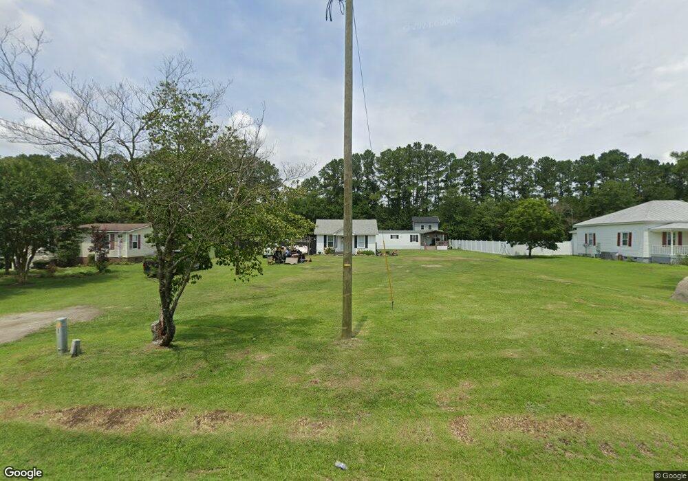
1288 Neuse Rd Kinston, NC 28501
Estimated Value: $107,000 - $163,000
3
Beds
3
Baths
1,170
Sq Ft
$117/Sq Ft
Est. Value
About This Home
This home is located at 1288 Neuse Rd, Kinston, NC 28501 and is currently estimated at $136,874, approximately $116 per square foot. 1288 Neuse Rd is a home located in Lenoir County with nearby schools including Southwood Elementary School, Woodington Middle School, and South Lenoir High School.
Ownership History
Date
Name
Owned For
Owner Type
Purchase Details
Closed on
May 22, 2025
Sold by
Schmick Roy E and Schmick Wendy O
Bought by
Ward Kathy M
Current Estimated Value
Home Financials for this Owner
Home Financials are based on the most recent Mortgage that was taken out on this home.
Original Mortgage
$135,168
Outstanding Balance
$134,565
Interest Rate
6.62%
Mortgage Type
FHA
Estimated Equity
$2,309
Purchase Details
Closed on
Sep 19, 2023
Sold by
Nettles Wanda O and Schmick Wendy
Bought by
Schmick Wendy and Schmick Roy E
Purchase Details
Closed on
Jan 23, 2019
Sold by
Lenox Britt and Burns-Britt Nancy
Bought by
Leigh-Britt Emily and Britt Lennox G
Purchase Details
Closed on
Jan 4, 2019
Sold by
Jones Donald and Jones Audrey
Bought by
Wingard Jenny
Create a Home Valuation Report for This Property
The Home Valuation Report is an in-depth analysis detailing your home's value as well as a comparison with similar homes in the area
Home Values in the Area
Average Home Value in this Area
Purchase History
| Date | Buyer | Sale Price | Title Company |
|---|---|---|---|
| Ward Kathy M | $138,000 | None Listed On Document | |
| Ward Kathy M | $138,000 | None Listed On Document | |
| Schmick Wendy | -- | None Listed On Document | |
| Leigh-Britt Emily | -- | -- | |
| Wingard Jenny | $60,000 | -- |
Source: Public Records
Mortgage History
| Date | Status | Borrower | Loan Amount |
|---|---|---|---|
| Open | Ward Kathy M | $135,168 | |
| Closed | Ward Kathy M | $135,168 |
Source: Public Records
Tax History Compared to Growth
Tax History
| Year | Tax Paid | Tax Assessment Tax Assessment Total Assessment is a certain percentage of the fair market value that is determined by local assessors to be the total taxable value of land and additions on the property. | Land | Improvement |
|---|---|---|---|---|
| 2025 | $905 | $108,311 | $17,392 | $90,919 |
| 2024 | $500 | $52,868 | $12,850 | $40,018 |
| 2023 | $579 | $52,868 | $12,850 | $40,018 |
| 2022 | $579 | $52,868 | $12,850 | $40,018 |
| 2021 | $579 | $52,868 | $12,850 | $40,018 |
| 2020 | $579 | $52,868 | $12,850 | $40,018 |
| 2019 | $579 | $52,868 | $12,850 | $40,018 |
| 2018 | $563 | $52,868 | $12,850 | $40,018 |
| 2017 | $560 | $52,868 | $12,850 | $40,018 |
| 2014 | $570 | $54,009 | $12,851 | $41,158 |
| 2013 | -- | $54,009 | $12,851 | $41,158 |
| 2011 | -- | $54,009 | $12,851 | $41,158 |
Source: Public Records
Map
Nearby Homes
- 305 British Rd
- 1413 British Rd
- Lot 1 Whaley Rd
- Lot 11 Whaley Rd
- 938 Whaley Rd
- Lot 8 Whaley Rd
- 926 Whaley Rd
- Lot 6 Whaley Rd
- 950 Whaley Rd
- Lot 7 Whaley Rd
- 2502 State Dr
- 0 Highway 70 E Unit 18109347
- 202 Heard St
- 2649 Delilah Dr
- 2643 Delilah Dr
- 2631 Delilah Dr
- 2635 Delilah Dr
- 1902 Truman Ave
- 802 Eagle Rd
- 513 J P Harrison Blvd