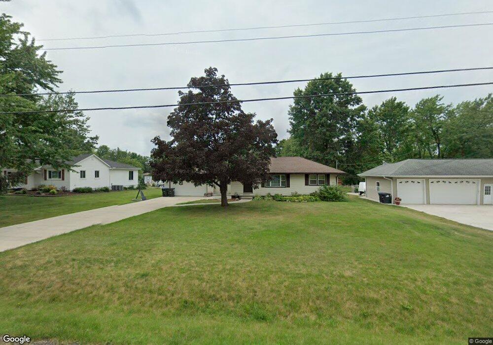
1288 Stearns St Brunswick, OH 44212
Estimated Value: $233,895 - $253,000
3
Beds
1
Bath
1,101
Sq Ft
$218/Sq Ft
Est. Value
About This Home
This home is located at 1288 Stearns St, Brunswick, OH 44212 and is currently estimated at $240,474, approximately $218 per square foot. 1288 Stearns St is a home located in Medina County with nearby schools including Hickory Ridge Elementary School, Willets Middle School, and Brunswick High School.
Ownership History
Date
Name
Owned For
Owner Type
Purchase Details
Closed on
May 6, 2019
Sold by
Easa Mitchell
Bought by
Evert Adam J
Current Estimated Value
Home Financials for this Owner
Home Financials are based on the most recent Mortgage that was taken out on this home.
Original Mortgage
$156,750
Outstanding Balance
$137,815
Interest Rate
4.2%
Mortgage Type
New Conventional
Estimated Equity
$102,659
Purchase Details
Closed on
Nov 30, 2018
Sold by
Burke Jaime and Estate Of Stephen J Krajcirik
Bought by
Easa Mitchell
Create a Home Valuation Report for This Property
The Home Valuation Report is an in-depth analysis detailing your home's value as well as a comparison with similar homes in the area
Home Values in the Area
Average Home Value in this Area
Purchase History
| Date | Buyer | Sale Price | Title Company |
|---|---|---|---|
| Evert Adam J | $165,333 | Black Tie Title | |
| Easa Mitchell | $100,000 | None Available |
Source: Public Records
Mortgage History
| Date | Status | Borrower | Loan Amount |
|---|---|---|---|
| Open | Evert Adam J | $156,750 |
Source: Public Records
Tax History Compared to Growth
Tax History
| Year | Tax Paid | Tax Assessment Tax Assessment Total Assessment is a certain percentage of the fair market value that is determined by local assessors to be the total taxable value of land and additions on the property. | Land | Improvement |
|---|---|---|---|---|
| 2024 | $2,857 | $57,760 | $24,260 | $33,500 |
| 2023 | $2,857 | $57,760 | $24,260 | $33,500 |
| 2022 | $2,702 | $57,760 | $24,260 | $33,500 |
| 2021 | $2,386 | $41,650 | $19,250 | $22,400 |
| 2020 | $2,260 | $41,650 | $19,250 | $22,400 |
| 2019 | $1,956 | $41,650 | $19,250 | $22,400 |
| 2018 | $2,267 | $38,570 | $16,310 | $22,260 |
| 2017 | $1,913 | $38,570 | $16,310 | $22,260 |
| 2016 | $1,911 | $38,570 | $16,310 | $22,260 |
| 2015 | $1,838 | $35,900 | $17,350 | $18,550 |
| 2014 | $1,832 | $35,900 | $17,350 | $18,550 |
| 2013 | $1,792 | $35,900 | $17,350 | $18,550 |
Source: Public Records
Map
Nearby Homes
- 1307 Stearns St
- 1407 Lincoln Ave
- 1431 Roosevelt Ave
- 1389 Mussel Shoals Dr
- 1151 Mulberry Ln
- 1464 Troon Ave
- 4383 Inner Circle Dr Unit C24
- 4383 Inner Circle Dr Unit A24
- 4385 Inner Circle Dr Unit B-18
- 4383 Inner Circle Dr Unit B22
- 4349 Inner Circle Dr Unit A-5
- 4684 Wolff Dr
- V/L Pearl Rd
- 0 Pearl Rd Unit 4173749
- 1536 Jefferson Ave
- 1044-1070 Pearl Rd
- 1202 Substation Rd
- 4597 Brushwood Cir
- 4273 Settlers Way
- 4224 Maiden Ct
- 1298 Stearns St
- 1278 Stearns St
- 1306 Stearns St
- 1268 Stearns St
- 1287 Stearns St
- 1297 Stearns St
- 1314 Stearns St
- 1277 Stearns St
- 1258 Stearns St
- 1267 Stearns St
- 1295 Cherry Ln
- 1320 Stearns St
- 1285 Cherry Ln
- 1273 Cherry Ln
- 1315 Stearns St
- 1303 Cherry Ln
- 1265 Cherry Ln
- 1257 Stearns St
- 1313 Cherry Ln
- 1248 Stearns St