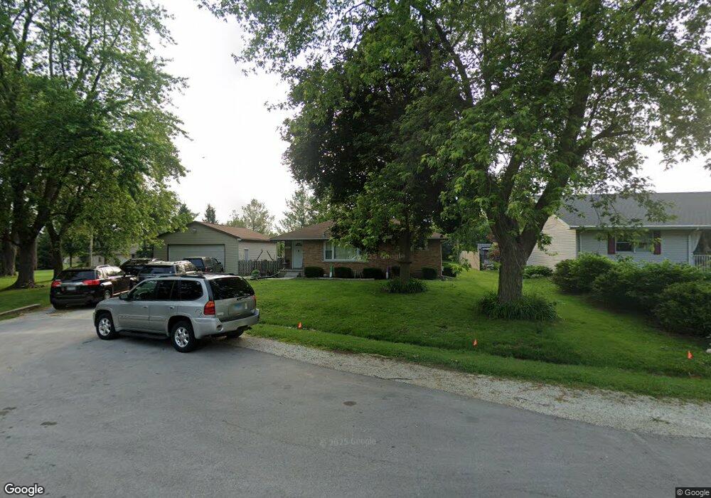
1289 Arrowhead Dr Bourbonnais, IL 60914
Estimated Value: $190,000 - $232,000
3
Beds
1
Bath
1,103
Sq Ft
$192/Sq Ft
Est. Value
About This Home
This home is located at 1289 Arrowhead Dr, Bourbonnais, IL 60914 and is currently estimated at $212,110, approximately $192 per square foot. 1289 Arrowhead Dr is a home located in Kankakee County with nearby schools including Noel Levasseur Elementary School, Liberty Intermediate School, and Bourbonnais Upper Grade Center.
Ownership History
Date
Name
Owned For
Owner Type
Purchase Details
Closed on
Jun 18, 2021
Sold by
Trust No 2457
Bought by
Kelso Joseph S and Kelso Randi
Current Estimated Value
Home Financials for this Owner
Home Financials are based on the most recent Mortgage that was taken out on this home.
Original Mortgage
$168,393
Outstanding Balance
$153,277
Interest Rate
3.25%
Mortgage Type
FHA
Estimated Equity
$58,833
Purchase Details
Closed on
Dec 30, 2016
Sold by
Strunk Terry D and Strunk Christina A
Bought by
Municipal Trust & Svgs Bk Tr 2457
Create a Home Valuation Report for This Property
The Home Valuation Report is an in-depth analysis detailing your home's value as well as a comparison with similar homes in the area
Home Values in the Area
Average Home Value in this Area
Purchase History
| Date | Buyer | Sale Price | Title Company |
|---|---|---|---|
| Kelso Joseph S | $171,500 | Standard Title | |
| Municipal Trust & Svgs Bk Tr 2457 | -- | Standard Title |
Source: Public Records
Mortgage History
| Date | Status | Borrower | Loan Amount |
|---|---|---|---|
| Open | Kelso Joseph S | $168,393 |
Source: Public Records
Tax History
| Year | Tax Paid | Tax Assessment Tax Assessment Total Assessment is a certain percentage of the fair market value that is determined by local assessors to be the total taxable value of land and additions on the property. | Land | Improvement |
|---|---|---|---|---|
| 2024 | $4,648 | $59,174 | $8,204 | $50,970 |
| 2023 | $4,264 | $54,790 | $7,596 | $47,194 |
| 2022 | $4,111 | $50,643 | $7,321 | $43,322 |
| 2021 | $4,047 | $49,529 | $7,160 | $42,369 |
| 2020 | $4,016 | $48,203 | $6,968 | $41,235 |
| 2019 | $3,812 | $45,259 | $6,765 | $38,494 |
| 2018 | $3,817 | $45,177 | $7,996 | $37,181 |
| 2017 | $3,749 | $44,075 | $7,801 | $36,274 |
| 2016 | $3,626 | $42,723 | $7,686 | $35,037 |
| 2015 | $3,359 | $39,104 | $7,610 | $31,494 |
| 2014 | $2,764 | $39,543 | $7,610 | $31,933 |
| 2013 | -- | $39,793 | $7,610 | $32,183 |
Source: Public Records
Map
Nearby Homes
- 3314 Toulouse
- 650 Justin Ct
- 3100 Sportsman Club Rd
- lot Briarcliff Ln
- Lot 5/5A Almar Pkwy
- 5 Inverness Dr
- 817 Stonewall Dr
- 2 Oxford Place
- 1387 Westminster Ln
- 703 Heritage Dr
- 310 Barrington Dr
- 284 Barrington Ln
- 1230 Eagle Bluff Dr
- 1313 Eagle Bluff Dr
- 549 Beach Ave
- 1356 Eagle Bluff Dr
- 309 Steeplechase Cir
- 1617 Waterford Place
- 830 W River St
- 132 N Tetrault Ave
- 1281 Arrowhead Dr
- 1282 Arrowhead Dr
- 1293 Arrowhead Dr
- 1270 Arrowhead Dr
- 1273 Arrowhead Dr
- 1169 Blaye
- 1305 Arrowhead Dr
- 1263 Arrowhead Dr
- 1266 Arrowhead Dr
- 1314 Arrowhead Dr
- 1143 Blaye
- 1315 Arrowhead Dr
- 1242 Arrowhead Dr
- 3235 N Meadow Ln
- 1164 Cotes de Bourg
- 1312 Theresa Ln
- 1152 Cotes de Bourg
- 1253 Arrowhead Dr
- 3217 N Meadow Ln
- 1138 Cotes de Bourg
Your Personal Tour Guide
Ask me questions while you tour the home.