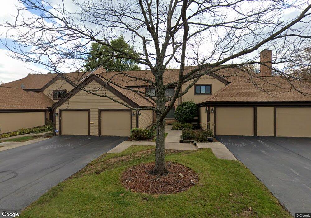
1289 Bristol Ln Unit M3 Buffalo Grove, IL 60089
Estimated Value: $384,960 - $401,000
3
Beds
3
Baths
1,762
Sq Ft
$222/Sq Ft
Est. Value
About This Home
This home is located at 1289 Bristol Ln Unit M3, Buffalo Grove, IL 60089 and is currently estimated at $391,990, approximately $222 per square foot. 1289 Bristol Ln Unit M3 is a home located in Lake County with nearby schools including Kildeer Countryside Elementary School, Woodlawn Middle School, and Adlai E Stevenson High School.
Ownership History
Date
Name
Owned For
Owner Type
Purchase Details
Closed on
May 16, 2008
Sold by
Kahn E Bruce and Kahn Aleta G
Bought by
Roy Amalendu and Karmaker Aparna
Current Estimated Value
Home Financials for this Owner
Home Financials are based on the most recent Mortgage that was taken out on this home.
Original Mortgage
$233,100
Outstanding Balance
$148,007
Interest Rate
5.93%
Mortgage Type
Purchase Money Mortgage
Estimated Equity
$243,983
Create a Home Valuation Report for This Property
The Home Valuation Report is an in-depth analysis detailing your home's value as well as a comparison with similar homes in the area
Home Values in the Area
Average Home Value in this Area
Purchase History
| Date | Buyer | Sale Price | Title Company |
|---|---|---|---|
| Roy Amalendu | $259,000 | Multiple |
Source: Public Records
Mortgage History
| Date | Status | Borrower | Loan Amount |
|---|---|---|---|
| Open | Roy Amalendu | $233,100 |
Source: Public Records
Tax History Compared to Growth
Tax History
| Year | Tax Paid | Tax Assessment Tax Assessment Total Assessment is a certain percentage of the fair market value that is determined by local assessors to be the total taxable value of land and additions on the property. | Land | Improvement |
|---|---|---|---|---|
| 2024 | $9,327 | $104,842 | $25,563 | $79,279 |
| 2023 | $8,801 | $98,927 | $24,121 | $74,806 |
| 2022 | $8,801 | $90,405 | $22,043 | $68,362 |
| 2021 | $8,465 | $89,430 | $21,805 | $67,625 |
| 2020 | $8,267 | $89,735 | $21,879 | $67,856 |
| 2019 | $8,155 | $89,404 | $21,798 | $67,606 |
| 2018 | $6,611 | $75,821 | $23,694 | $52,127 |
| 2017 | $6,483 | $74,051 | $23,141 | $50,910 |
| 2016 | $6,302 | $70,909 | $22,159 | $48,750 |
| 2015 | $6,118 | $66,314 | $20,723 | $45,591 |
| 2014 | $5,204 | $56,557 | $22,257 | $34,300 |
| 2012 | $5,052 | $56,671 | $22,302 | $34,369 |
Source: Public Records
Map
Nearby Homes
- 1324 Fairfax Ln Unit B32
- 1325 Fairfax Ln
- 1357 Bristol Ln Unit Q4
- 5107 N Arlington Heights Rd
- 12 Cloverdale Ct
- 1032 Courtland Dr Unit 9
- 950 Belmar Ln
- 1514 Sumter Dr
- 890 Knollwood Dr
- 1141 Devonshire Rd
- 800 Clohesey Dr
- 1265 Devonshire Rd
- 1545 Chickamauga Ln
- 931 Shady Grove Ln
- 1242 Antietam Dr
- 327 Lasalle Ln
- 1546 Brandywyn Ln
- 1728 Holly Ct
- 610 Checker Dr
- 614 Lyon Ct
- 1285 Bristol Ln Unit M4
- 1293 Bristol Ln Unit M2
- 1281 Bristol Ln Unit M5
- 1297 Bristol Ln Unit M1
- 1277 Bristol Ln Unit M6
- 1273 Bristol Ln Unit M7
- 1260 Franklin Ln Unit M8
- 1301 Bristol Ln Unit N6
- 1305 Bristol Ln Unit N5
- 1058 Fremont Ct W Unit E8
- 1064 Fremont Ct W Unit E5
- 1068 Fremont Ct W Unit E3
- 1070 Fremont Ct W Unit E2
- 1072 Fremont Ct W Unit E1
- 1064 Fremont Ct W
- 1309 Bristol Ln Unit N4
- 1056 Fremont Ct W Unit F1
- 1054 Fremont Ct W Unit F2
- 1052 Fremont Ct W Unit F3
- 1066 Fremont Court Ct W