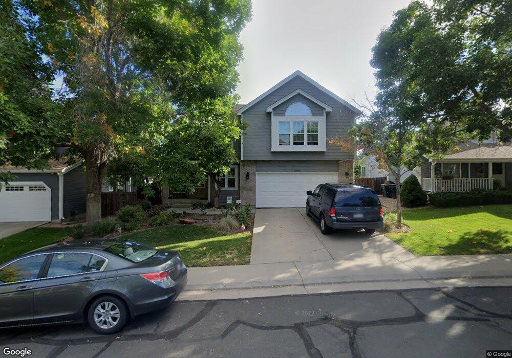
1289 E 131st Dr Thornton, CO 80241
Hunters Glen NeighborhoodEstimated Value: $568,052 - $660,000
3
Beds
3
Baths
2,883
Sq Ft
$214/Sq Ft
Est. Value
About This Home
This home is located at 1289 E 131st Dr, Thornton, CO 80241 and is currently estimated at $617,013, approximately $214 per square foot. 1289 E 131st Dr is a home located in Adams County with nearby schools including Hunters Glen Elementary School, Century Middle School, and Mountain Range High School.
Ownership History
Date
Name
Owned For
Owner Type
Purchase Details
Closed on
Jul 16, 2018
Sold by
Himmel Richard W and Himmel Mary T
Bought by
Cole Jeffrey A and Cole Kimberly A
Current Estimated Value
Home Financials for this Owner
Home Financials are based on the most recent Mortgage that was taken out on this home.
Original Mortgage
$390,000
Outstanding Balance
$335,143
Interest Rate
4.5%
Mortgage Type
VA
Estimated Equity
$281,870
Purchase Details
Closed on
Sep 8, 2011
Sold by
Richard W Himmel Trust
Bought by
Himmel Richard W and Himmel Mary T
Purchase Details
Closed on
Sep 29, 2003
Sold by
Himmel Richard W and Himmel Mary T
Bought by
Richard W Himmel Trust
Home Financials for this Owner
Home Financials are based on the most recent Mortgage that was taken out on this home.
Original Mortgage
$96,733
Interest Rate
5.87%
Mortgage Type
Unknown
Purchase Details
Closed on
Aug 29, 2003
Sold by
Richard W Himmel Trust
Bought by
Himmel Richard W and Himmel Mary T
Home Financials for this Owner
Home Financials are based on the most recent Mortgage that was taken out on this home.
Original Mortgage
$96,733
Interest Rate
5.87%
Mortgage Type
Unknown
Purchase Details
Closed on
Nov 27, 2002
Sold by
Himmel Richard W and Himmel Mary T
Bought by
Richard W Himmel Trust
Purchase Details
Closed on
Jun 14, 2002
Sold by
Romano Michael R and Gergely Gabriela S
Bought by
Himmel Richard W and Himmel Mary T
Home Financials for this Owner
Home Financials are based on the most recent Mortgage that was taken out on this home.
Original Mortgage
$80,000
Interest Rate
6.77%
Purchase Details
Closed on
May 5, 2000
Sold by
Derosha Daniel A and Derosha Heather M
Bought by
Romero Michael R and Gergely Gabriela S
Home Financials for this Owner
Home Financials are based on the most recent Mortgage that was taken out on this home.
Original Mortgage
$200,000
Interest Rate
7.62%
Purchase Details
Closed on
May 8, 1998
Sold by
Konrady Gregory L
Bought by
Derosha Daniel A and Derosha Heather M
Home Financials for this Owner
Home Financials are based on the most recent Mortgage that was taken out on this home.
Original Mortgage
$115,000
Interest Rate
9.99%
Purchase Details
Closed on
Apr 26, 1996
Sold by
Falk Craig B and Falk Shelley A
Bought by
Konrady Gregory L
Home Financials for this Owner
Home Financials are based on the most recent Mortgage that was taken out on this home.
Original Mortgage
$154,550
Interest Rate
7.78%
Create a Home Valuation Report for This Property
The Home Valuation Report is an in-depth analysis detailing your home's value as well as a comparison with similar homes in the area
Home Values in the Area
Average Home Value in this Area
Purchase History
| Date | Buyer | Sale Price | Title Company |
|---|---|---|---|
| Cole Jeffrey A | $476,000 | Land Title Guarantee | |
| Himmel Richard W | -- | None Available | |
| Richard W Himmel Trust | -- | -- | |
| Himmel Richard W | -- | Empire Title & Escrow | |
| Richard W Himmel Trust | -- | -- | |
| Himmel Richard W | $272,000 | Empire Title & Escrow | |
| Romero Michael R | $250,000 | -- | |
| Derosha Daniel A | $205,000 | -- | |
| Konrady Gregory L | $193,200 | Land Title |
Source: Public Records
Mortgage History
| Date | Status | Borrower | Loan Amount |
|---|---|---|---|
| Open | Cole Jeffrey A | $390,000 | |
| Previous Owner | Himmel Richard W | $96,733 | |
| Previous Owner | Himmel Richard W | $80,000 | |
| Previous Owner | Romero Michael R | $200,000 | |
| Previous Owner | Derosha Daniel A | $115,000 | |
| Previous Owner | Konrady Gregory L | $154,550 | |
| Closed | Romero Michael R | $25,000 |
Source: Public Records
Tax History
| Year | Tax Paid | Tax Assessment Tax Assessment Total Assessment is a certain percentage of the fair market value that is determined by local assessors to be the total taxable value of land and additions on the property. | Land | Improvement |
|---|---|---|---|---|
| 2025 | $3,957 | $40,940 | $7,960 | $32,980 |
| 2024 | $3,957 | $37,620 | $7,310 | $30,310 |
| 2023 | $3,917 | $41,940 | $7,370 | $34,570 |
| 2022 | $3,178 | $28,850 | $7,580 | $21,270 |
| 2021 | $3,283 | $28,850 | $7,580 | $21,270 |
| 2020 | $3,089 | $27,690 | $7,790 | $19,900 |
| 2019 | $3,095 | $27,690 | $7,790 | $19,900 |
| 2018 | $2,178 | $26,130 | $7,490 | $18,640 |
| 2017 | $1,981 | $26,130 | $7,490 | $18,640 |
| 2016 | $1,630 | $23,130 | $4,860 | $18,270 |
| 2015 | $1,628 | $15,160 | $3,180 | $11,980 |
| 2014 | $1,500 | $13,000 | $2,620 | $10,380 |
Source: Public Records
Map
Nearby Homes
- 1174 E 130th Dr
- 1162 E 130th Ave Unit B
- 1672 E 131st Ct
- 12905 Lafayette St Unit H
- 7 Sandpiper Cir
- 13262 Pearl Cir
- 12885 Vine St
- 2066 E 129th Ave
- 13550 Washington St Unit 7C
- 491 E 133rd Way
- 13508 Vine St
- 58 Blue Heron Dr
- 12962 Grant Cir E Unit A
- 1960 E 135th Place
- 2275 E 129th Ave
- 12913 Grant Cir E Unit A
- 12963 Grant Cir E Unit A
- 12944 Grant Cir W Unit B
- 13023 Grant Cir E Unit C
- 2297 E 128th Ave
- 1269 E 131st Dr
- 1309 E 131st Dr
- 1249 E 131st Dr
- 1319 E 131st Dr
- 1280 E 131st Dr
- 1310 E 131st Dr
- 1250 E 131st Dr
- 1339 E 131st Dr
- 1209 E 131st Dr
- 1220 E 131st Dr
- 1503 E 131st Place
- 1359 E 131st Dr
- 1350 E 131st Dr
- 1504 E 131st Place
- 1241 E 130th Place
- 1190 E 131st Dr
- 1199 E 131st Dr
- 1201 E 130th Place
- 1507 E 131st Place
- 1379 E 131st Dr
Your Personal Tour Guide
Ask me questions while you tour the home.