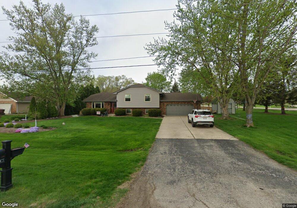
1289 Edmond Ave New Lenox, IL 60451
Estimated Value: $413,000 - $464,000
--
Bed
--
Bath
--
Sq Ft
0.58
Acres
About This Home
This home is located at 1289 Edmond Ave, New Lenox, IL 60451 and is currently estimated at $426,238. 1289 Edmond Ave is a home located in Will County with nearby schools including Oster-Oakview School, Haines Elementary School, and Lincoln Way West.
Ownership History
Date
Name
Owned For
Owner Type
Purchase Details
Closed on
Jun 9, 2015
Sold by
Fox Donna
Bought by
Copanos Nikolaos L and Copanos Jennifer L
Current Estimated Value
Home Financials for this Owner
Home Financials are based on the most recent Mortgage that was taken out on this home.
Original Mortgage
$226,550
Outstanding Balance
$178,542
Interest Rate
4.25%
Mortgage Type
New Conventional
Estimated Equity
$247,696
Purchase Details
Closed on
Nov 22, 2004
Sold by
First Midwest Bank
Bought by
Fox Donna
Create a Home Valuation Report for This Property
The Home Valuation Report is an in-depth analysis detailing your home's value as well as a comparison with similar homes in the area
Home Values in the Area
Average Home Value in this Area
Purchase History
| Date | Buyer | Sale Price | Title Company |
|---|---|---|---|
| Copanos Nikolaos L | $238,500 | Prairie Title | |
| Fox Donna | -- | -- |
Source: Public Records
Mortgage History
| Date | Status | Borrower | Loan Amount |
|---|---|---|---|
| Open | Copanos Nikolaos L | $226,550 |
Source: Public Records
Tax History Compared to Growth
Tax History
| Year | Tax Paid | Tax Assessment Tax Assessment Total Assessment is a certain percentage of the fair market value that is determined by local assessors to be the total taxable value of land and additions on the property. | Land | Improvement |
|---|---|---|---|---|
| 2024 | $8,911 | $121,883 | $34,183 | $87,700 |
| 2023 | $8,911 | $111,105 | $31,160 | $79,945 |
| 2022 | $8,037 | $102,354 | $28,706 | $73,648 |
| 2021 | $7,628 | $96,261 | $26,997 | $69,264 |
| 2020 | $7,407 | $92,827 | $26,034 | $66,793 |
| 2019 | $7,083 | $89,949 | $25,227 | $64,722 |
| 2018 | $6,915 | $86,848 | $24,357 | $62,491 |
| 2017 | $6,562 | $84,351 | $23,657 | $60,694 |
| 2016 | $6,367 | $82,094 | $23,024 | $59,070 |
| 2015 | -- | $79,510 | $22,299 | $57,211 |
| 2014 | -- | $78,529 | $22,024 | $56,505 |
| 2013 | -- | $79,588 | $22,321 | $57,267 |
Source: Public Records
Map
Nearby Homes
- 208 Redwood Ave
- 200 Redwood Ave
- 807 Picardy Place
- 1261 S Regan Rd
- 224 Hauser Ct
- 1344 N Cedar Rd
- 217 Aspen Dr
- 133 Barbara Ln
- 203 Fir St
- 125 Kimber Dr
- 1920 Edmonds Ave
- 1108 Plaza Dr
- 1125 Georgias Way
- 1139 Georgias Way
- 338 Willow St
- 13420 Florence Rd
- Lot 108 S Richard Ave
- 328 E Lincoln Hwy
- 12001 W Route 6
- 1193 Georgias Way
- 1289 Edmonds Ave
- 400 E Francis Rd
- 1279 Edmond Ave
- 611 Walker Way
- 427 E Francis Rd
- 1275 Edmond Ave
- 425 E Francis Rd
- 340 E Francis Rd
- 610 Walker Way
- 621 Walker Way
- 1271 Edmonds Ave
- 620 Walker Way
- 611 Gibbons Dr
- 1305 Edmond Ave
- 1305 Edmonds Ave
- 1267 Edmonds Ave
- 1267 Edmonds Ave
- 631 Walker Way
- 330 Redwood Ave
- 621 Gibbons Dr