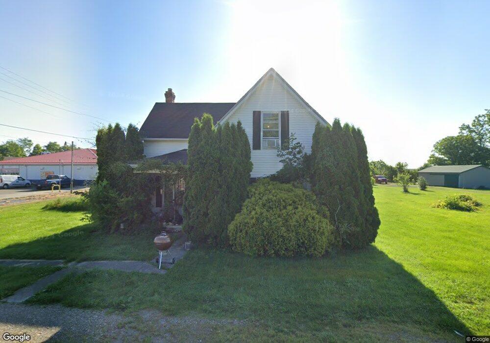
12893 Barrett Mill Rd Bainbridge, OH 45612
Estimated Value: $140,345 - $174,000
4
Beds
1
Bath
1,392
Sq Ft
$116/Sq Ft
Est. Value
About This Home
This home is located at 12893 Barrett Mill Rd, Bainbridge, OH 45612 and is currently estimated at $161,586, approximately $116 per square foot. 12893 Barrett Mill Rd is a home located in Highland County with nearby schools including McClain High School.
Ownership History
Date
Name
Owned For
Owner Type
Purchase Details
Closed on
Dec 7, 2018
Sold by
Free Patricia J
Bought by
Hatmaker William and Hatmaker Jennell
Current Estimated Value
Home Financials for this Owner
Home Financials are based on the most recent Mortgage that was taken out on this home.
Original Mortgage
$32,582
Outstanding Balance
$16,472
Interest Rate
4.9%
Mortgage Type
Commercial
Estimated Equity
$145,114
Purchase Details
Closed on
Jan 1, 1990
Bought by
Free Michael S & Patricia J
Create a Home Valuation Report for This Property
The Home Valuation Report is an in-depth analysis detailing your home's value as well as a comparison with similar homes in the area
Home Values in the Area
Average Home Value in this Area
Purchase History
| Date | Buyer | Sale Price | Title Company |
|---|---|---|---|
| Hatmaker William | $35,000 | None Available | |
| Free Michael S & Patricia J | -- | -- |
Source: Public Records
Mortgage History
| Date | Status | Borrower | Loan Amount |
|---|---|---|---|
| Open | Hatmaker William | $32,582 |
Source: Public Records
Tax History Compared to Growth
Tax History
| Year | Tax Paid | Tax Assessment Tax Assessment Total Assessment is a certain percentage of the fair market value that is determined by local assessors to be the total taxable value of land and additions on the property. | Land | Improvement |
|---|---|---|---|---|
| 2024 | $1,097 | $35,710 | $3,260 | $32,450 |
| 2023 | $1,097 | $27,200 | $2,870 | $24,330 |
| 2022 | $924 | $27,200 | $2,870 | $24,330 |
| 2021 | $878 | $27,200 | $2,870 | $24,330 |
| 2020 | $752 | $22,650 | $2,380 | $20,270 |
| 2019 | $763 | $22,650 | $2,380 | $20,270 |
| 2018 | $475 | $22,650 | $2,380 | $20,270 |
| 2017 | $161 | $13,480 | $2,380 | $11,100 |
| 2016 | $162 | $13,480 | $2,380 | $11,100 |
| 2015 | $479 | $13,480 | $2,380 | $11,100 |
| 2014 | $503 | $13,480 | $2,380 | $11,100 |
| 2013 | $518 | $13,480 | $2,380 | $11,100 |
Source: Public Records
Map
Nearby Homes
- 12977 U S 50
- 6838 McCoppin Mill Rd
- 6935 Laura Blvd
- 7094 Cedar Trail
- 0 Martha Dr Unit 1857951
- 0.459ac Lakefront Dr
- 11850 Maple Trail
- 11245 Karnes Rd
- 6749 Loch Lomond Cir
- 11515 Dundee Dr
- 7069 Forest Cove Cir
- 6949 Highland Trail W Unit TLW
- 61 Maple Dr
- 355 Maple Dr
- 0 Maple Dr Unit 1841507
- acres +- N Beach Rd
- 14703 Brier Rd
- 0 Overman Rd Unit 1837015
- ac Overman Rd
- 7196 Cathy Rd
- 12890 Barrett Mill Rd
- 12926 Us Highway 50 W
- 12926 Us Highway 50 W
- 12908 Barrett Mill Rd
- 12917 Barretts Mill Rd
- 5016 Ohio 753
- 12905 Us Highway 50 W
- 12875 South St
- 12911 Us Highway 50 W
- 12879 Us Rt 50
- 12917 Us Highway 50 W
- 12945 Barrett Mill Rd
- 12930 Us Highway 50 W
- 12867 South St
- 12860 U S 50
- 12943 Us Highway 50 W
- 10940 U S 50
- 6750 U S 50
- 12952 Us Highway 50 W
- 12819 Us Highway 50