Estimated Value: $81,973 - $137,000
3
Beds
2
Baths
1,256
Sq Ft
$87/Sq Ft
Est. Value
About This Home
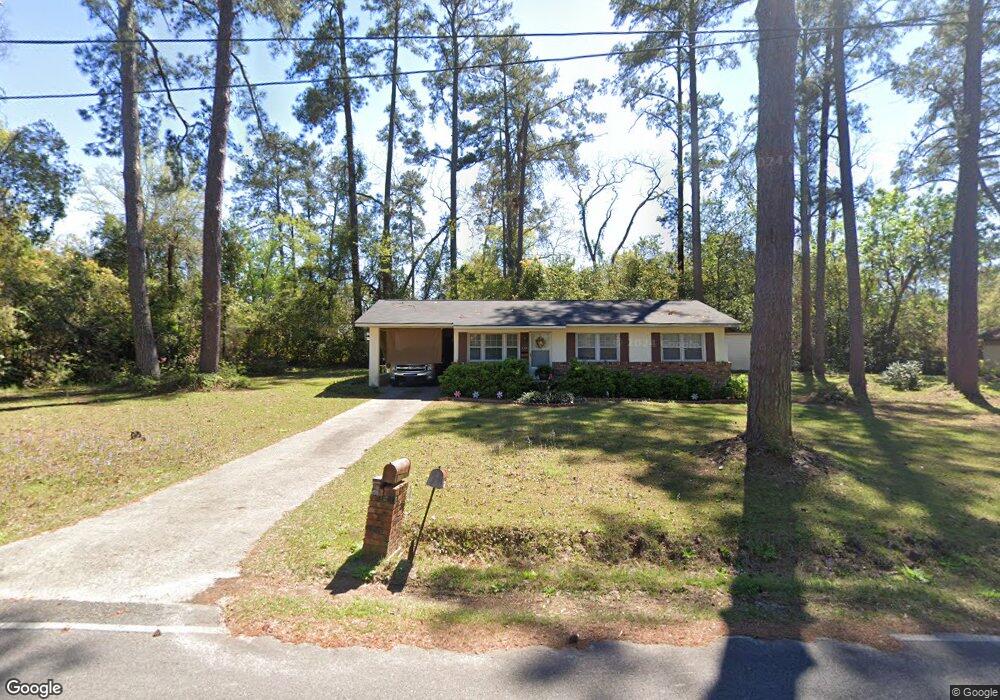
This home is located at 129 12th Ave SW, Cairo, GA 39828 and is currently estimated at $108,991, approximately $86 per square foot. 129 12th Ave SW is a home located in Grady County with nearby schools including Cairo High School.
Ownership History
Date
Name
Owned For
Owner Type
Purchase Details
Closed on
Jun 10, 2005
Sold by
Federal Home Loan Mortgage Corporation
Bought by
Magallanes Dale Regina
Current Estimated Value
Purchase Details
Closed on
Mar 1, 2005
Sold by
Chase Home Finance Llc
Bought by
Federal Home Loan Mortgage Corporation
Purchase Details
Closed on
Mar 12, 2001
Sold by
Mills D Ronnie
Bought by
Ware Linda J
Purchase Details
Closed on
Sep 25, 2000
Sold by
Almon Philip K
Bought by
Mills D Ronnie
Purchase Details
Closed on
Jun 14, 1978
Bought by
Almon Philip K
Create a Home Valuation Report for This Property
The Home Valuation Report is an in-depth analysis detailing your home's value as well as a comparison with similar homes in the area
Home Values in the Area
Average Home Value in this Area
Purchase History
| Date | Buyer | Sale Price | Title Company |
|---|---|---|---|
| Magallanes Dale Regina | -- | -- | |
| Federal Home Loan Mortgage Corporation | -- | -- | |
| Chase Home Finance Llc | -- | -- | |
| Ware Linda J | $63,000 | -- | |
| Mills D Ronnie | $25,000 | -- | |
| Almon Philip K | -- | -- |
Source: Public Records
Tax History Compared to Growth
Tax History
| Year | Tax Paid | Tax Assessment Tax Assessment Total Assessment is a certain percentage of the fair market value that is determined by local assessors to be the total taxable value of land and additions on the property. | Land | Improvement |
|---|---|---|---|---|
| 2024 | $1,243 | $33,060 | $5,200 | $27,860 |
| 2023 | $583 | $17,410 | $5,248 | $12,162 |
| 2022 | $609 | $17,410 | $5,248 | $12,162 |
| 2021 | $610 | $17,410 | $5,248 | $12,162 |
| 2020 | $612 | $17,410 | $5,248 | $12,162 |
| 2019 | $612 | $17,410 | $5,248 | $12,162 |
| 2018 | $551 | $19,494 | $5,248 | $14,246 |
| 2017 | $657 | $20,133 | $5,248 | $14,885 |
| 2016 | $574 | $17,397 | $5,248 | $12,149 |
| 2015 | $568 | $17,397 | $5,248 | $12,149 |
| 2014 | $568 | $17,397 | $5,248 | $12,149 |
| 2013 | -- | $16,107 | $5,248 | $10,859 |
Source: Public Records
Map
Nearby Homes
- 109 Oriac Ave SW
- 117 Pine Cir SW
- 1193 S Broad St
- 112 Pine Cir SW
- 75 14th Ave SE
- 270 Muggridge Ln
- 720 1st St SW
- 27 6th Ave SW
- 460 2nd St SW
- 40 5th Ave SW
- 130 17th Ave SE
- 786 Madison Ln
- 1310 Stone Ave
- 000 Hwy 111 South 20 59 Acres
- 000 S Broad St
- 602 4th St SE
- 1406 Platt Ave
- 198 Oakdale Rd SE
- 530 6th Ave SE
- 481 4th St SE
- 163 12th Ave SW
- 1290 1st St SW
- 122 12th Ave SW
- 142 12th Ave SW
- 130 13th Ave SW
- 150 13th Ave SW
- 162 12th Ave SW
- 173 12th Ave SW
- 90 13th Ave SW
- 170 13th Ave SW
- 187 12th Ave SW
- 103 Oriac Ave SW
- 182 12th Ave SW
- 161 13th Ave SW
- 91 13th Ave SW
- 105 Oriac Ave SW
- 101 Oriac Ave SW
- 81 13th Ave SW
- 198 12th Ave SW
- 107 Oriac Ave SW