Estimated Value: $820,348 - $878,000
Studio
--
Bath
2,036
Sq Ft
$417/Sq Ft
Est. Value
About This Home
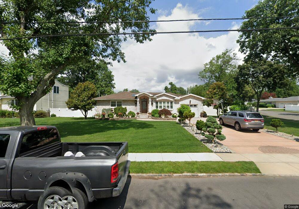
This home is located at 129 Acorn Dr, Clark, NJ 07066 and is currently estimated at $849,337, approximately $417 per square foot. 129 Acorn Dr is a home located in Union County with nearby schools including Frank K. Hehnly Elementary School, Carl H. Kumpf Middle School, and Arthur L. Johnson High School.
Ownership History
Date
Name
Owned For
Owner Type
Purchase Details
Closed on
Feb 13, 2012
Sold by
Pires Jose and Pires Maria
Bought by
Pires Jose and Pires Maria
Current Estimated Value
Purchase Details
Closed on
Sep 13, 2011
Sold by
Missaggia Kathleen and Delaney Patricia Finger
Bought by
Pires Jose and Pires Maria
Home Financials for this Owner
Home Financials are based on the most recent Mortgage that was taken out on this home.
Original Mortgage
$155,000
Outstanding Balance
$102,213
Interest Rate
3.5%
Mortgage Type
New Conventional
Estimated Equity
$747,124
Purchase Details
Closed on
Feb 16, 2007
Sold by
Finger Irene M
Bought by
Tru Patricia Finger Delaney As and As Kathleen Missaggia
Create a Home Valuation Report for This Property
The Home Valuation Report is an in-depth analysis detailing your home's value as well as a comparison with similar homes in the area
Home Values in the Area
Average Home Value in this Area
Purchase History
| Date | Buyer | Sale Price | Title Company |
|---|---|---|---|
| Pires Jose | -- | Multiple | |
| Pires Jose | $405,000 | Chicago Title Insurance Co | |
| Tru Patricia Finger Delaney As | -- | -- |
Source: Public Records
Mortgage History
| Date | Status | Borrower | Loan Amount |
|---|---|---|---|
| Open | Pires Jose | $155,000 |
Source: Public Records
Tax History
| Year | Tax Paid | Tax Assessment Tax Assessment Total Assessment is a certain percentage of the fair market value that is determined by local assessors to be the total taxable value of land and additions on the property. | Land | Improvement |
|---|---|---|---|---|
| 2025 | $15,018 | $678,300 | $309,000 | $369,300 |
| 2024 | $14,794 | $678,300 | $309,000 | $369,300 |
| 2023 | $14,794 | $678,300 | $309,000 | $369,300 |
| 2022 | $14,366 | $678,300 | $309,000 | $369,300 |
| 2021 | $12,739 | $143,300 | $51,900 | $91,400 |
| 2020 | $12,532 | $143,300 | $51,900 | $91,400 |
| 2019 | $12,405 | $143,300 | $51,900 | $91,400 |
| 2018 | $12,256 | $143,300 | $51,900 | $91,400 |
| 2017 | $12,060 | $143,300 | $51,900 | $91,400 |
| 2016 | $11,616 | $143,300 | $51,900 | $91,400 |
| 2015 | $11,498 | $143,300 | $51,900 | $91,400 |
| 2014 | $11,256 | $143,300 | $51,900 | $91,400 |
Source: Public Records
Map
Nearby Homes
- 279 Madison Hill Rd
- 675 Raritan Rd Unit 12
- 39 Yarmouth Ct
- 8 Maddaket
- 27 Stemmer Dr
- 81 Hutchinson St
- 1033 Cellar Ave Unit 1033
- 1995 Winding Brook Way
- 64 William St
- 631 Kensington Dr
- 172 Briarheath Ln
- 22 S Wickom Dr
- 20 Alastair Place
- 17 Rolling Hill Way
- 1283 Rahway Ave
- 131 Morningside Rd
- 272 Westfield Ave
- 8 Normandy Rd
- 45 Lexington Blvd
- 67 Brookside Terrace
Your Personal Tour Guide
Ask me questions while you tour the home.