Estimated Value: $289,000 - $309,000
3
Beds
1
Bath
1,044
Sq Ft
$287/Sq Ft
Est. Value
About This Home
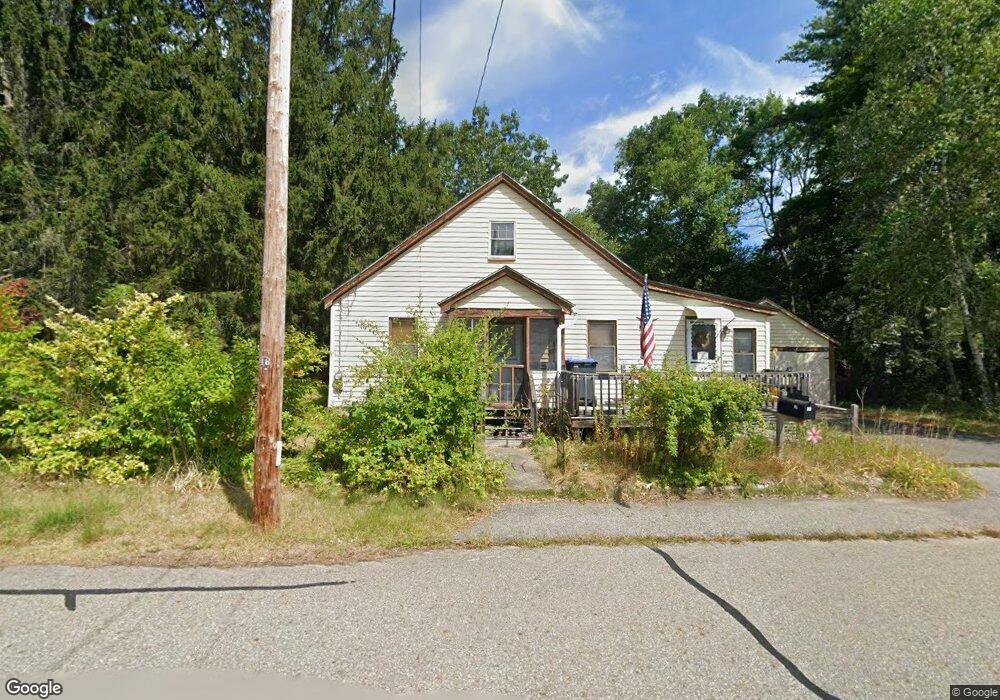
This home is located at 129 Arthur Ave, Athol, MA 01331 and is currently estimated at $299,508, approximately $286 per square foot. 129 Arthur Ave is a home located in Worcester County with nearby schools including Athol High School.
Ownership History
Date
Name
Owned For
Owner Type
Purchase Details
Closed on
Aug 1, 1996
Sold by
Lachance Scott J and Lachance Laura
Bought by
Duguay William S and Duguay Sandra
Current Estimated Value
Home Financials for this Owner
Home Financials are based on the most recent Mortgage that was taken out on this home.
Original Mortgage
$68,000
Interest Rate
8.27%
Mortgage Type
Purchase Money Mortgage
Purchase Details
Closed on
Sep 1, 1993
Sold by
Est Lester Duguay and Duguay Marc R
Bought by
Lachance Scott J and Sakowicz Laura
Home Financials for this Owner
Home Financials are based on the most recent Mortgage that was taken out on this home.
Original Mortgage
$72,000
Interest Rate
7.11%
Mortgage Type
Purchase Money Mortgage
Create a Home Valuation Report for This Property
The Home Valuation Report is an in-depth analysis detailing your home's value as well as a comparison with similar homes in the area
Home Values in the Area
Average Home Value in this Area
Purchase History
| Date | Buyer | Sale Price | Title Company |
|---|---|---|---|
| Duguay William S | $67,000 | -- | |
| Lachance Scott J | $72,000 | -- |
Source: Public Records
Mortgage History
| Date | Status | Borrower | Loan Amount |
|---|---|---|---|
| Open | Lachance Scott J | $102,400 | |
| Closed | Lachance Scott J | $68,000 | |
| Previous Owner | Lachance Scott J | $72,000 |
Source: Public Records
Tax History Compared to Growth
Tax History
| Year | Tax Paid | Tax Assessment Tax Assessment Total Assessment is a certain percentage of the fair market value that is determined by local assessors to be the total taxable value of land and additions on the property. | Land | Improvement |
|---|---|---|---|---|
| 2025 | $3,110 | $244,700 | $49,900 | $194,800 |
| 2024 | $2,996 | $233,500 | $49,900 | $183,600 |
| 2023 | $2,846 | $202,700 | $36,200 | $166,500 |
| 2022 | $2,668 | $166,200 | $34,500 | $131,700 |
| 2021 | $2,630 | $148,900 | $31,400 | $117,500 |
| 2020 | $2,486 | $144,700 | $28,500 | $116,200 |
| 2019 | $2,190 | $125,500 | $26,900 | $98,600 |
| 2018 | $2,431 | $124,200 | $24,500 | $99,700 |
| 2017 | $2,234 | $109,500 | $24,500 | $85,000 |
| 2016 | $2,068 | $104,300 | $24,500 | $79,800 |
| 2015 | $1,985 | $104,300 | $24,500 | $79,800 |
| 2014 | $1,922 | $104,300 | $24,500 | $79,800 |
Source: Public Records
Map
Nearby Homes
- 71 Wendell St
- 27 Warwick Ave
- 551 Sanders St
- 133 Harvard Ave
- 3 Chestnut St
- 315 S Athol Rd
- 305 S Athol Rd
- 459 Fairview Ave
- 792 Cottage St
- 696 Cottage St Unit Lot 10
- 182 Harrison St
- 73 Fern St
- 193 Freedom St
- 631 Chestnut St
- 105 Freedom St
- 22 Charles Place
- 161 Prospect St
- 62 Lindsay Ln
- 9 Kendall St
- 91 Cottage St Unit A
- 306 Harvard Ave
- 144 Wendell St
- 120 Arthur Ave
- 114 Arthur Ave
- 122 Wendell St
- 316 Harvard Ave
- 0 Arthur Ave
- 104 Arthur Ave
- 87 Arthur Ave
- 107 Chestnut St
- 119 Warwick Ave
- 309 Harvard Ave
- 133 Chestnut St
- 89 Chestnut St
- 89 Chestnut St
- 70 Arthur Ave
- 75 Warwick Ave
- 79 Warwick Ave
- 102 Wendell St
- 331 Harvard Ave