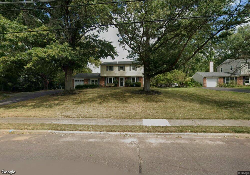
129 Bates Dr Chalfont, PA 18914
Estimated Value: $600,000 - $621,000
Studio
3
Baths
1,964
Sq Ft
$309/Sq Ft
Est. Value
About This Home
This home is located at 129 Bates Dr, Chalfont, PA 18914 and is currently estimated at $607,844, approximately $309 per square foot. 129 Bates Dr is a home located in Bucks County with nearby schools including Simon Butler Elementary, Unami Middle School, and Central Bucks High School - South.
Ownership History
Date
Name
Owned For
Owner Type
Purchase Details
Closed on
Jul 9, 2024
Sold by
Franey Nancy B and Franey Phillip J
Bought by
Edling Robert and Edling Michelle
Current Estimated Value
Home Financials for this Owner
Home Financials are based on the most recent Mortgage that was taken out on this home.
Original Mortgage
$492,000
Outstanding Balance
$484,413
Interest Rate
7.03%
Mortgage Type
New Conventional
Estimated Equity
$123,431
Purchase Details
Closed on
Jul 27, 1983
Sold by
Molettiere Anthony M and Molettiere Barbara
Bought by
Franey Phillip J and Franey Nancy B
Create a Home Valuation Report for This Property
The Home Valuation Report is an in-depth analysis detailing your home's value as well as a comparison with similar homes in the area
Home Values in the Area
Average Home Value in this Area
Purchase History
| Date | Buyer | Sale Price | Title Company |
|---|---|---|---|
| Edling Robert | $615,000 | None Listed On Document | |
| Franey Phillip J | $82,500 | -- |
Source: Public Records
Mortgage History
| Date | Status | Borrower | Loan Amount |
|---|---|---|---|
| Open | Edling Robert | $492,000 |
Source: Public Records
Tax History
| Year | Tax Paid | Tax Assessment Tax Assessment Total Assessment is a certain percentage of the fair market value that is determined by local assessors to be the total taxable value of land and additions on the property. | Land | Improvement |
|---|---|---|---|---|
| 2025 | $5,657 | $32,640 | $6,400 | $26,240 |
| 2024 | $5,657 | $32,640 | $6,400 | $26,240 |
| 2023 | $5,477 | $32,640 | $6,400 | $26,240 |
| 2022 | $5,368 | $32,640 | $6,400 | $26,240 |
| 2021 | $5,308 | $32,640 | $6,400 | $26,240 |
| 2020 | $5,308 | $32,640 | $6,400 | $26,240 |
| 2019 | $5,242 | $32,640 | $6,400 | $26,240 |
| 2018 | $5,242 | $32,640 | $6,400 | $26,240 |
| 2017 | $5,202 | $32,640 | $6,400 | $26,240 |
| 2016 | $5,202 | $32,640 | $6,400 | $26,240 |
| 2015 | -- | $32,640 | $6,400 | $26,240 |
| 2014 | -- | $32,640 | $6,400 | $26,240 |
Source: Public Records
Map
Nearby Homes
- 100 New Jersey Ave
- 0 S Limekiln Pike
- 40 E Butler Ave
- 128 Krista Ct
- 150 Galway Cir
- 406 Dornishwood Place
- 50 Hickory Ln
- 106 Remington Ct
- 201 Coventry Rd
- 125 Statesman Rd
- 113 Glennbrook Ct
- 244 Holly Dr
- 301 Brookside Ct
- 12 Warren Dr
- 3 Warren Dr Unit 47-HAMILTON MODEL
- 2 Warren Dr
- 458 Reagans Ln
- 401 Reagans Ln
- 428 Reagans Ln
- 456 Regans Ln
Your Personal Tour Guide
Ask me questions while you tour the home.