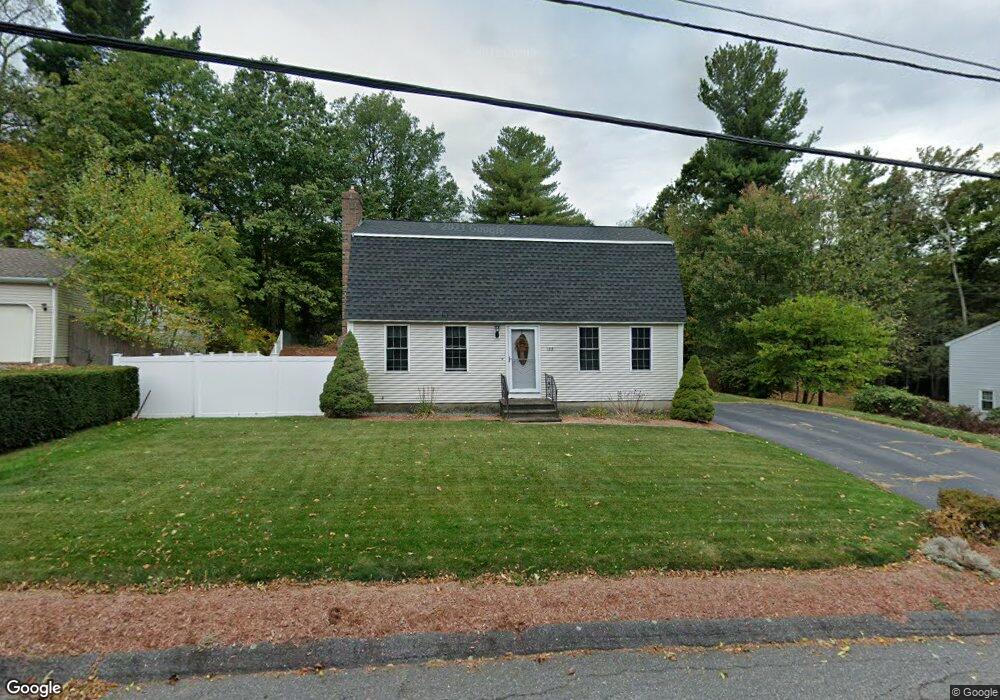
129 Birchcroft Rd Leominster, MA 01453
Estimated Value: $511,547 - $555,000
3
Beds
2
Baths
1,632
Sq Ft
$324/Sq Ft
Est. Value
About This Home
This home is located at 129 Birchcroft Rd, Leominster, MA 01453 and is currently estimated at $528,887, approximately $324 per square foot. 129 Birchcroft Rd is a home located in Worcester County with nearby schools including Leominster High School, St. Anna Catholic School, and St. Leo School.
Ownership History
Date
Name
Owned For
Owner Type
Purchase Details
Closed on
Oct 30, 1998
Sold by
Hall Jonathan D and Hall Karen F
Bought by
Cormier Dennis R and Cormier Deborah J
Current Estimated Value
Home Financials for this Owner
Home Financials are based on the most recent Mortgage that was taken out on this home.
Original Mortgage
$144,500
Interest Rate
6.68%
Mortgage Type
Purchase Money Mortgage
Create a Home Valuation Report for This Property
The Home Valuation Report is an in-depth analysis detailing your home's value as well as a comparison with similar homes in the area
Home Values in the Area
Average Home Value in this Area
Purchase History
| Date | Buyer | Sale Price | Title Company |
|---|---|---|---|
| Cormier Dennis R | $154,500 | -- |
Source: Public Records
Mortgage History
| Date | Status | Borrower | Loan Amount |
|---|---|---|---|
| Open | Cormier Dennis R | $173,500 | |
| Closed | Cormier Dennis R | $144,500 | |
| Previous Owner | Cormier Dennis R | $13,000 | |
| Previous Owner | Cormier Dennis R | $80,000 |
Source: Public Records
Tax History
| Year | Tax Paid | Tax Assessment Tax Assessment Total Assessment is a certain percentage of the fair market value that is determined by local assessors to be the total taxable value of land and additions on the property. | Land | Improvement |
|---|---|---|---|---|
| 2025 | $5,907 | $421,000 | $135,600 | $285,400 |
| 2024 | $5,808 | $400,300 | $129,100 | $271,200 |
| 2023 | $5,545 | $356,800 | $112,300 | $244,500 |
| 2022 | $5,288 | $319,300 | $97,600 | $221,700 |
| 2021 | $4,875 | $268,900 | $76,000 | $192,900 |
| 2020 | $4,635 | $257,800 | $76,000 | $181,800 |
| 2019 | $4,507 | $243,100 | $72,300 | $170,800 |
| 2018 | $4,483 | $231,900 | $70,300 | $161,600 |
| 2017 | $4,337 | $219,800 | $65,600 | $154,200 |
| 2016 | $4,231 | $216,100 | $65,600 | $150,500 |
| 2015 | $3,915 | $201,400 | $65,600 | $135,800 |
| 2014 | $3,806 | $201,500 | $70,300 | $131,200 |
Source: Public Records
Map
Nearby Homes
- 21 Regina Dr
- 41 Hill St
- 6 Chapman Place
- 19 Kittredge St
- 25 Meadow Pond Dr Unit j
- 372 Litchfield St
- 30 Abbey Rd Unit 202
- 10 Abbey Rd Unit 108
- 242 Pleasant St
- 192 Pleasant St Unit 25
- 192 Pleasant St Unit 23
- 46 Franklin St
- 23 Lantern Ln
- 113 Pleasant St
- 0 Wheeler St
- 42 Wheeler St
- 6 Longwood Ave
- 51 Pleasant St
- 0 Johnson St
- 675 Willard St
- 123 Birchcroft Rd
- 135 Birchcroft Rd
- 141 Eva Dr
- 122 Birchcroft Rd
- 135 Eva Dr
- 128 Birchcroft Rd
- 117 Birchcroft Rd
- 141 Birchcroft Rd
- 116 Birchcroft Rd
- 147 Eva Dr
- 129 Eva Dr
- 134 Birchcroft Rd
- 110 Birchcroft Rd
- 27 Glenwood Dr
- 33 Glenwood Dr
- 134 Eva Dr
- 111 Birchcroft Rd
- 147 Birchcroft Rd
- 21 Glenwood Dr
- 140 Birchcroft Rd
Your Personal Tour Guide
Ask me questions while you tour the home.