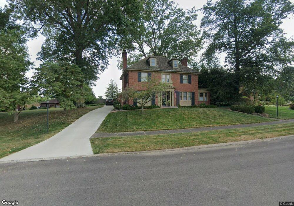
129 Brady Cir E Steubenville, OH 43952
Estimated Value: $263,487 - $296,000
3
Beds
2
Baths
2,601
Sq Ft
$109/Sq Ft
Est. Value
About This Home
This home is located at 129 Brady Cir E, Steubenville, OH 43952 and is currently estimated at $282,372, approximately $108 per square foot. 129 Brady Cir E is a home located in Jefferson County with nearby schools including McKinley STEM Academy, East Garfield Elementary School, and Wells Academy.
Ownership History
Date
Name
Owned For
Owner Type
Purchase Details
Closed on
May 3, 2018
Sold by
Adulewicz Judith L and Steitz Mary
Bought by
Cutshall Paul Eric and Cutshall Tamara Jean
Current Estimated Value
Home Financials for this Owner
Home Financials are based on the most recent Mortgage that was taken out on this home.
Original Mortgage
$140,000
Outstanding Balance
$120,683
Interest Rate
4.45%
Mortgage Type
New Conventional
Estimated Equity
$161,689
Create a Home Valuation Report for This Property
The Home Valuation Report is an in-depth analysis detailing your home's value as well as a comparison with similar homes in the area
Home Values in the Area
Average Home Value in this Area
Purchase History
| Date | Buyer | Sale Price | Title Company |
|---|---|---|---|
| Cutshall Paul Eric | $175,000 | None Available |
Source: Public Records
Mortgage History
| Date | Status | Borrower | Loan Amount |
|---|---|---|---|
| Open | Cutshall Paul Eric | $140,000 |
Source: Public Records
Tax History Compared to Growth
Tax History
| Year | Tax Paid | Tax Assessment Tax Assessment Total Assessment is a certain percentage of the fair market value that is determined by local assessors to be the total taxable value of land and additions on the property. | Land | Improvement |
|---|---|---|---|---|
| 2024 | $2,301 | $68,338 | $7,088 | $61,250 |
| 2023 | $2,301 | $68,338 | $7,088 | $61,250 |
| 2022 | $2,443 | $68,338 | $7,088 | $61,250 |
| 2021 | $2,469 | $68,338 | $7,088 | $61,250 |
| 2020 | $2,664 | $68,338 | $7,088 | $61,250 |
| 2019 | $2,668 | $0 | $0 | $0 |
| 2018 | $0 | $0 | $0 | $0 |
| 2017 | $1,815 | $0 | $0 | $0 |
| 2016 | $1,919 | $0 | $0 | $0 |
| 2015 | $1,881 | $0 | $0 | $0 |
| 2014 | $1,888 | $0 | $0 | $0 |
| 2012 | $915 | $53,760 | $7,315 | $46,445 |
Source: Public Records
Map
Nearby Homes
- 1810 Hamilton Place
- 1912 Oregon Ave
- 144 Wildon Ave
- 1001 Granard Pkwy
- 742 Broadway Blvd
- 0 Pennsylvania
- 1611 Pennsylvania Ave
- 1627 Woodlawn Ct
- 1500 Pennsylvania Ave
- 1437 & 1439 Oregon Ave
- 1344 Pennsylvania Ave
- 1407 Oregon Ave
- 1331 Pennsylvania Ave
- 266 Hollywood Blvd
- 270 Hollywood Blvd
- 1346 Oakgrove Ave
- 1810 Mary Ave
- 311 Cedar Ave
- 1302 Oregon Ave
- 1242 Ridge Ave
- 129 Brady Cir E
- 129 Brady Cir E
- 129 Brady Cir E
- 133 Brady Cir E
- 133 Brady Cir E
- 133 Brady Cir E
- 133 Brady Cir E
- 133 Brady Cir E
- 123 Brady Cir E
- 134 Brady Cir E
- 132 Brady Cir E
- 121 Brady Cir E
- 604 Granard Pkwy
- 606 Granard Pkwy
- 139 Brady Cir W
- 608 Granard Pkwy
- 146 Brady Cir W
- 1714 Oregon Ave
- 1712 Oregon Ave
- 605 Granard Pkwy