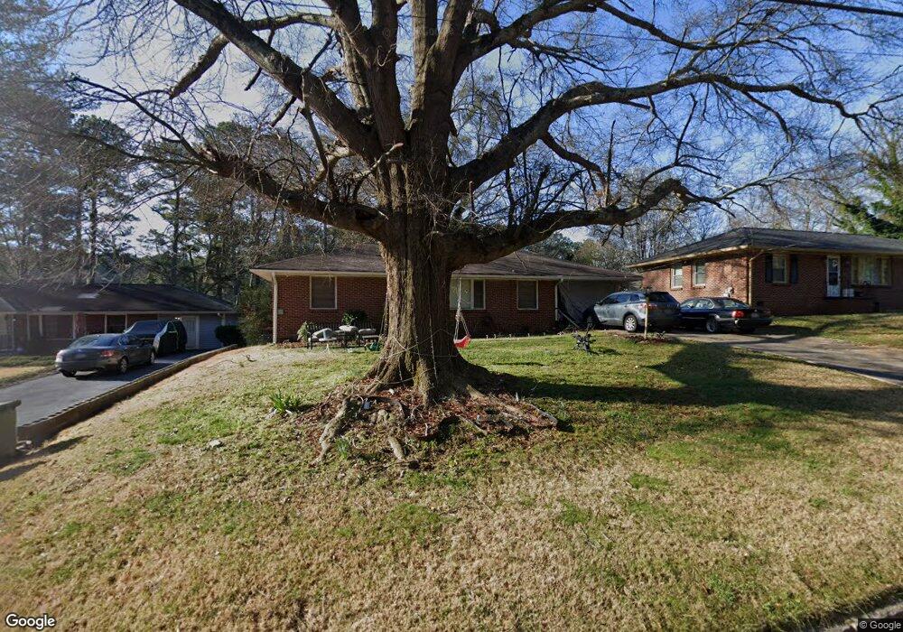
129 Bromack Dr SE Atlanta, GA 30315
Browns Mill Park NeighborhoodEstimated Value: $180,000 - $214,000
2
Beds
1
Bath
1,050
Sq Ft
$186/Sq Ft
Est. Value
About This Home
This home is located at 129 Bromack Dr SE, Atlanta, GA 30315 and is currently estimated at $194,984, approximately $185 per square foot. 129 Bromack Dr SE is a home located in Fulton County with nearby schools including Cleveland Elementary School, Long Middle School, and South Atlanta High School.
Ownership History
Date
Name
Owned For
Owner Type
Purchase Details
Closed on
Apr 5, 2018
Sold by
Green Spencer
Bought by
Wright Mary Lois
Current Estimated Value
Purchase Details
Closed on
Sep 29, 1993
Sold by
Honiker Armand Exec
Bought by
Green John W
Home Financials for this Owner
Home Financials are based on the most recent Mortgage that was taken out on this home.
Original Mortgage
$49,400
Interest Rate
7.01%
Mortgage Type
FHA
Create a Home Valuation Report for This Property
The Home Valuation Report is an in-depth analysis detailing your home's value as well as a comparison with similar homes in the area
Home Values in the Area
Average Home Value in this Area
Purchase History
| Date | Buyer | Sale Price | Title Company |
|---|---|---|---|
| Wright Mary Lois | -- | -- | |
| Green John W | $50,000 | -- |
Source: Public Records
Mortgage History
| Date | Status | Borrower | Loan Amount |
|---|---|---|---|
| Previous Owner | Green John W | $49,400 |
Source: Public Records
Tax History Compared to Growth
Tax History
| Year | Tax Paid | Tax Assessment Tax Assessment Total Assessment is a certain percentage of the fair market value that is determined by local assessors to be the total taxable value of land and additions on the property. | Land | Improvement |
|---|---|---|---|---|
| 2025 | $2,486 | $53,880 | $21,120 | $32,760 |
| 2023 | $3,226 | $77,920 | $45,240 | $32,680 |
| 2022 | $2,313 | $57,160 | $23,840 | $33,320 |
| 2021 | $1,685 | $29,560 | $9,200 | $20,360 |
| 2020 | $1,196 | $29,200 | $9,080 | $20,120 |
| 2019 | $490 | $22,000 | $8,680 | $13,320 |
| 2018 | $459 | $11,080 | $2,760 | $8,320 |
| 2017 | $446 | $10,320 | $2,160 | $8,160 |
| 2016 | $447 | $10,320 | $2,160 | $8,160 |
| 2015 | $935 | $10,320 | $2,160 | $8,160 |
| 2014 | $12 | $10,320 | $2,160 | $8,160 |
Source: Public Records
Map
Nearby Homes
- 2383 Baywood Dr SE
- 2187 Baywood Dr SE
- 2469 Baywood Dr SE
- 2462 Macon Dr SW
- 2410 Macon Dr SW
- 233 Banberry Dr SE
- 2459 Macon Dr SW
- 2362 Macon Dr SW
- 2466 Old Hapeville Rd SW
- 263 Banberry Dr SE
- 270 Bromack Dr SE
- 276 Lydia Dr SE
- 2500 Old Hapeville Rd SW
- 287 Banberry Dr SE
- 296 Bromack Dr SE
- 0 Swallow Cir SE
- 305 Banberry Dr SE
- 00 Swallow Cir SE
- 152 Preston Ln SW
- 137 Bromack Dr SE
- 123 Bromack Dr SE
- 143 Bromack Dr SE
- 117 Bromack Dr SE
- 128 Hillsdale Dr SE
- 136 Hillsdale Dr SE
- 122 Hillsdale Dr SE
- 142 Hillsdale Dr SE
- 116 Hillsdale Dr SE
- 109 Bromack Dr SE
- 2407 Antwerp Dr SE
- 2411 Antwerp Dr SE
- 0 Hillsdale Dr SE
- 108 Hillsdale Dr SE
- 2421 Antwerp Dr SE
- 2398 Baywood Dr SE
- 101 Bromack Dr SE
- 2429 Antwerp Dr SE
- 100 SE Hillsdale SW
- 100 Hillsdale Dr SE