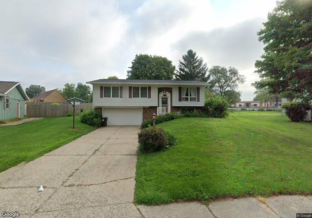
129 Castle Dr Dunlap, IL 61525
Estimated Value: $224,000 - $251,000
4
Beds
2
Baths
1,396
Sq Ft
$170/Sq Ft
Est. Value
About This Home
This home is located at 129 Castle Dr, Dunlap, IL 61525 and is currently estimated at $237,146, approximately $169 per square foot. 129 Castle Dr is a home located in Peoria County with nearby schools including Dunlap Grade School, Dunlap Valley Middle School, and Dunlap High School.
Create a Home Valuation Report for This Property
The Home Valuation Report is an in-depth analysis detailing your home's value as well as a comparison with similar homes in the area
Tax History
| Year | Tax Paid | Tax Assessment Tax Assessment Total Assessment is a certain percentage of the fair market value that is determined by local assessors to be the total taxable value of land and additions on the property. | Land | Improvement |
|---|---|---|---|---|
| 2024 | $4,103 | $63,140 | $9,210 | $53,930 |
| 2023 | $3,866 | $59,570 | $8,690 | $50,880 |
| 2022 | $3,565 | $54,960 | $8,060 | $46,900 |
| 2021 | $3,412 | $52,350 | $7,680 | $44,670 |
| 2020 | $3,333 | $50,830 | $7,460 | $43,370 |
| 2019 | $3,344 | $51,860 | $7,610 | $44,250 |
| 2018 | $3,370 | $52,840 | $7,760 | $45,080 |
| 2017 | $3,563 | $55,040 | $8,080 | $46,960 |
| 2016 | $3,431 | $55,040 | $8,080 | $46,960 |
| 2015 | $3,421 | $52,920 | $7,770 | $45,150 |
| 2014 | $3,344 | $53,700 | $7,880 | $45,820 |
| 2013 | -- | $52,650 | $7,730 | $44,920 |
Source: Public Records
Map
Nearby Homes
- Lot 136 French Dr
- 628 Copperpoint Dr
- LOT 209 Copperpoint Dr
- LOT 208 Copperpoint Dr
- LOT 204 W Salem School Ct
- 13462 N Lakewood Dr
- 13014 N Crater Ln
- 5821 W Dickison Cemetery Rd
- 11518 N Nettle Creek Dr
- 11428 N Boulder Creek Ct
- 11227 N Stone Creek Dr
- 11124 N Tuscany Ridge Ct
- Lot 7 W Augusta Dr
- 2218 W Augusta Dr
- 2247 W Augusta Dr
- 3508 W Trail Wood Ct
- 2817 W Lake Trail Ct
- 3220 W Rosebury Ln
- 4016 W Crimson Rd
- 2331 W Molly Ln
Your Personal Tour Guide
Ask me questions while you tour the home.