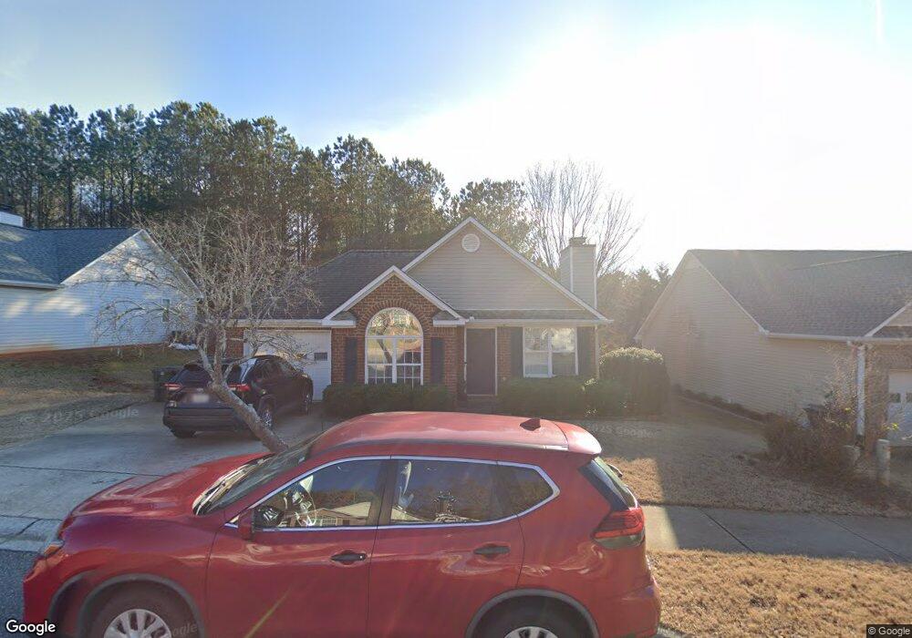
129 Cedar Rock Trace Athens, GA 30605
Estimated Value: $295,611 - $324,000
3
Beds
2
Baths
1,205
Sq Ft
$261/Sq Ft
Est. Value
About This Home
This home is located at 129 Cedar Rock Trace, Athens, GA 30605 and is currently estimated at $314,153, approximately $260 per square foot. 129 Cedar Rock Trace is a home located in Clarke County with nearby schools including Barnett Shoals Elementary School, Hilsman Middle School, and Cedar Shoals High School.
Ownership History
Date
Name
Owned For
Owner Type
Purchase Details
Closed on
Oct 27, 2016
Sold by
Franklin D
Bought by
West Park Grp Llc
Current Estimated Value
Purchase Details
Closed on
Aug 19, 2016
Sold by
Matthew
Bought by
West Franklin D
Home Financials for this Owner
Home Financials are based on the most recent Mortgage that was taken out on this home.
Original Mortgage
$113,600
Interest Rate
2.75%
Mortgage Type
New Conventional
Purchase Details
Closed on
Feb 6, 2015
Sold by
Jedrick Alison B
Bought by
Russell Matthew
Home Financials for this Owner
Home Financials are based on the most recent Mortgage that was taken out on this home.
Original Mortgage
$97,600
Interest Rate
3.81%
Mortgage Type
New Conventional
Purchase Details
Closed on
Jun 24, 2002
Sold by
Live Oak Communities Llc
Bought by
Jedrick Alison B
Purchase Details
Closed on
Apr 24, 2002
Sold by
Pinecrest Community Llc
Bought by
Live Oak Communities Llc
Create a Home Valuation Report for This Property
The Home Valuation Report is an in-depth analysis detailing your home's value as well as a comparison with similar homes in the area
Purchase History
| Date | Buyer | Sale Price | Title Company |
|---|---|---|---|
| West Park Grp Llc | -- | -- | |
| West Franklin D | $142,000 | -- | |
| Russell Matthew | $122,000 | -- | |
| Jedrick Alison B | $114,900 | -- | |
| Live Oak Communities Llc | $20,000 | -- |
Source: Public Records
Mortgage History
| Date | Status | Borrower | Loan Amount |
|---|---|---|---|
| Previous Owner | West Franklin D | $113,600 | |
| Previous Owner | Russell Matthew | $97,600 |
Source: Public Records
Tax History
| Year | Tax Paid | Tax Assessment Tax Assessment Total Assessment is a certain percentage of the fair market value that is determined by local assessors to be the total taxable value of land and additions on the property. | Land | Improvement |
|---|---|---|---|---|
| 2025 | $3,601 | $115,982 | $12,000 | $103,982 |
| 2024 | $3,601 | $106,350 | $12,000 | $94,350 |
| 2023 | $3,323 | $99,465 | $12,000 | $87,465 |
| 2022 | $2,736 | $85,779 | $10,400 | $75,379 |
| 2021 | $2,440 | $72,417 | $10,400 | $62,017 |
| 2020 | $2,272 | $67,407 | $10,400 | $57,007 |
| 2019 | $2,018 | $59,432 | $10,400 | $49,032 |
| 2018 | $1,973 | $58,102 | $10,400 | $47,702 |
| 2017 | $1,884 | $55,498 | $10,400 | $45,098 |
| 2016 | $1,657 | $49,244 | $10,400 | $38,844 |
| 2015 | $1,324 | $48,920 | $10,400 | $38,520 |
| 2014 | $1,193 | $45,017 | $10,400 | $34,617 |
Source: Public Records
Map
Nearby Homes
- 140 Whitehall Rd
- 119 Pine Ridge Trace
- 400 Ansley Dr
- 325 Segrest Cir
- 148 Warren Way
- 365 Whitehall Rd
- 369 Whitehall Rd
- 223 Oconee River Cir
- 375 Segrest Cir
- 150 Rumson Rd
- 360 Ansley Dr
- 370 Ansley Dr
- 380 Ansley Dr
- 109 Layla Ct
- 431 College Cir
- 1055 College Station Rd
- 411 College Cir
- 0 Barnett Shoals Rd Unit Lot 1
- 145 Phinizy Ln
- 110 Vista Dr
- 125 Cedar Rock Trace
- 133 Cedar Rock Trace
- 111 Birch Valley Dr
- 121 Cedar Rock Trace
- 128 Cedar Rock Trace
- 121 Birch Valley Dr
- 124 Cedar Rock Trace
- 132 Cedar Rock Trace
- 120 Cedar Rock Trace
- 117 Cedar Rock Trace
- 136 Cedar Rock Trace
- 110 Birch Valley Dr
- 131 Birch Valley Dr
- 116 Cedar Rock Trace
- 120 Birch Valley Dr
- 140 Cedar Rock Trace
- 113 Cedar Rock Trace
- 145 Cedar Rock Trace Unit LOT 2B
- 130 Birch Valley Dr
- 141 Birch Valley Dr
Your Personal Tour Guide
Ask me questions while you tour the home.