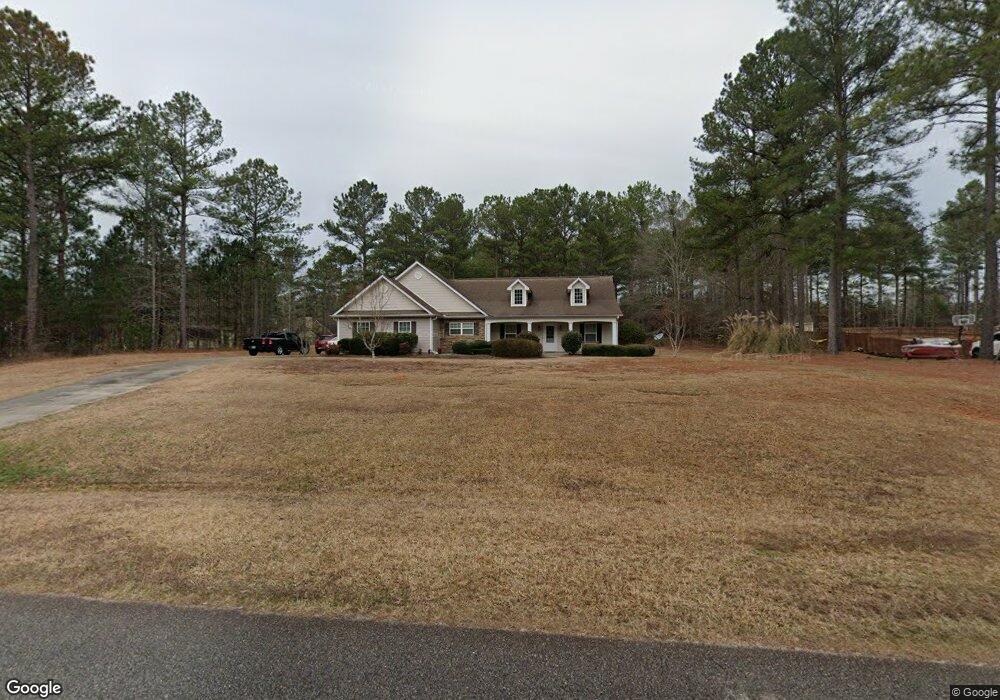
129 Cole Forest Blvd Barnesville, GA 30204
Estimated Value: $316,669 - $478,000
3
Beds
2
Baths
1,708
Sq Ft
$220/Sq Ft
Est. Value
About This Home
This home is located at 129 Cole Forest Blvd, Barnesville, GA 30204 and is currently estimated at $375,917, approximately $220 per square foot. 129 Cole Forest Blvd is a home located in Lamar County with nearby schools including Lamar County Primary School, Lamar County Elementary School, and Lamar County Middle School.
Ownership History
Date
Name
Owned For
Owner Type
Purchase Details
Closed on
Jan 21, 2014
Sold by
Crawley Dorothy B
Bought by
Moon Richard Terrell
Current Estimated Value
Purchase Details
Closed on
Mar 10, 2009
Sold by
Smith James T
Bought by
Rabuck Patsy Ann
Purchase Details
Closed on
Jul 29, 2004
Sold by
Bradley Roger
Bought by
Crawley Dorothy
Purchase Details
Closed on
Jan 16, 2004
Sold by
Cole Forest Llc
Bought by
Bradley Roger
Create a Home Valuation Report for This Property
The Home Valuation Report is an in-depth analysis detailing your home's value as well as a comparison with similar homes in the area
Purchase History
| Date | Buyer | Sale Price | Title Company |
|---|---|---|---|
| Moon Richard Terrell | -- | -- | |
| Rabuck Patsy Ann | -- | -- | |
| Smith Ricky Clay | -- | -- | |
| Starling April Lynn | -- | -- | |
| Rabuck Patsy Ann | -- | -- | |
| Smith Ricky Clay | -- | -- | |
| Starling April Lynn | -- | -- | |
| Crawley Dorothy | $147,200 | -- | |
| Bradley Roger | $27,500 | -- |
Source: Public Records
Tax History
| Year | Tax Paid | Tax Assessment Tax Assessment Total Assessment is a certain percentage of the fair market value that is determined by local assessors to be the total taxable value of land and additions on the property. | Land | Improvement |
|---|---|---|---|---|
| 2025 | $2,259 | $115,608 | $10,000 | $105,608 |
| 2024 | $2,089 | $95,553 | $10,000 | $85,553 |
| 2023 | $2,224 | $94,558 | $10,000 | $84,558 |
| 2022 | $2,007 | $86,704 | $10,000 | $76,704 |
| 2021 | $1,744 | $72,146 | $12,000 | $60,146 |
| 2020 | $1,732 | $68,882 | $12,000 | $56,882 |
| 2019 | $1,678 | $52,867 | $8,000 | $44,867 |
| 2018 | $1,611 | $52,867 | $8,000 | $44,867 |
| 2017 | $1,602 | $52,867 | $8,000 | $44,867 |
| 2016 | $1,602 | $52,867 | $8,000 | $44,867 |
| 2015 | $1,601 | $52,867 | $8,000 | $44,867 |
| 2014 | $1,552 | $52,867 | $8,000 | $44,867 |
| 2013 | -- | $52,866 | $8,000 | $44,866 |
Source: Public Records
Map
Nearby Homes
- 119 Mylee Cove
- 278 Cole Forest Blvd
- 206 Cole Forest Blvd
- 277 Cole Forest Blvd
- 225 Cole Forest Blvd
- 218 City Pond Rd
- V L Silver Dollar Rd
- 134 Belleflower Way
- 787 Silver Dollar Rd
- 0 Silver Dollar Rd Unit 10552561
- 654 Liberty Hill Rd
- 103 Silver Dollar Rd
- 104 Savannah Way
- 587 Highway 41 N
- LOT 1 Mathews Rd
- LOT 2 Mathews Rd
- 0 Savannah Way Unit 10672993
- 166 Mathews Rd
- 162 Mathews Rd
- 113 Heatherwood Ln
- 125 Cole Forest Blvd
- 125 Cole Forest Blvd Unit Lot 125
- 47 Cole Forest Blvd
- 117 Cole Forest Blvd
- 43 Cole Forest Blvd
- 45 Cole Forest Blvd
- 113 Cole Forest Blvd
- 47 Cole Forest Blvd Unit Lot 47
- 43 Cole Forest Blvd Unit Lot 43
- 117 Cole Forest Blvd Unit Lot 117
- 113 Cole Forest Blvd Unit LOT 113
- 45 Cole Forest Blvd Unit Lot 45
- 119 Cole Forest Blvd
- 119 Cole Forest Blvd Unit Lot 119
- 115 Cole Forest Blvd Unit lot 115
- 109 Mcginnis Glen
- 126 Cole Forest Blvd
- 134 Cole Forest Blvd
- 113 Mcginnis Glen
- 156 Evergreen N
Your Personal Tour Guide
Ask me questions while you tour the home.