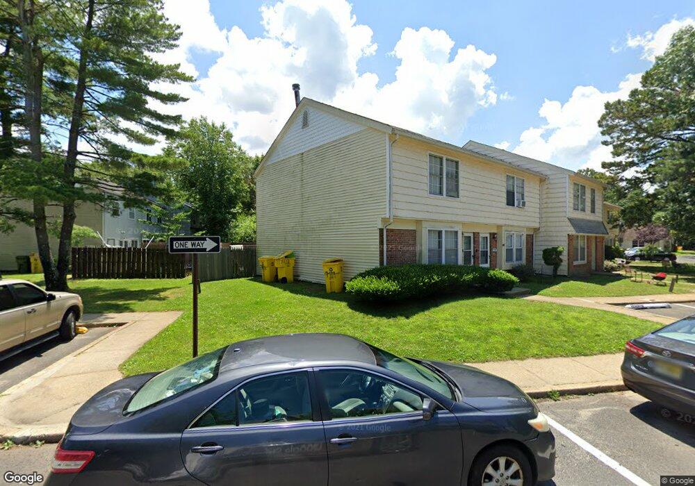
129 Colony Cir Unit 1 Lakewood, NJ 08701
Estimated Value: $394,000 - $437,000
3
Beds
2
Baths
1,220
Sq Ft
$333/Sq Ft
Est. Value
About This Home
This home is located at 129 Colony Cir Unit 1, Lakewood, NJ 08701 and is currently estimated at $406,236, approximately $332 per square foot. 129 Colony Cir Unit 1 is a home located in Ocean County with nearby schools including Lakewood High School, Bais Faiga School For Girls, and Yeshiva K'tana Of Lakewood.
Ownership History
Date
Name
Owned For
Owner Type
Purchase Details
Closed on
Jan 14, 2020
Sold by
Kupferstein Herman and Kuperstein Susan
Bought by
Kupferstein Yisroel and Susan Kupferstein Family Trust
Current Estimated Value
Purchase Details
Closed on
Jun 27, 2008
Sold by
Mayer Sheldon and Mayer Raizl
Bought by
Kupferstein Herman and Kupferstein Susan
Purchase Details
Closed on
May 25, 2003
Sold by
Brander Joseph and Brander Goldie
Bought by
Mayer Sheldon
Home Financials for this Owner
Home Financials are based on the most recent Mortgage that was taken out on this home.
Original Mortgage
$94,400
Interest Rate
5.93%
Mortgage Type
Purchase Money Mortgage
Purchase Details
Closed on
Mar 27, 2003
Sold by
Dowek Reuvein
Bought by
Brander Joseph and Brander Goldie
Home Financials for this Owner
Home Financials are based on the most recent Mortgage that was taken out on this home.
Original Mortgage
$94,400
Interest Rate
5.93%
Mortgage Type
Purchase Money Mortgage
Create a Home Valuation Report for This Property
The Home Valuation Report is an in-depth analysis detailing your home's value as well as a comparison with similar homes in the area
Home Values in the Area
Average Home Value in this Area
Purchase History
| Date | Buyer | Sale Price | Title Company |
|---|---|---|---|
| Kupferstein Yisroel | -- | None Available | |
| Kupferstein Herman | $195,000 | Madison Title Agency Llc | |
| Mayer Sheldon | -- | None Available | |
| Brander Joseph | $118,000 | -- |
Source: Public Records
Mortgage History
| Date | Status | Borrower | Loan Amount |
|---|---|---|---|
| Previous Owner | Brander Joseph | $94,400 |
Source: Public Records
Tax History Compared to Growth
Tax History
| Year | Tax Paid | Tax Assessment Tax Assessment Total Assessment is a certain percentage of the fair market value that is determined by local assessors to be the total taxable value of land and additions on the property. | Land | Improvement |
|---|---|---|---|---|
| 2025 | $4,766 | $191,800 | $100,000 | $91,800 |
| 2024 | $4,534 | $191,800 | $100,000 | $91,800 |
| 2023 | $4,377 | $191,800 | $100,000 | $91,800 |
| 2022 | $4,377 | $191,800 | $100,000 | $91,800 |
| 2021 | $4,369 | $191,800 | $100,000 | $91,800 |
| 2020 | $4,358 | $191,800 | $100,000 | $91,800 |
| 2019 | $4,193 | $191,800 | $100,000 | $91,800 |
| 2018 | $3,997 | $191,800 | $100,000 | $91,800 |
| 2017 | $4,517 | $191,800 | $100,000 | $91,800 |
| 2016 | $4,975 | $169,800 | $110,000 | $59,800 |
| 2015 | $4,814 | $169,800 | $110,000 | $59,800 |
| 2014 | $4,566 | $169,800 | $110,000 | $59,800 |
Source: Public Records
Map
Nearby Homes
- 1701 Princeton Ave
- 180 Tudor Ct Unit 10
- 32 E 13th St
- 156 Tudor Ct
- 184 Downing St
- 176 Downing St Unit 1
- 126 14th St
- 6 11th St
- 6 11th St Unit B
- 0 Appolo Rd
- 114 Carey St
- 1013 Lexington Ave
- 601 Appolo Rd
- 52 E 9th St
- 402 Twin Oaks Dr
- 412 15th St
- 27 7th St Unit 2
- 0 Maxim Southard Rd Unit 22531504
- 907 Park Terrace
- 1418 Forest Ave
- 131 Colony Cir
- 133 Colony Cir Unit 3
- 135 Colony Cir
- 127 Colony Cir
- 127 Colony Cir Unit 1000
- 125 Colony Cir Unit 6
- 137 Colony Cir
- 123 Colony Cir Unit 5
- 139 Colony Cir Unit 6
- 121 Colony Cir
- 121 Colony Cir Unit 1000
- 119 Colony Cir Unit 3
- 117 Colony Cir Unit 2
- 105 Colony Cir
- 107 Colony Cir
- 109 Colony Cir
- 103 Colony Cir
- 115 Colony Cir Unit 1
- 101 Colony Cir
- 111 Colony Cir Unit 6