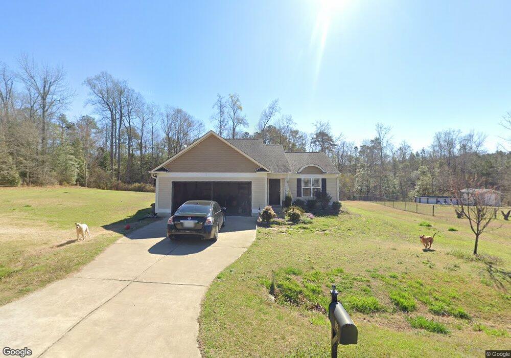
129 Crownside Dr Four Oaks, NC 27524
Elevation NeighborhoodEstimated Value: $291,000 - $302,574
3
Beds
2
Baths
1,400
Sq Ft
$213/Sq Ft
Est. Value
About This Home
This home is located at 129 Crownside Dr, Four Oaks, NC 27524 and is currently estimated at $298,144, approximately $212 per square foot. 129 Crownside Dr is a home located in Johnston County with nearby schools including Four Oaks Elementary School, Four Oaks Middle School, and South Johnston High School.
Ownership History
Date
Name
Owned For
Owner Type
Purchase Details
Closed on
Jun 10, 2015
Sold by
Golden Properties And Development Inc
Bought by
Jones Illya
Current Estimated Value
Home Financials for this Owner
Home Financials are based on the most recent Mortgage that was taken out on this home.
Original Mortgage
$156,000
Outstanding Balance
$121,555
Interest Rate
3.92%
Mortgage Type
New Conventional
Estimated Equity
$176,589
Purchase Details
Closed on
Jun 5, 2014
Sold by
King Mill Development Llc
Bought by
Golden Properties & Development Inc
Create a Home Valuation Report for This Property
The Home Valuation Report is an in-depth analysis detailing your home's value as well as a comparison with similar homes in the area
Home Values in the Area
Average Home Value in this Area
Purchase History
| Date | Buyer | Sale Price | Title Company |
|---|---|---|---|
| Jones Illya | $156,000 | None Available | |
| Golden Properties & Development Inc | $108,000 | None Available |
Source: Public Records
Mortgage History
| Date | Status | Borrower | Loan Amount |
|---|---|---|---|
| Open | Jones Illya | $156,000 |
Source: Public Records
Tax History
| Year | Tax Paid | Tax Assessment Tax Assessment Total Assessment is a certain percentage of the fair market value that is determined by local assessors to be the total taxable value of land and additions on the property. | Land | Improvement |
|---|---|---|---|---|
| 2025 | $1,907 | $300,290 | $60,000 | $240,290 |
| 2024 | $1,422 | $175,550 | $26,500 | $149,050 |
| 2023 | $1,387 | $175,550 | $26,500 | $149,050 |
| 2022 | $1,457 | $175,550 | $26,500 | $149,050 |
| 2021 | $1,457 | $175,550 | $26,500 | $149,050 |
| 2020 | $1,510 | $175,550 | $26,500 | $149,050 |
| 2019 | $1,510 | $175,550 | $26,500 | $149,050 |
| 2018 | $1,346 | $152,960 | $23,000 | $129,960 |
| 2017 | $1,346 | $152,960 | $23,000 | $129,960 |
| 2016 | $1,346 | $152,960 | $23,000 | $129,960 |
| 2015 | -- | $104,720 | $23,000 | $81,720 |
Source: Public Records
Map
Nearby Homes
- 130 Cherryhill Dr
- 110 Brookside Ln
- Lot 2 Raleigh Rd
- 266 Golfview Ave
- 207 Golfview Ave
- 15 Bristow Ct
- 114 Tee Time Terrace
- 2568 Lassiter Rd
- 84 Tee Time Terrace
- 236 Golfview Ave
- 2590 Lassiter Rd
- 79 Tee Time Terrace
- 63 Tee Time Terrace
- 2560 Lassiter Rd
- 0 Lassiter Rd Unit 100555881
- 608 Barbour Farm Ln
- 280 Golfview Ave
- 290 Golfview Ave
- 294 Barbour Farm Ln
- 23 Nonabell Ln
- 155 Crownside Dr
- 117 Crownside Dr
- 175 Crownside Dr
- 124 Crown Side Dr
- 175 Crown Side Dr
- 105 Crownside Dr
- 112 Crownside Dr
- 144 Crown Unit Dr
- 144 Crown Side Dr
- 144 Crownside Dr
- 168 Crownside Dr
- 95 Crownside Dr Unit Lot8
- 0 Crownside Dr Unit 1937890
- 0 Crownside Dr Unit 1937893
- 0 Crownside Dr Unit 21 TR1937893
- 0 Crownside Dr Unit 2 1937890
- 195 Crown Unit Dr
- 105 Crown Side Dr
- 15 Haggerty Ln
- 195 Crown Side Dr
Your Personal Tour Guide
Ask me questions while you tour the home.