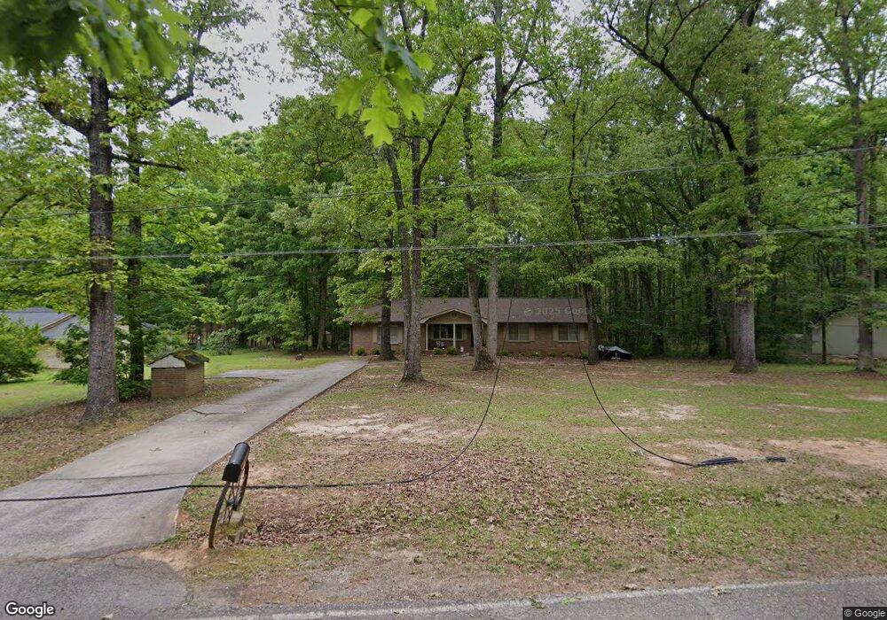
129 Diane Dr Griffin, GA 30223
Spalding County NeighborhoodEstimated Value: $199,000 - $240,000
3
Beds
2
Baths
1,800
Sq Ft
$122/Sq Ft
Est. Value
About This Home
This home is located at 129 Diane Dr, Griffin, GA 30223 and is currently estimated at $219,733, approximately $122 per square foot. 129 Diane Dr is a home located in Spalding County with nearby schools including Cowan Road Elementary School, Cowan Road Middle School, and Griffin High School.
Ownership History
Date
Name
Owned For
Owner Type
Purchase Details
Closed on
Feb 10, 1982
Sold by
Stacy Samuel V
Bought by
Moye Fred E
Current Estimated Value
Purchase Details
Closed on
Jul 1, 1981
Sold by
Peoples Financial Corp
Bought by
Stacy Samuel V
Purchase Details
Closed on
May 16, 1980
Sold by
Blalock Wesley and Blalock Diane W
Bought by
Peoples Financial Corp
Purchase Details
Closed on
Nov 1, 1976
Sold by
Elder David P
Bought by
Blalock Wesley and Blalock Diane W
Purchase Details
Closed on
Jul 15, 1976
Sold by
Allen Mark and Thompson Charles
Bought by
Elder David P
Create a Home Valuation Report for This Property
The Home Valuation Report is an in-depth analysis detailing your home's value as well as a comparison with similar homes in the area
Home Values in the Area
Average Home Value in this Area
Purchase History
| Date | Buyer | Sale Price | Title Company |
|---|---|---|---|
| Moye Fred E | $9,500 | -- | |
| Stacy Samuel V | $12,000 | -- | |
| Peoples Financial Corp | -- | -- | |
| Blalock Wesley | $31,000 | -- | |
| Elder David P | -- | -- |
Source: Public Records
Tax History Compared to Growth
Tax History
| Year | Tax Paid | Tax Assessment Tax Assessment Total Assessment is a certain percentage of the fair market value that is determined by local assessors to be the total taxable value of land and additions on the property. | Land | Improvement |
|---|---|---|---|---|
| 2024 | $2,386 | $66,695 | $6,800 | $59,895 |
| 2023 | $2,386 | $66,695 | $6,800 | $59,895 |
| 2022 | $2,078 | $57,154 | $6,000 | $51,154 |
| 2021 | $1,464 | $40,264 | $6,000 | $34,264 |
| 2020 | $1,469 | $40,264 | $6,000 | $34,264 |
| 2019 | $1,499 | $40,264 | $6,000 | $34,264 |
| 2018 | $1,407 | $36,814 | $6,000 | $30,814 |
| 2017 | $1,369 | $36,814 | $6,000 | $30,814 |
| 2016 | $1,393 | $36,814 | $6,000 | $30,814 |
| 2015 | $1,435 | $36,814 | $6,000 | $30,814 |
| 2014 | $1,463 | $36,814 | $6,000 | $30,814 |
Source: Public Records
Map
Nearby Homes
- 580 Hardy Ln
- 4251 Fayetteville Rd
- 164 David Elder Rd
- 2637 Birdie Rd
- 171 Davidson Dr
- 394 Sidney Dr
- 1317 Cheatham Rd
- 3701 Fayetteville Rd
- 1019 Oakridge Dr
- 505 New Salem Rd
- 177 Lowery Rd
- 1100 Stiles Crossing
- 1102 Stiles Crossing
- 697 Steele Rd
- 250 Lowery Rd
- 0 Deason St Unit 23730
- 0 Deason St Unit 10624935
- 150 Goodman Dr
- 725 County Line Church Rd
- 155 Chantilly Ln
- 125 Diane Dr
- 133 Diane Dr
- 121 Diane Dr
- 87 Diane Dr
- 64 Bicycle Rd
- 81 Diane Dr
- 100 Bicycle Rd
- 59 Diane Dr
- 4417 Fayetteville Rd
- 58 Diane Dr
- 0 Bicycle Rd Unit 8830347
- 0 Bicycle Rd Unit 7374661
- 0 Bicycle Rd Unit 9033677
- 0 Bicycle Rd Unit 9063529
- 204 Bicycle Rd
- 44 Bicycle Rd
- 4383 Fayetteville Rd
- 4401 Fayetteville Rd
- 87 Bicycle Rd
- 42 Bicycle Rd