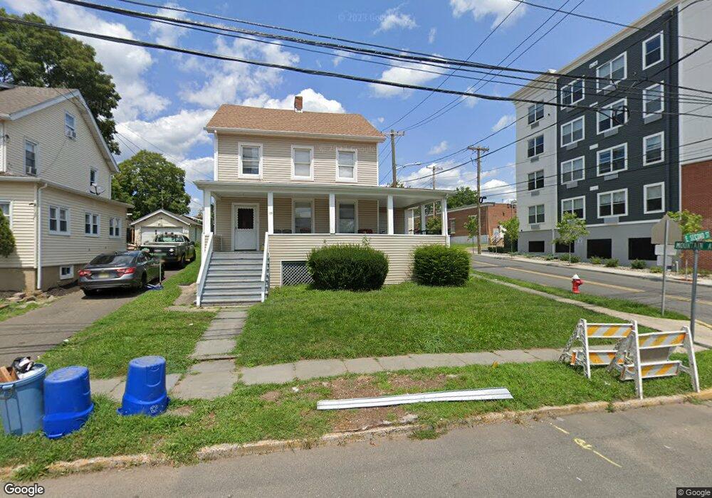
129 E 2nd St Bound Brook, NJ 08805
2
Beds
1
Bath
--
Sq Ft
6,534
Sq Ft Lot
About This Home
This home is located at 129 E 2nd St, Bound Brook, NJ 08805. 129 E 2nd St is a home located in Somerset County with nearby schools including LaMonte Annex Elementary School, Lafayette Elementary School, and Bound Brook High School.
Create a Home Valuation Report for This Property
The Home Valuation Report is an in-depth analysis detailing your home's value as well as a comparison with similar homes in the area
Home Values in the Area
Average Home Value in this Area
Tax History
| Year | Tax Paid | Tax Assessment Tax Assessment Total Assessment is a certain percentage of the fair market value that is determined by local assessors to be the total taxable value of land and additions on the property. | Land | Improvement |
|---|---|---|---|---|
| 2025 | $9,741 | $388,000 | $234,000 | $154,000 |
| 2024 | $9,741 | $429,300 | $214,000 | $215,300 |
| 2023 | $9,531 | $404,200 | $194,000 | $210,200 |
| 2022 | $9,308 | $374,100 | $174,000 | $200,100 |
| 2021 | $7,918 | $296,800 | $114,000 | $182,800 |
| 2020 | $7,860 | $254,600 | $89,000 | $165,600 |
| 2019 | $7,918 | $244,600 | $79,000 | $165,600 |
| 2018 | $7,028 | $210,800 | $69,000 | $141,800 |
| 2017 | $7,044 | $206,500 | $69,000 | $137,500 |
| 2016 | $6,924 | $204,500 | $34,000 | $170,500 |
| 2015 | $7,688 | $232,200 | $44,000 | $188,200 |
| 2014 | $7,377 | $215,200 | $27,000 | $188,200 |
Source: Public Records
Map
Nearby Homes
- 29-31 John St
- 17 Talmage Ave
- 112 East St
- 315 East St
- 408 E Union Ave
- 126 W High St
- 154 W High St
- 520 Winsor St
- 153 W Union Ave
- 20 van Syckle Blvd
- 28 Fisher Ave
- 105 Swing Bridge Ln Unit 1009
- 8 Swing Bridge Ln Unit 904
- 589 Mountain Ave
- 610 Watchung Rd
- 261 W Main St
- 272 W Main St
- 120B Little Place
- 650 Central Ave
- 151 Beechwood Ave
Your Personal Tour Guide
Ask me questions while you tour the home.