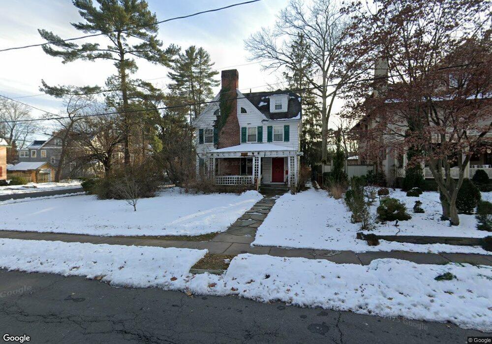
129 Elizabeth St Hartford, CT 06105
West End NeighborhoodEstimated Value: $484,067 - $573,000
5
Beds
5
Baths
2,965
Sq Ft
$178/Sq Ft
Est. Value
About This Home
This home is located at 129 Elizabeth St, Hartford, CT 06105 and is currently estimated at $527,267, approximately $177 per square foot. 129 Elizabeth St is a home located in Hartford County with nearby schools including Noah Webster Micro Society School, Rawson School, and McKinley School.
Ownership History
Date
Name
Owned For
Owner Type
Purchase Details
Closed on
Feb 20, 2024
Sold by
Armstrong Aleyda G
Bought by
Aleyda G Armstrong Ft and Armstrong
Current Estimated Value
Purchase Details
Closed on
Jul 18, 1988
Sold by
Dillon Jean C
Bought by
Armstrong Julio D
Home Financials for this Owner
Home Financials are based on the most recent Mortgage that was taken out on this home.
Original Mortgage
$175,000
Interest Rate
10.57%
Mortgage Type
Purchase Money Mortgage
Create a Home Valuation Report for This Property
The Home Valuation Report is an in-depth analysis detailing your home's value as well as a comparison with similar homes in the area
Home Values in the Area
Average Home Value in this Area
Purchase History
| Date | Buyer | Sale Price | Title Company |
|---|---|---|---|
| Aleyda G Armstrong Ft | -- | None Available | |
| Armstrong Julio D | $259,900 | -- |
Source: Public Records
Mortgage History
| Date | Status | Borrower | Loan Amount |
|---|---|---|---|
| Previous Owner | Armstrong Julio D | $184,500 | |
| Previous Owner | Armstrong Julio D | $33,600 | |
| Previous Owner | Armstrong Julio D | $2,000 | |
| Previous Owner | Armstrong Julio D | $175,000 |
Source: Public Records
Tax History Compared to Growth
Tax History
| Year | Tax Paid | Tax Assessment Tax Assessment Total Assessment is a certain percentage of the fair market value that is determined by local assessors to be the total taxable value of land and additions on the property. | Land | Improvement |
|---|---|---|---|---|
| 2025 | $7,351 | $106,612 | $53,876 | $52,736 |
| 2024 | $7,351 | $106,612 | $53,876 | $52,736 |
| 2023 | $7,351 | $106,612 | $53,876 | $52,736 |
| 2022 | $7,351 | $106,612 | $53,876 | $52,736 |
| 2021 | $6,805 | $91,595 | $51,310 | $40,285 |
| 2020 | $6,805 | $91,595 | $51,310 | $40,285 |
| 2019 | $6,805 | $91,595 | $51,310 | $40,285 |
| 2018 | $6,575 | $88,507 | $49,580 | $38,927 |
| 2016 | $6,990 | $94,085 | $47,219 | $46,866 |
| 2015 | $6,990 | $91,089 | $44,977 | $46,112 |
| 2014 | $6,602 | $88,862 | $43,877 | $44,985 |
Source: Public Records
Map
Nearby Homes
- 276 Oxford St Unit 278
- 260 Oxford St Unit 262
- 275 Kenyon St
- 120 Whitney St
- 94 Goodwin Cir Unit 94
- 62 Whitney St
- 28 Whitney St
- 31 Woodland St Unit 9 A
- 31 Woodland St Unit 4I
- 31 Woodland St Unit 1E
- 31 Woodland St Unit 7 O
- 31 Woodland St Unit 4G
- 30 Woodland St Unit 4G
- 30 Woodland St Unit 3D
- 30 Woodland St Unit 9H
- 30 Woodland St Unit 5H
- 40 Owen St Unit B5
- 40 Owen St Unit A3
- 175 Scarborough St
- 14 Gray St Unit 16
- 131 Elizabeth St
- 193 Kenyon St
- 208 Kenyon St
- 130 Elizabeth St
- 135 Elizabeth St
- 189 Kenyon St
- 111 Elizabeth St
- 198 Kenyon St
- 141 Elizabeth St
- 219 Kenyon St
- 194 Kenyon St
- 210 Whitney St
- 107 Elizabeth St
- 220 Kenyon St
- 204 Whitney St
- 186 Kenyon St
- 140 Elizabeth St
- 179 Kenyon St
- 200 Whitney St
- 103 Elizabeth St Unit 105