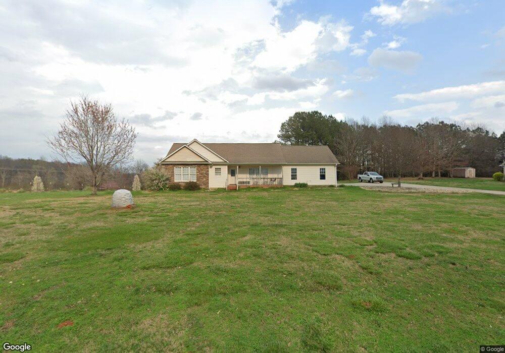
129 Fagan Rd Columbus, NC 28722
Estimated Value: $389,000 - $665,000
3
Beds
2
Baths
1,586
Sq Ft
$293/Sq Ft
Est. Value
About This Home
This home is located at 129 Fagan Rd, Columbus, NC 28722 and is currently estimated at $465,223, approximately $293 per square foot. 129 Fagan Rd is a home.
Ownership History
Date
Name
Owned For
Owner Type
Purchase Details
Closed on
May 12, 2005
Sold by
Horne Wayne A and Horne Julianna B
Bought by
Grigg Mitchell S and Grigg Julie L
Current Estimated Value
Home Financials for this Owner
Home Financials are based on the most recent Mortgage that was taken out on this home.
Original Mortgage
$164,700
Outstanding Balance
$86,647
Interest Rate
5.98%
Mortgage Type
Construction
Estimated Equity
$378,576
Purchase Details
Closed on
Jan 6, 2000
Bought by
Grigg Mitchell
Purchase Details
Closed on
Feb 11, 1991
Bought by
Grigg Mitchell
Create a Home Valuation Report for This Property
The Home Valuation Report is an in-depth analysis detailing your home's value as well as a comparison with similar homes in the area
Home Values in the Area
Average Home Value in this Area
Purchase History
| Date | Buyer | Sale Price | Title Company |
|---|---|---|---|
| Grigg Mitchell S | $120,000 | None Available | |
| Grigg Mitchell | $45,000 | -- | |
| Grigg Mitchell | $100,000 | -- |
Source: Public Records
Mortgage History
| Date | Status | Borrower | Loan Amount |
|---|---|---|---|
| Open | Grigg Mitchell S | $164,700 |
Source: Public Records
Tax History Compared to Growth
Tax History
| Year | Tax Paid | Tax Assessment Tax Assessment Total Assessment is a certain percentage of the fair market value that is determined by local assessors to be the total taxable value of land and additions on the property. | Land | Improvement |
|---|---|---|---|---|
| 2025 | $1,528 | $287,613 | $44,630 | $242,983 |
| 2024 | $1,429 | $220,482 | $31,690 | $188,792 |
| 2023 | $1,407 | $220,482 | $31,690 | $188,792 |
| 2022 | $1,398 | $220,482 | $31,690 | $188,792 |
| 2021 | $1,354 | $220,482 | $31,690 | $188,792 |
| 2020 | $1,166 | $178,443 | $31,690 | $146,753 |
| 2019 | $1,166 | $178,443 | $31,690 | $146,753 |
| 2018 | $1,095 | $178,443 | $31,690 | $146,753 |
| 2017 | $1,059 | $186,236 | $31,690 | $154,546 |
| 2016 | $1,118 | $186,236 | $31,690 | $154,546 |
| 2015 | $1,054 | $0 | $0 | $0 |
| 2014 | $1,054 | $0 | $0 | $0 |
| 2013 | -- | $0 | $0 | $0 |
Source: Public Records
Map
Nearby Homes
- 650 Mc Dowell Rd
- 36 Skylane Ct
- 00 Green Creek Dr
- 226 John Smith Rd
- 157 Melvin Hill Rd
- 1970 Chesnee Rd
- 133 Pheasant Ln
- 174 Way Home Ln
- 241 Pinefield Dr
- 00 Chesnee Rd
- 156 Eagle Nest Rd
- 102 Uncle Coss Pond
- 265 Phillip Henderson Rd
- 0 E Green Creek Dr
- 390 Old Mill Rd
- 201 Hughes Cr Rd
- 000 Skylark Ln Unit 6
- 251 Vera Ln
- 0 Prince Rd Unit Lot 4 CAR4217750
- 0 Prince Rd Unit 1546693