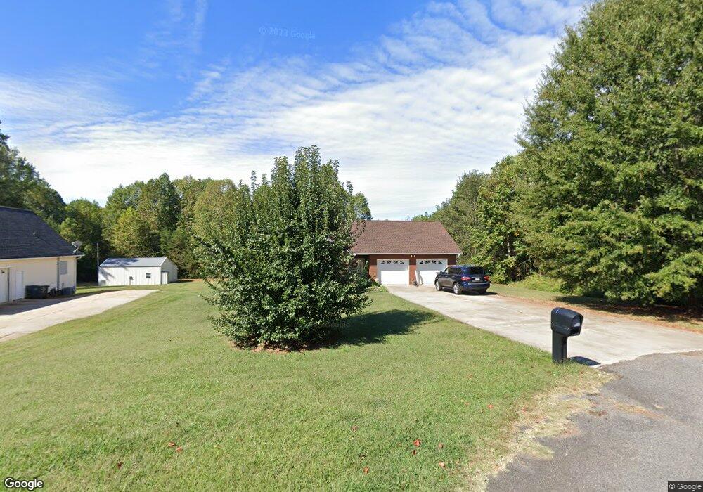
129 Fairgate Dr Statesville, NC 28625
Estimated Value: $263,179 - $313,000
3
Beds
2
Baths
1,430
Sq Ft
$207/Sq Ft
Est. Value
About This Home
This home is located at 129 Fairgate Dr, Statesville, NC 28625 and is currently estimated at $296,545, approximately $207 per square foot. 129 Fairgate Dr is a home located in Iredell County with nearby schools including Cloverleaf Elementary School, East Iredell Middle School, and Statesville High School.
Ownership History
Date
Name
Owned For
Owner Type
Purchase Details
Closed on
Sep 16, 2005
Sold by
Austin & Austin Builders Inc
Bought by
Johnson M Lynn and Johnson Alisha R
Current Estimated Value
Home Financials for this Owner
Home Financials are based on the most recent Mortgage that was taken out on this home.
Original Mortgage
$139,950
Outstanding Balance
$87,639
Interest Rate
8.7%
Mortgage Type
Fannie Mae Freddie Mac
Estimated Equity
$208,906
Purchase Details
Closed on
Nov 1, 1997
Bought by
Cline M B
Create a Home Valuation Report for This Property
The Home Valuation Report is an in-depth analysis detailing your home's value as well as a comparison with similar homes in the area
Home Values in the Area
Average Home Value in this Area
Purchase History
| Date | Buyer | Sale Price | Title Company |
|---|---|---|---|
| Johnson M Lynn | $156,000 | -- | |
| Cline M B | -- | -- |
Source: Public Records
Mortgage History
| Date | Status | Borrower | Loan Amount |
|---|---|---|---|
| Open | Johnson M Lynn | $139,950 |
Source: Public Records
Tax History Compared to Growth
Tax History
| Year | Tax Paid | Tax Assessment Tax Assessment Total Assessment is a certain percentage of the fair market value that is determined by local assessors to be the total taxable value of land and additions on the property. | Land | Improvement |
|---|---|---|---|---|
| 2024 | $1,269 | $204,960 | $24,000 | $180,960 |
| 2023 | $1,269 | $204,960 | $24,000 | $180,960 |
| 2022 | $1,012 | $151,780 | $16,000 | $135,780 |
| 2021 | $1,008 | $151,780 | $16,000 | $135,780 |
| 2020 | $1,008 | $151,780 | $16,000 | $135,780 |
| 2019 | $993 | $151,780 | $16,000 | $135,780 |
| 2018 | $886 | $139,640 | $16,000 | $123,640 |
| 2017 | $886 | $139,640 | $16,000 | $123,640 |
| 2016 | $886 | $139,640 | $16,000 | $123,640 |
| 2015 | $886 | $139,640 | $16,000 | $123,640 |
| 2014 | $865 | $146,460 | $16,000 | $130,460 |
Source: Public Records
Map
Nearby Homes
- 495&501 Turnersburg Hwy
- 136 Rimmer Rd
- 472 Turnersburg Hwy
- 201 Tarrington Dr
- 150 Oconee Trail
- 145 Oconee Trail
- 160 Tarrington Dr
- 139 Valencia Ln
- 141 Altondale Dr
- 109 Oconee Trail
- Lawson Plan at Sullivan Farm
- Frost Plan at Sullivan Farm
- Dickenson Plan at Sullivan Farm
- Whitman Plan at Sullivan Farm
- Crane Plan at Sullivan Farm
- Emerson Plan at Sullivan Farm
- 359 Turnersburg Hwy
- 350 Turnersburg Hwy
- 152 Postell Dr
- 105 Rock Ave
- 123 Fairgate Dr
- 117 Fairgate Dr
- 130 Fairgate Dr
- 122 Fairgate Dr
- 116 Fairgate Dr
- 111 Fairgate Dr
- 110 Fairgate Dr
- 505 Turnersburg Hwy
- 114 Zurich Ln
- 000 Zurich Ln
- 0 Fairgate Dr Unit 837015
- 122 Zurich Ln
- 122 Zurich Ln Unit 14
- 523 Turnersburg Hwy
- 507 Turnersburg Hwy
- 539 Turnersburg Hwy
- 533 Turnersburg Hwy
- Lot 35 Rimmer Rd
- 0 Rimmer Rd
- 495 Turnersburg Hwy