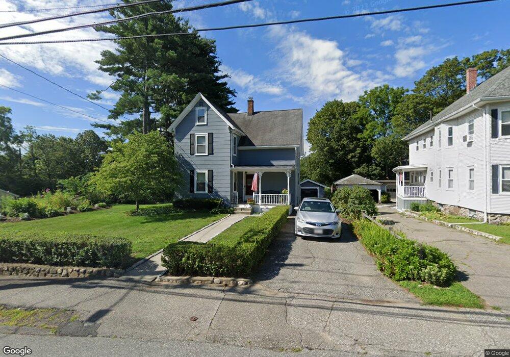
129 Garfield Ave Woburn, MA 01801
Downtown Woburn NeighborhoodEstimated Value: $743,000 - $858,000
3
Beds
2
Baths
1,812
Sq Ft
$438/Sq Ft
Est. Value
About This Home
This home is located at 129 Garfield Ave, Woburn, MA 01801 and is currently estimated at $793,823, approximately $438 per square foot. 129 Garfield Ave is a home located in Middlesex County with nearby schools including Shamrock Elementary School, Daniel L. Joyce Middle School, and Woburn High School.
Ownership History
Date
Name
Owned For
Owner Type
Purchase Details
Closed on
Jul 23, 2021
Sold by
Foley Judith A
Bought by
Judith A Foley Lt and Foley
Current Estimated Value
Purchase Details
Closed on
Aug 2, 1966
Bought by
Foley James J
Create a Home Valuation Report for This Property
The Home Valuation Report is an in-depth analysis detailing your home's value as well as a comparison with similar homes in the area
Home Values in the Area
Average Home Value in this Area
Purchase History
| Date | Buyer | Sale Price | Title Company |
|---|---|---|---|
| Judith A Foley Lt | -- | None Available | |
| Judith A Foley Lt | -- | None Available | |
| Foley James J | -- | -- |
Source: Public Records
Mortgage History
| Date | Status | Borrower | Loan Amount |
|---|---|---|---|
| Previous Owner | Foley James J | $50,000 |
Source: Public Records
Tax History Compared to Growth
Tax History
| Year | Tax Paid | Tax Assessment Tax Assessment Total Assessment is a certain percentage of the fair market value that is determined by local assessors to be the total taxable value of land and additions on the property. | Land | Improvement |
|---|---|---|---|---|
| 2025 | $5,687 | $665,900 | $306,100 | $359,800 |
| 2024 | $5,048 | $626,300 | $291,500 | $334,800 |
| 2023 | $5,087 | $584,700 | $265,000 | $319,700 |
| 2022 | $4,889 | $523,500 | $230,500 | $293,000 |
| 2021 | $4,469 | $479,000 | $219,500 | $259,500 |
| 2020 | $4,449 | $477,400 | $219,500 | $257,900 |
| 2019 | $4,379 | $460,900 | $209,000 | $251,900 |
| 2018 | $4,138 | $418,400 | $191,800 | $226,600 |
| 2017 | $3,917 | $394,100 | $182,700 | $211,400 |
| 2016 | $3,739 | $372,000 | $170,700 | $201,300 |
| 2015 | $3,600 | $354,000 | $159,500 | $194,500 |
| 2014 | $3,496 | $334,900 | $159,500 | $175,400 |
Source: Public Records
Map
Nearby Homes
- 61 Mount Pleasant St
- 2 George Rd Unit 2
- 14 Cross St
- 44 Main St
- 64 Garfield Ave
- 14 Ash St
- 29 Shepard Ct
- 69 Eastern Ave
- 39 Garfield Ave
- 20 Arthur St
- 171 Swanton St Unit 73
- 237 Swanton St
- 51 Vernon St
- 35 Prospect St Unit 215
- 35 Prospect St Unit 204
- 62 Jefferson Ave
- 95 Irving St
- 3 Laurel St
- 149 Horn Pond Brook Rd
- 15 Sturgis St
- 125 Garfield Ave
- 131 Garfield Ave
- 123 Garfield Ave
- 12 Belmont St
- 14 Belmont St Unit 14
- 2B Abbott Ct Unit 2B
- 2 Abbott Ct Unit B
- 2 Abbott Ct Unit A
- 128 Garfield Ave
- 121 Garfield Ave
- 15 Belmont St
- 132 Garfield Ave
- 17 Belmont St
- 11 Belmont St
- 11 Belmont St Unit 2
- 10 Belmont St
- 130 Garfield Ave
- 1 Abbott Ct
- 124 Garfield Ave
- 133 Garfield Ave