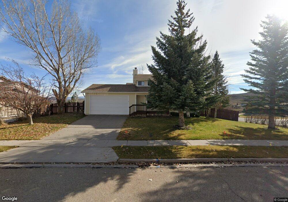
129 Grand View Cir Evanston, WY 82930
Estimated Value: $376,000 - $383,000
4
Beds
3
Baths
1,103
Sq Ft
$345/Sq Ft
Est. Value
About This Home
This home is located at 129 Grand View Cir, Evanston, WY 82930 and is currently estimated at $380,094, approximately $344 per square foot. 129 Grand View Cir is a home located in Uinta County with nearby schools including Evanston High School and Evanston Child Development Center.
Ownership History
Date
Name
Owned For
Owner Type
Purchase Details
Closed on
Sep 10, 2021
Sold by
Cielocha Jean M
Bought by
Chappell Lance and Chappell Desiree
Current Estimated Value
Home Financials for this Owner
Home Financials are based on the most recent Mortgage that was taken out on this home.
Original Mortgage
$262,626
Outstanding Balance
$238,970
Interest Rate
2.8%
Mortgage Type
New Conventional
Estimated Equity
$141,124
Purchase Details
Closed on
Feb 12, 2010
Sold by
Jacketta Michael G and Jacketta Lisa
Bought by
Cieloeha Jean M
Home Financials for this Owner
Home Financials are based on the most recent Mortgage that was taken out on this home.
Original Mortgage
$167,500
Interest Rate
5.05%
Mortgage Type
New Conventional
Create a Home Valuation Report for This Property
The Home Valuation Report is an in-depth analysis detailing your home's value as well as a comparison with similar homes in the area
Home Values in the Area
Average Home Value in this Area
Purchase History
| Date | Buyer | Sale Price | Title Company |
|---|---|---|---|
| Chappell Lance | -- | First American Title Ins Co | |
| Cieloeha Jean M | -- | None Available |
Source: Public Records
Mortgage History
| Date | Status | Borrower | Loan Amount |
|---|---|---|---|
| Open | Chappell Lance | $262,626 | |
| Previous Owner | Cieloeha Jean M | $167,500 |
Source: Public Records
Tax History Compared to Growth
Tax History
| Year | Tax Paid | Tax Assessment Tax Assessment Total Assessment is a certain percentage of the fair market value that is determined by local assessors to be the total taxable value of land and additions on the property. | Land | Improvement |
|---|---|---|---|---|
| 2025 | $1,914 | $21,855 | $2,795 | $19,060 |
| 2024 | $1,914 | $28,162 | $3,726 | $24,436 |
| 2023 | $2,016 | $29,805 | $3,544 | $26,261 |
| 2022 | $1,730 | $25,413 | $2,077 | $23,336 |
| 2021 | $1,472 | $21,588 | $2,077 | $19,511 |
| 2020 | $1,268 | $18,613 | $1,891 | $16,722 |
| 2019 | $1,186 | $17,435 | $1,768 | $15,667 |
| 2018 | $1,024 | $16,235 | $1,858 | $14,377 |
| 2017 | $1,080 | $15,891 | $1,858 | $14,033 |
| 2016 | $1,148 | $16,874 | $1,631 | $15,243 |
| 2015 | -- | $15,420 | $1,413 | $14,007 |
| 2014 | -- | $18,841 | $0 | $0 |
Source: Public Records
Map
Nearby Homes
- 104 Windy Ridge Ct
- 106 Grandview
- 193 Southridge Rd
- 144 Spring Brook Dr
- 206 Jared Ln
- 231 Highridge Point
- 66 Aspen Grove Dr W
- 132 Skyline Dr
- 240 Darby Ln
- 260 Darby Ln
- 46 City View Dr
- 149 Toponce Dr
- 113 Butterfield Rd
- 104 Evans Ln
- 130 Silver Sage Dr
- 132 Silver Sage Dr
- 102 Mohawk Ct
- 105 Zuni Ct
- 200 S Valley Lot 7 Dr
- 200 S Valley Lot 12 Dr
- 105 Windy Ridge Ct
- 108 Windy Ridge Ct
- 111 Windy Ridge Ct
- 125 Fox Point Loop Rd
- 123 Fox Point Loop Rd
- 127 Fox Point Loop Rd
- 121 Fox Point Loop Rd
- 129 Fox Point Loop Rd
- 119 Fox Point Loop Rd
- 119 Fox Point
- 131 Fox Point Loop Rd
- 125 Grand View Cir
- 133 Fox Point Loop Rd
- 107 Windy Ridge Ct
- 135 Fox Point Loop Rd
- 106 Windy Ridge Ct Unit Grand View
- 137 Fox Point Loop Rd
- 107 Grandview
- 109 Grandview
- 139 Fox Point Loop Rd