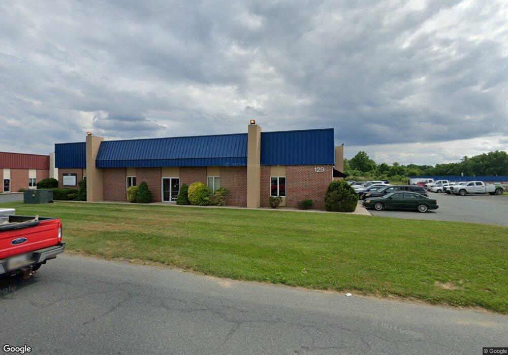
129 Industry Ln Forest Hill, MD 21050
Estimated Value: $3,151,660
--
Bed
--
Bath
16,182
Sq Ft
$195/Sq Ft
Est. Value
About This Home
This home is located at 129 Industry Ln, Forest Hill, MD 21050 and is currently estimated at $3,151,660, approximately $194 per square foot. 129 Industry Ln is a home located in Harford County with nearby schools including Forest Hill Elementary School, North Harford Middle School, and North Harford High School.
Ownership History
Date
Name
Owned For
Owner Type
Purchase Details
Closed on
Oct 6, 2017
Sold by
Vy Investments Llc
Bought by
Beavers And Fair Development Inc
Current Estimated Value
Home Financials for this Owner
Home Financials are based on the most recent Mortgage that was taken out on this home.
Original Mortgage
$2,000,000
Outstanding Balance
$1,670,563
Interest Rate
3.82%
Mortgage Type
Purchase Money Mortgage
Estimated Equity
$1,481,097
Purchase Details
Closed on
Jul 29, 2011
Sold by
129 Industry Lane Llc
Bought by
Vy Investments Llc
Home Financials for this Owner
Home Financials are based on the most recent Mortgage that was taken out on this home.
Original Mortgage
$680,000
Interest Rate
4.51%
Mortgage Type
Purchase Money Mortgage
Purchase Details
Closed on
Jul 25, 2011
Sold by
129 Industry Lane Llc
Bought by
Vy Investments Llc
Home Financials for this Owner
Home Financials are based on the most recent Mortgage that was taken out on this home.
Original Mortgage
$680,000
Interest Rate
4.51%
Mortgage Type
Purchase Money Mortgage
Purchase Details
Closed on
May 22, 2006
Sold by
Martin Family Llc
Bought by
129 Industry Lane Llc
Home Financials for this Owner
Home Financials are based on the most recent Mortgage that was taken out on this home.
Original Mortgage
$1,842,500
Interest Rate
6.27%
Mortgage Type
Purchase Money Mortgage
Purchase Details
Closed on
Jan 31, 2006
Sold by
Martin Family Llc
Bought by
129 Industry Lane Llc
Home Financials for this Owner
Home Financials are based on the most recent Mortgage that was taken out on this home.
Original Mortgage
$1,842,500
Interest Rate
6.27%
Mortgage Type
Purchase Money Mortgage
Purchase Details
Closed on
Sep 1, 2005
Sold by
Martin Family Llc
Bought by
Martin Family Llc
Create a Home Valuation Report for This Property
The Home Valuation Report is an in-depth analysis detailing your home's value as well as a comparison with similar homes in the area
Home Values in the Area
Average Home Value in this Area
Purchase History
| Date | Buyer | Sale Price | Title Company |
|---|---|---|---|
| Beavers And Fair Development Inc | $2,000,000 | None Available | |
| Vy Investments Llc | $1,700,000 | -- | |
| Vy Investments Llc | $1,700,000 | None Available | |
| Vy Investments Llc | $1,700,000 | -- | |
| 129 Industry Lane Llc | $130,000 | -- | |
| 129 Industry Lane Llc | $130,000 | -- | |
| Martin Family Llc | -- | -- |
Source: Public Records
Mortgage History
| Date | Status | Borrower | Loan Amount |
|---|---|---|---|
| Open | Beavers And Fair Development Inc | $2,000,000 | |
| Previous Owner | Vy Investments Llc | $680,000 | |
| Previous Owner | Vy Investments Llc | $680,000 | |
| Previous Owner | 129 Industry Lane Llc | $1,842,500 | |
| Previous Owner | 129 Industry Lane Llc | $1,842,500 |
Source: Public Records
Tax History Compared to Growth
Tax History
| Year | Tax Paid | Tax Assessment Tax Assessment Total Assessment is a certain percentage of the fair market value that is determined by local assessors to be the total taxable value of land and additions on the property. | Land | Improvement |
|---|---|---|---|---|
| 2025 | $19,628 | $1,837,200 | $227,500 | $1,609,700 |
| 2024 | $19,628 | $1,800,933 | $0 | $0 |
| 2023 | $19,233 | $1,764,667 | $0 | $0 |
| 2022 | $18,838 | $1,728,400 | $227,500 | $1,500,900 |
| 2021 | $18,139 | $1,650,100 | $0 | $0 |
| 2020 | $18,139 | $1,571,800 | $0 | $0 |
| 2019 | $17,235 | $1,493,500 | $227,500 | $1,266,000 |
| 2018 | $17,079 | $1,493,500 | $227,500 | $1,266,000 |
| 2017 | $17,079 | $1,493,500 | $0 | $0 |
| 2016 | $70 | $1,810,000 | $0 | $0 |
| 2015 | $19,782 | $1,781,233 | $0 | $0 |
| 2014 | $19,782 | $1,752,467 | $0 | $0 |
Source: Public Records
Map
Nearby Homes
- 2139 Mardic Dr
- 2103 Mardic Dr
- 253 Trudy Ct
- 310 Willrich Cir
- 311 Willrich Cir Unit G
- 332 Ponfield Rd E
- 2040 Colgate Cir
- 218 Aster Ln
- 2151 Sewanee Dr
- 1817 Rock Spring Rd
- 1710 Chrisara Ct
- 1702 Rich Way Unit 2C
- 430 Underwood Ln
- 430 Underwood Cir
- 1713 Landmark Dr Unit 1L
- 105 Sunshine Ct Unit G
- 209 Christopher Rd
- 1700 Landmark Dr Unit 1M
- 2427 Rocks Rd
- 1405 Kahoe Rd
- 131 Industry Ln
- 127 Industry Ln
- 130 Industry Ln
- 132 Industry Ln
- 133 Industry Ln
- 125 Industry Ln
- 135 Industry Ln
- 2200 Commerce Rd
- 134 Industry Ln
- 121 A Industry Ln
- 121 Industry Ln
- 124 Industry Ln
- 137 Industry Ln
- 120 Industry Ln
- 215 E Jarrettsville Rd
- 213 E Jarrettsville Rd
- 138 Industry Ln
- 119 Industry Ln
- 217 E Jarrettsville Rd
- 209 E Jarrettsville Rd